

Mount Yale - Mount Yale Trail -
Southwest Slopes
The Adventure Guide to Mount Yale - Mount Yale Trail includes a trail description, photographs of the trail, comments from our hikes, mileage data, and a custom Mount Yale topo map. The guide will familiarize you with the Mount Yale Trail and the area. We hope the guide helps you on your climb.
Route Data
Photos from: JUL09, JUL14
Elevation: 14,196'
Elevation: Denny Creek Trailhead: 9,120'
Range: Sawatch Range, CO - the land is managed by the Salida Ranger District of San Isabel National Forest
719-539-3591
Denny Creek Trailhead
Latitude: 38.815112, Longitude: -106.334465
Map Coordinate System - Geodetic Base: NAD83 (1986)
Route: Mount Massive Trail - Southwest Slopes
One-Way Distance: 4.60 miles, Denny Creek Trail to Mount Yale Trail then Mount Yale Trail to summit of Mount Yale
For Map, Trail Mileage, GPS, and Trail Notes go to Page 2
Mount Yale Trail Comments
We have climbed the Southwest Route on Yale three times. In the summer of 2014 when we re-hiked the Mount Yale Trail we found that the trail had been vastly improved. Amazingly CFI.org managed to tame the upper scree slope. The route was a good trail all the way to the shoulder at 13,960'. From the shoulder it is an easy scramble (if you follow the correct route) to the summit.
The Climb
Directions: From Hwy 24 in Buena Vista, CO turn west on West Main St - County Road 306. The paved road leads to the trailhead in about 11 miles. The Trailhead is on the right (north) side of the road. The Trailhead is about a mile past the NF Collegiate Peaks Campground.
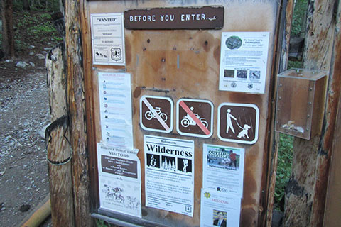
The Denny Creek Trailhead is the standard starting point for climbing Mount Yale. The Trailhead has a rather large parking area, privies, and a trail kiosk. The kiosk marks the Wilderness boundary.
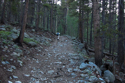
From the parking area at the Denny Creek Trailhead, the trail follows an old road as it climbs steadily for 280 feet in elevation gain. The road makes a good warm up.
The route continues to follow the road as the grade decreases to an easier walk. At 1 mile from the trailhead the route crosses Denny Creek. The crossing has been improved, but it is still fun.
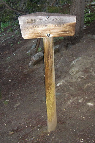
After crossing Denny Creek, the trail continues following the old road. At 0.30 mile from the crossing, the Denny Creek Trail reaches the Mount Yale Trail.
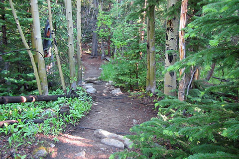
Leaving the Denny Creek Trail (road) the Mount Yale Trail twists and turns as to climb through an aspen grove and reach a shoulder separating Denny Creek and Delaney Creek. The trail leaves the shoulder and enters the Delaney drainage.
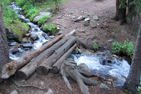
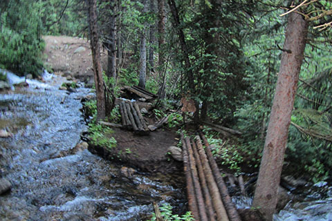
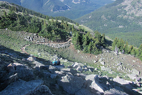
Climb along Delaney Creek for about 0.50 mile then cross the Delaney on logs. The crossing is 0.90 mile from the start of the Yale Trail and 2.20 mile from the trailhead.
Leaving Delaney Creek the trail begins switchbacking up a partly open slope. The trail climbs from about 11,300 feet to 11,700 feet and then begins traversing to the east.
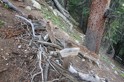
A "Closed for Restoration" sign is reached in 0.30 mile. This was the old (now closed) trail.
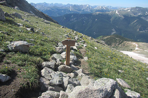
Climbing above treeline the new trail weaves through rocks and boulders with switchbacks and curves.
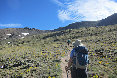
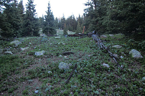
At about 12,500 feet elevation, the climb eases and crosses slopes of wildflowers (Old Man of the Mountain).
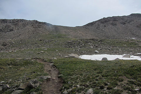
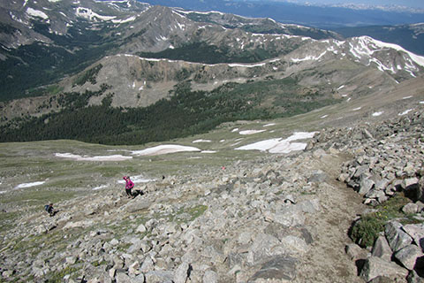
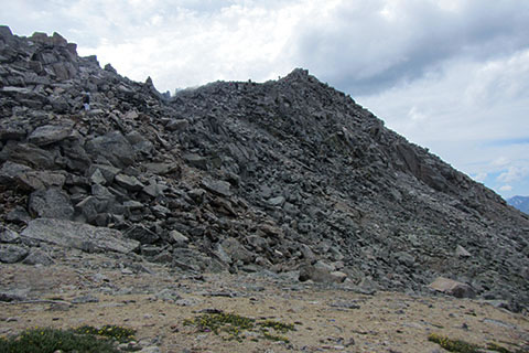
Looking up at the final slope to the shoulder below the summit of Yale, the climb begins!
At 1.80 mile from the crossing of Delaney Creek (13,300') the new trail reaches the junction with the old trail. A "Closed for Restoration" sign marks the old trail.
The switchbacks tame the steepness and the scree (loose stones).
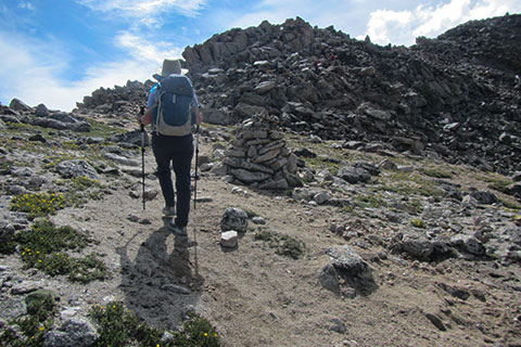
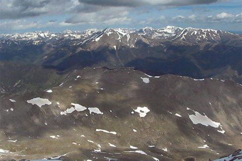
Approaching the shoulder, the ridge to the summit is obvious.
The shoulder at 13,960' is reached in 0.35 mile from the top of the old trail, 2.15 mile from Delaney Creek, and 4.35 mile from the Denny Creek Trailhead.
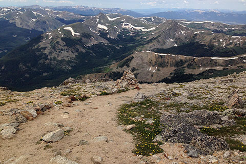
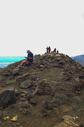
The final 0.25 mile to the summit is a fun and relatively easy scramble. Cairns (rock piles) mark the path to the summit. Take care to find the easiest options.
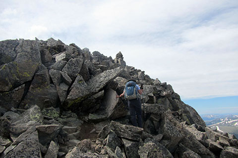
Starting on the right side of the ridge climb with a rising traverse.
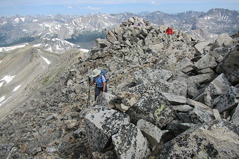
The ridge has bumps, but no false summit.
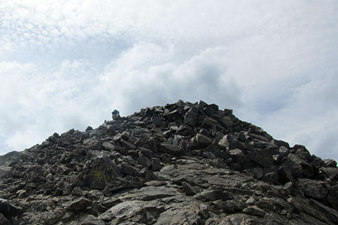
The last rise is cairned toward the left (north) side of the ridge. The climb gains the ridge and leads to the summit.
Mount Yale is 4.60 miles from the Denny Creek Trailhead. The round trip is 9.20 miles.