

Mount Yale - Mount Yale Trail -
Southwest Slopes
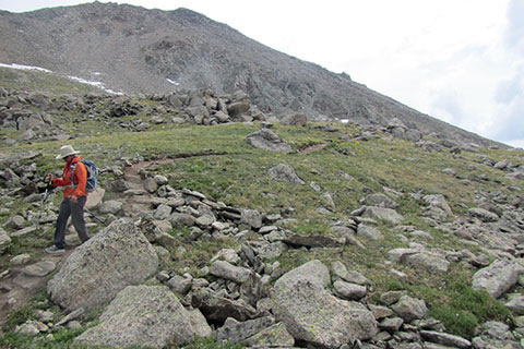
Above treeline hiker on the rocky trail
Trail Notes
The trailhead is on a paved county road (306).
The parking area is large, but it definitely fills on weekends.
There are privies at the trailhead, but they are heavily used. If you need a clean privy, better bring cleaning supplies!
There is no potable water at the trailhead.
The wilderness area registration is not checked on a daily or even weekly basis. Do not assume anyone will be checking at the end of each day for overdue hikers.
Mount Yale is in the Collegiate Peaks Wilderness Area. The list of rules that govern the Wilderness Area include limiting group size, dogs must be on a leash, and avoid shortcutting. Link to the Collegiate Peaks Wilderness Area. A link to the special Wilderness rules is listed on the Collegiate Peaks page.
The start of the trail follows an old mining road. The wide road makes for easy hiking, but remember to watch your pace. The road is steep.
Crossing Denny Creek is not difficult. The old foot bridge was a bit further up the creek.
The junction of the Denny Creek Trail and the Mount Yale Trail is not difficult to locate. The junction is clearly marked.
We enjoyed the start of the Mount Yale Trail as it climbs through an aspen grove.
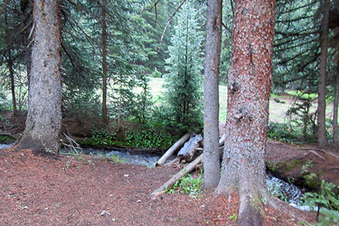
Logs crossing Delaney Creek to an opening
After the Mount Yale Trail joins Delaney Creek an obvious camping area is located across the creek (before the point where the trail crosses the creek.)
The slope after crossing Delaney Creek is steep. Finally some good switchbacks!
Treeline is at about 12,000'.
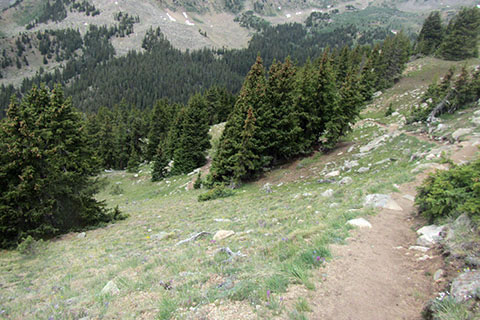
Trail crossing the partially open slope
The new re-routed trail is great. It picks a great line and seems sustainable.
Being old timers, we did miss the old trail. Well, not all of the old trail, just sections of it that were special.
Around 12,500' we crossed a field of the yellow leafed Old Man of the Mountain wildflower.
Some maps and guides have the trail joining the ridge at a saddle at about 13,500' and then the trail traversed to the shoulder at 13,960'. The distance to the summit from the saddle was 0.60 mile. We really don't know when the trail changed. In 2009, when we climbed Yale we gained the ridge at about the same place as the current trail. In fact, we hunkered down on the other side of the shoulder (east facing side).
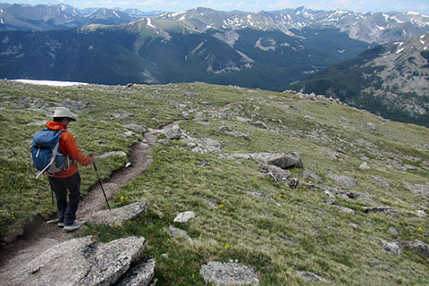
Hiker descending
The ridge that leads from shoulder to the summit is mostly a walk, but at times passage requires a bit of scrambling. The scrambling on the ridge is limited to a couple of moves in a few steeper sections of blocky rock. There really is not much exposure on the ridge, but still care should be given while moving over rock. The scrambler must find the route (the easiest path), test the holds before weighting them, and stay centered - in balance.
Crossing the ridge the weather conditions may be very windy.
Snow can be expected any time of the year.
Snow lingers on the upper slopes of the mountain. Snow is slippery and ice is even more slippery. Sure, most folks have had to walk on a snow covered sidewalk in town, but snow in the mountains is different. Safe passage might require tools, skills, and experience. A slip or fall on snow or ice may produce a slide and possible injury or death.
Always keep a special eye to the sky, watching for storms.
An early start (alpine start) helps lessen the chances of being caught on the mountain in afternoon storms.
From the summit there are great views of Princeton to the south and Harvard and Columbia to the north.
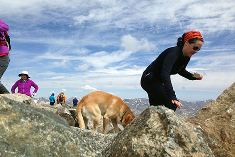
Hikers and a dog on the summit of Mount Yale
Just because the mountain has an easy to reach trailhead, it still climbs over 4,000'. Yale is a mountain and must be respected.
For Mountain Data and Route Guide
go to Page
1
Mount Yale Trail Mileage
0.00 Denny Creek Trailhead
1.00 Cross Denny Creek
1.30 Mount Yale Trail Junction
2.20 Cross Delaney Creek
4.35 Shoulder
4.60 Summit Mount Yale - 14,196’
Map Link
The link opens in a new window.
Mount Yale Map - pdf