

Paintbrush Divide Loop Trail -
Grand Teton
National Park
The Adventure Guide to the Paintbrush Divide Loop Trail (Grand Teton National Park) includes trail descriptions, photographs of the trail, comments from our hikes, mileage data, custom topo map, and the Paintbrush Divide Loop Trail tracklog. The guide will familiarize you with the Paintbrush Divide Loop Trail system and the area. We hope the guide helps you on your hike.
Route Data
Photos from: July 2004, 2012
Elevation of String Lake Trailhead: 6,880'
Elevation of Paintbrush Divide: 10,700'
Range: Grand Teton National Park
Map Coordinate System - Geodetic Base (NAD27)
String Lake Trailhead Latitude: 43.784134,
Longitude: -110.726666
Route: String Lake Trail, Holly Lake Trail, Paintbrush Canyon Trail, Paintbrush Divide Trail, North Fork of Cascade Canyon Trail, Cascade Canyon Trail, Inspiration Point Bypass Horse Trail, and Jenny Lake Trail.
Loop Mileage: 18.85, with no side trips
For Map, Trail Mileage, and Trail Notes
go to Page
2
Comments
We first hiked the Paintbrush Loop in 2004. Leaving with an alpine start we quickly climbed to Holly Lake and on to the Divide. There was one fairly long snow traverse, but those who had passed that way before had left us good steps. The crossing was not bad, but a slip would not have been good. The Divide and the descent to Solitude were great. The North Fork and Cascade Canyon trails were fun, but we were back in the trees and could set an easy pace. Returning to the trailhead we had a long day, but it was a good hike.
In 2012, we hiked the Paintbrush Loop again, but that time we went to Lake Solitude first and then down Paintbrush Canyon.
We did both directions as day hikes but both are suitable for backpacking adventures.
Both trips were good hikes and the scenery just could hardly be beat. You really can't go wrong which direction you choose, but we will give the description going up Paintbrush first.
The Guide
Directions: From the fee-entrance station in Moose, WY - head north on the Teton Park Road. Continue past the South Jenny Lake Junction (at 6.80 miles) for 2.90 miles to the North Jenny Lake Junction. Turn left (west) on Jenny Lake Loop Road. 1.5 miles from the Park Road, turn right on String Lake Road. Parking for the String Lake Trailhead is the first left. The area is well signed.
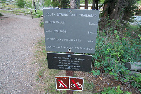
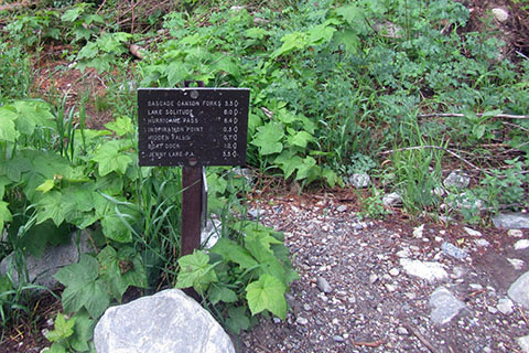
The Sting Lake Trailhead is a parking area. There is a trailhead kiosk near the junction with the Jenny Lake Trail. Restrooms and water are available at the end of the String Lake Road at the Leigh Lake Trailhead. The mileage sign does not really have distances that are used with the Paintbrush Loop.
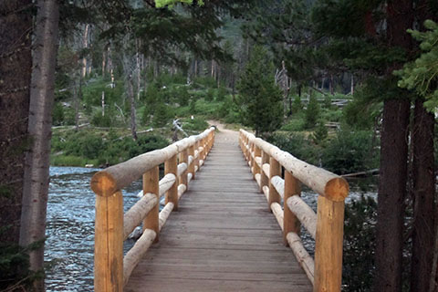
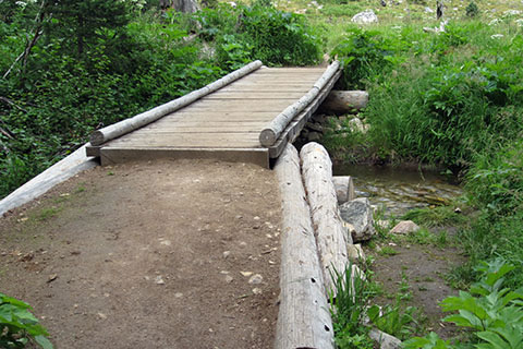
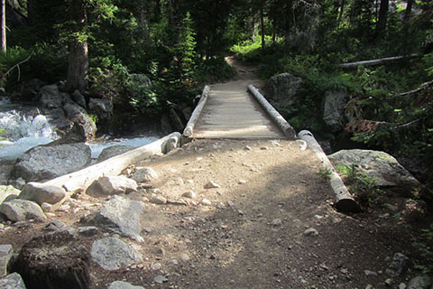
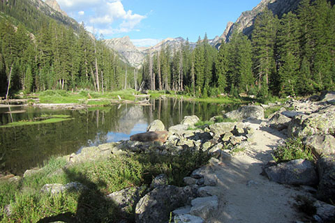
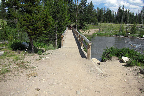
From the trailhead kiosk, join the Jenny Lake Trail and cross the String Lake Outlet on a good bridge. There are great views to the south of the Cathedral Group (Tetons) and north to String Lake.
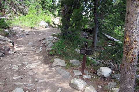
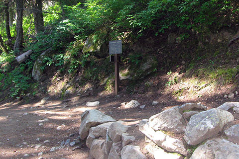
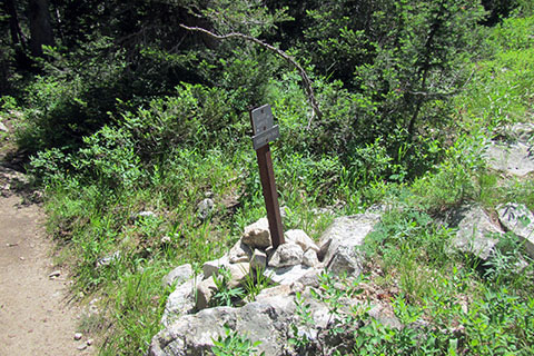
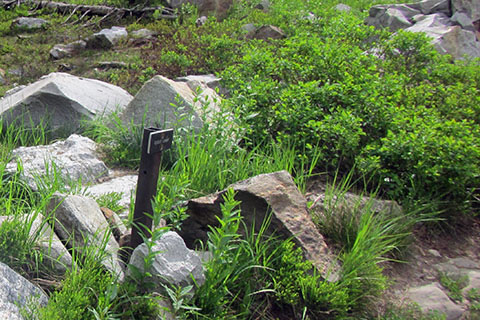
After traveling 0.25 mile from the trailhead kiosk the Jenny Lake Trail reaches a junction, a "Y". The String Lake Trail goes north (right) - the trail is to the left in the photo opposite of the sign. The route follows the west side of String Lake. Read more about the route selection and options in the Notes on Page 2.
At 0.20 mile from the Jenny Lake Junction the String Lake Trail crosses the creek from Laurel Lake.
The String Lake Trail approaches the shore of the lake and then begins a climb.
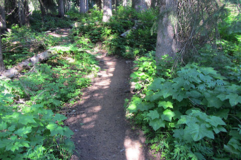
Though the trail is close to the busy String Lake area, the west side of the String Lake Loop Trail is wild.
The trail climbs and leaves the views of the lake as it enters the forest.
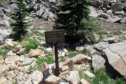
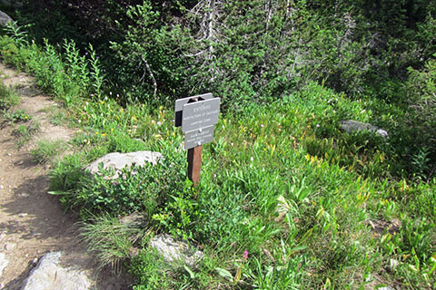
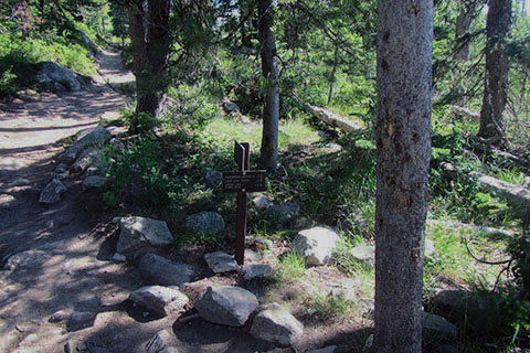
At 1.60 miles from the String Lake Parking Area the trail arrives at the Paintbrush Canyon Junction.
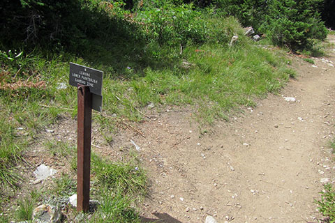
Note: Photo taken from opposite direction
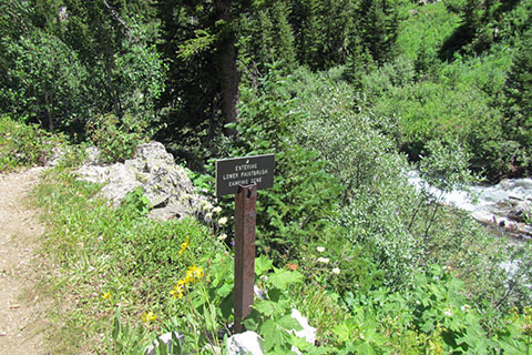
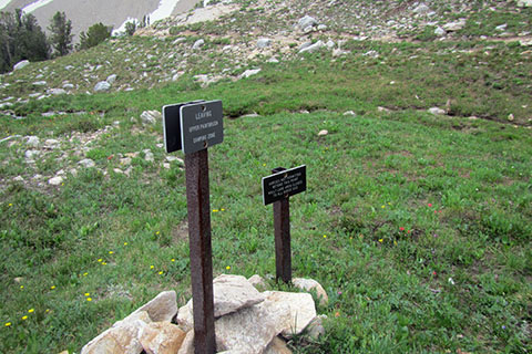
From the junction with the String Lake Trail and start of the Holly Lake or (Paintbrush Canyon) Trail, the trail climbs north and then west as it contours around Rockchuck Peak and into lower Paintbrush Canyon. At 1.85 miles from the String Lake Trail, the trail reaches the Lower Paintbrush Camping Zone.
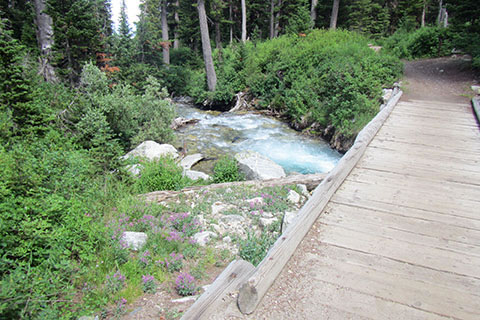
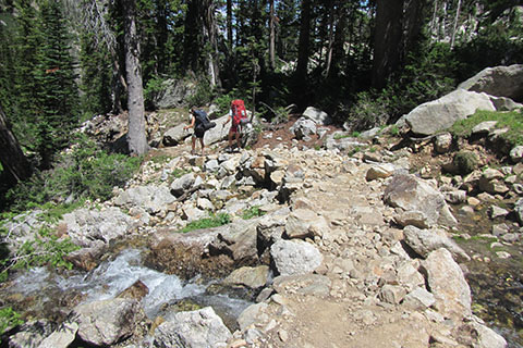
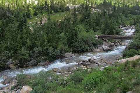
Midway through the camping zone, the trail crosses the Paintbrush Canyon Creek on a sturdy bridge.
Note: Photo taken from opposite direction
At 2.60 miles from the String Lake Trail, the trail leaves the Lower Paintbrush Canyon Camping Zone.
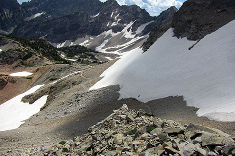
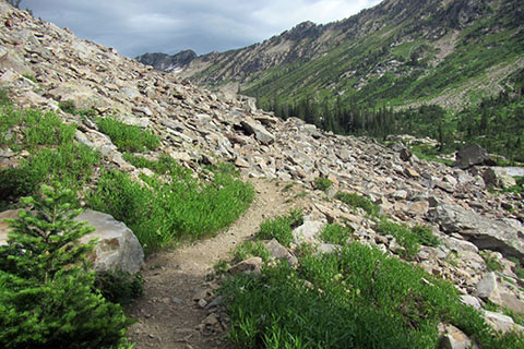
The trail crosses a large scree field at 3.15 miles from the String Lake Trail. A good path eases the rocky terrain.
At 3.30 miles from the String Lake Trail the trail reaches the Outlier Campsite.
From the Outlier Site, the trail climbs steadily through switchbacks.
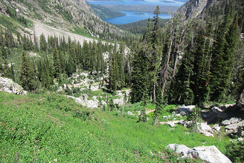
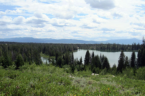
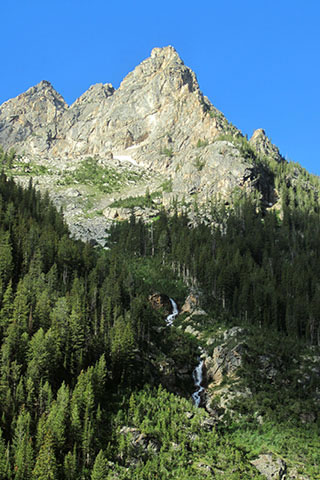
Good views, give a reason to rest and marvel at the terrain covered. Leigh and Jackson Lakes are framed by the canyons walls.
The trail reaches a junction with the Upper Paintbrush Camping Zone trail. The side trail does not go to Holly Lake. The junction is 4.35 miles from String Lake Trail.
The trail passes the Group (horse) Site and a great balcony with views of the Canyon.
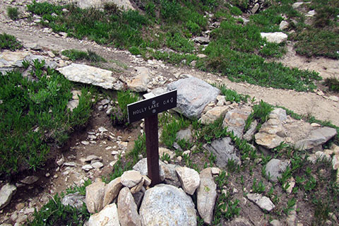
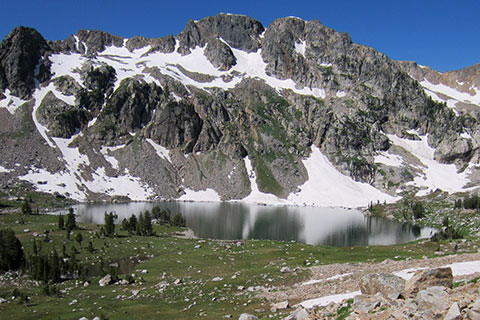
4.90 miles from the String Lake Trail and 6.50 miles from String Lake Trailhead the trail reaches Holly Lake. The alpine lake sits nestled beneath Mount Woodring.
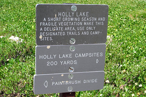
Holly Lake is a good location for a short rest, but keep an eye to the sky. If day hiking the loop, remember it is still 4 miles to Lake Solitude and over 12 miles to return to the trailhead.
From Holly Lake follow a drainage as you climb the slopes to a shoulder. The trail enters the Upper Paintbrush Canyon Camping Zone at 0.35 mile from Holly Lake.
The side trail that junctioned 0.55 mile below Holly Lake rejoins the Paintbrush Canyon Trail at 0.40 mile above the lake.
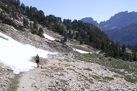
The trail climbs through the upper canyon. The snow lingers through July (and maybe all year) and can be very dangerous.
At 0.85 mile above Holly Lake, the trail leaves the Upper Paintbrush Canyon Camping Zone.
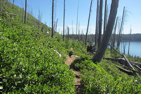
The trail leaves Paintbrush Canyon and crosses a scree slope (often covered in snow.) As the trail contours around the bowl it switchbacks up through the scree.
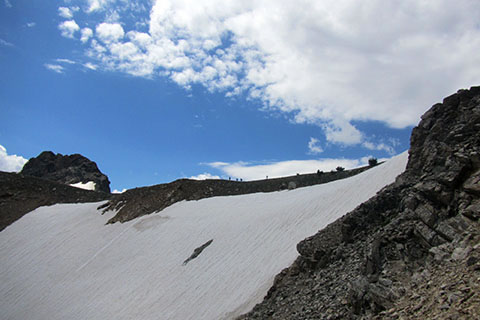
The switchbacks lead to a passage around the steep snow.
A ramp leads to the divide ridge.
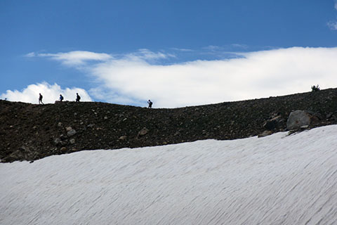
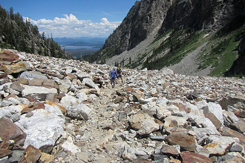
The trail crosses the ridge (seen with hikers crossing snow) and enjoys a wonderful stroll on top of the world.
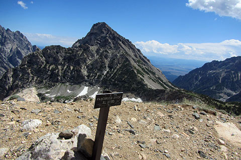
At 1.75 miles from Holly Lake, the trail reaches Paintbrush Divide - 10,700'.

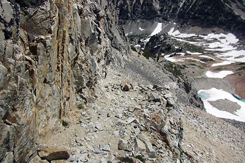
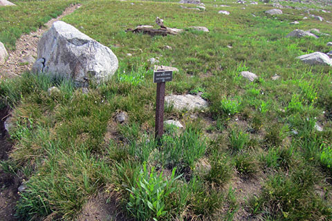
A guarter of a mile from the Paintbrush Divide, the trail reaches a wooden directional sign. The views of the North Fork of Cascade Canyon begin to appear.
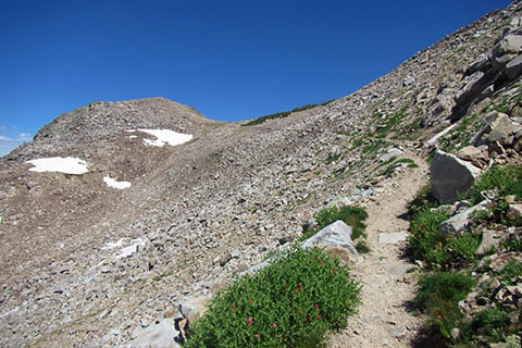
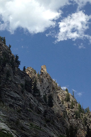
From the wooden directional sign the trail uses 0.75 mile to make one switchback. The trail crosses toward the knob on the left (photo above) and then the swithcback.
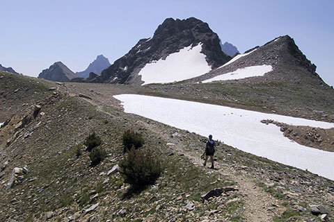
The trail begins a steady 1.25 mile descent to the Upper North Fork of Cascade Canyon basin.
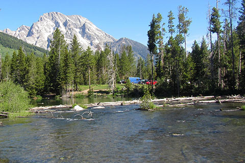
To the south great views of the Tetons dominate the sky - (L to R) Teewinot, Owen, Grand, and Middle.
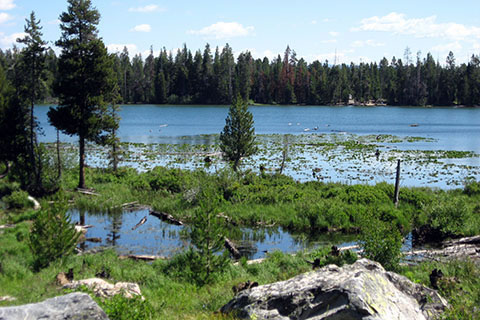
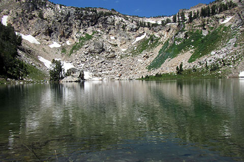
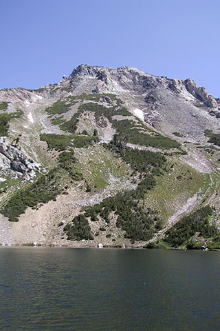
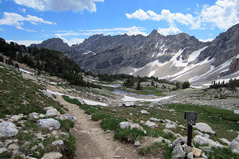
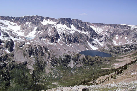
Lake Solitude is the next destination.
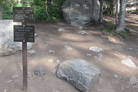
At 2.25 miles from Paintbrush Divide and 6.25 miles from Holly Lake reach the North Fork of Cascade Canyon Trail (on the shores of Lake Solitude.) The lake is 10.50 miles from String Lake Trailhead - via Paintbrush Canyon and 8.35 miles to complete the loop and return to the trailhead - via Cacade Canyon and Jenny Lake.
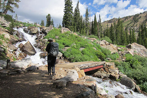
Leaving Lake Solitude the trail passes below the lake's shelf and crosses the outlet stream on a good bridge.
The trail begins to descend the west side of the creek. In 0.15 mile the trail enters the North Fork of Cascade Canyon Camping Zone. Just beyond the Camping Zone sign the trail crosses the Mica Lake outlet.
The trail passes through boulders, grass, and clumbs of trees as it descends through the canyon. A large screefield is passed 1.50 miles from Lake Solitude.
The Group Site is then passed 1.60 miles from the Lake.
Leave the camping zone in 0.10 mile.
A bridge crosses the North Fork in another 0.10 mile. The bridge is 0.85 mile to the Forks of Cascade Canyon.
The Creek is crossed again on another good bridge in 0.60 mile.
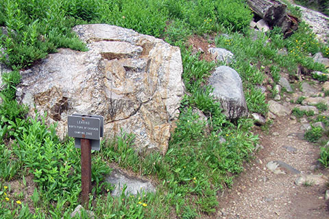
Finally the forks are reached, 2.65 miles from Lake Solitude. The Forks is 13.15 miles from the String Lake Trailhead with 5.70 miles to go.
In 0.20 mile from the Forks the North Fork is crossed once again (and for the last time!)
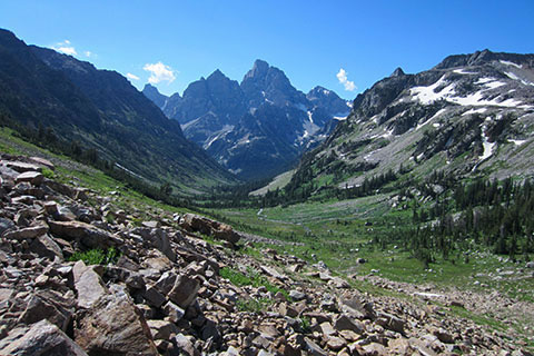
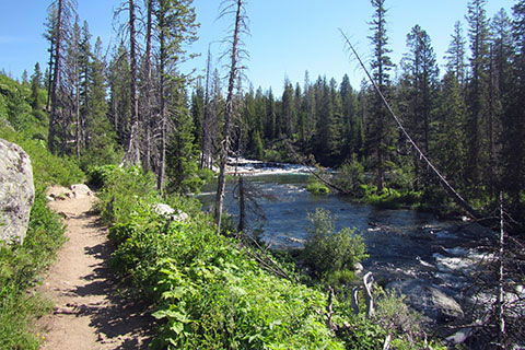
The views from the Canyon are superb.
The Cacade Canyon Trail is very moderate. It does pass through boulders and screefields, but maintains a fairly easy grade for the mountains.
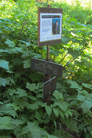
3.50 miles from the Forks the trail reaches the Horse Trail. The trail leaves the Cascade Canyon Trail before Inspiration Point.
The horse trail is also used as an access trail from climbers trying to reach climbs along Symmetry Coulior and Baxter Pinnacle.
The horse trail is not as improved as the popular hiking trails, but it is passable.
The Jenny Lake Trail is reached in 0.65 mile from the Cascade Canyon Trail. It is 1.55 miles to the String Lake Trailhead.
The Jenny Lake Trail heads northeast around the lake passing through the Alder Burn.
1 mile from the horse trail the Jenny Lake Trail reaches the String Lake Outlet. The trail turns away from Jenny Lake and climbs gently to String Lake.
It is 0.25 mile along the String Lake Outlet to the junction with the String Lake Loop Trail. Follow Jenny Lake signs.
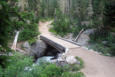
It is 0.25 mile from the Jenny Lake - String Lake Loop junction to the bridge. The String Lake Trailhead parking area is close.
Looking north from the bridge, Mount Moran dominates the sky, but the parking area may also be seen.
The total Paintbrush Divide Loop distance is 18.85 miles.