

Paintbrush Divide Loop Trail - page 2 -
Grand Teton
National Park
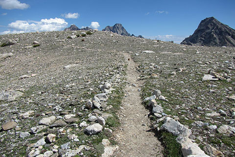
Trail along the Paintbrush Divide
Route Notes
The String Lake Trailhead Parking Area is easy to locate. The lot fills by mid-morning.
Restrooms and water are at the end of String Lake Rd.
Oddly enough the Leigh Lake Trailhead is at the end of the String Lake Rd at the String Lake Picnic Area. The trail starting at the Leigh Lake Trailhead is the String Lake Trail (Loop). At the head of String Lake, the Leigh Lake begins.
We have hiked the route both directions. Our favorite direction is hiking up Paintbrush Divide. Why?
- The distance to the Divide up Paintbrush Canyon is shorter (8.25 miles) than Cascade Canyon (10.10 miles). We are always very concerned about the weather and the summer afternoon thunderstorms. We want to be over the Divide before the storms.
- Paintbrush Divide seems steeper. We would rather hike up than down steeper slopes.
- Both of our trips were in July. There was steep snow on the upper slopes of Paintbrush Divide. If we brought ice axes, boots, and crampons the slopes would have been easily managed, but in running shoes, they were a bit dicey. With limited equipment (poles), we prefer climbing the snow slopes rather than descending them. When traveling in either direction, if the slopes were dangerous, we would look for alternative routes or turn around.
The scenery is great in either direction.
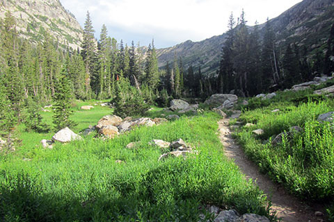
Trail heading into the North Fork
For backpacking, most folks seem to camp around Holly Lake in the Upper Paintbrush Canyon Camping Zone and the North Fork of Cascade Canyon Camping Zone.
The advantage of backpacking is that you are backpacking, sleeping and living in the mountains. The disadvantage of backpacking is that you are backpacking, carrying all of that weight in the mountains (over the divide.)
To safely hike the route (either direction) an early (alpine) start is needed. We started our hike before 6 so that we would cross the divide before noon.
Headlamps have seen more improvements over the past 15 years than any other outdoor gear. A good lamp makes the hiking almost as easy as in the daylight.
Bears do like to mosey around in the early mornings. Make noise and keep groups together. Do not forget bear spray.
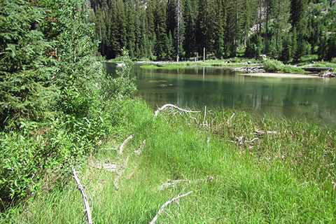
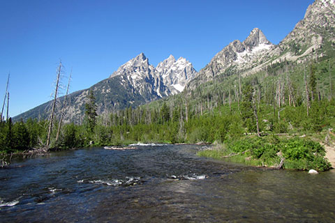
Cascade Creek
Trekking poles help with balance and power on the steeper slopes.
Good shoes and socks help cushion your feet from the rocky path. Especially if hiking the Loop as a day hike, use footwear that still feels good after 18 plus miles. There are plenty of places to collect water, but all water should be treated or filtered.
Last year, in July the mosquitoes were unforgettable in the String Lake area. Bring repellent.
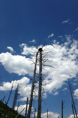
Osprey nest along Jenny Lake
The route uses alternate trails to avoid two very crowded areas and to shorten the overall distance.
1) Instead of following the String Lake Trail across the outlet and then west around the Lake, an alternate route starts from the Leigh Lake Trailhead (String Lake Picnic Area). The alternate route goes around the lake following the east shore. At the portage (String to Leigh) it is a nice side trip to visit Leigh Lake. Back at String Lake, continue on the trail and cross the Leigh Lake outlet. After crossing the outlet the trail climbs to the Paintbrush Canyon Junction.
The east shore is 0.45 mile longer and is very popular on sunny summer days.
2) Instead of taking the Horse Trail Bypass from Cascade Canyon Trail to Jenny Lake Trail, the alternative would be to stay on Cascade Canyon Trail to Inspiration Point, Hidden Falls, the West Boat Dock and the Jenny Lake Trail.
The Inspiration Point Trail is really the standard route, but it is very busy on good weather days. The Horse Trail Bypass also saves 0.70 mile.
Hikers attempting to day hike the route should be well acclimated, fit, and accustomed to mountain travel. Backpackers will have to carry their packs over the divide. Pack carefully and leave the iron skillet in the car.
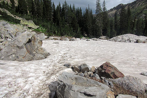
Snow in North Fork of Cascade Canyon
The trails are not marked with blazes, but they are easy to follow (when free of snow) and signs help with directions at each junction.
Check at the Jenny Lake Ranger Station for current conditions before starting the route. Rangers walk the trails and check on hikers, climbers, and conditions.
Snow lingers on the upper slopes. Safe passage might require tools, skills, and experience. A slip or fall on snow or ice may produce a slide and possible injury or death.
On the upper slopes of Paintbrush Canyon, at the switchbacks just before the ramp that leads to the ridge, the scree is very loose. Stay on the trail to minimize impact.
In 2012 the trail crews were working on the trail to Holly Lake, but they were probably not going much higher.
Cathedral Peaks from the String Lake Outlet Bridge
For Mountain Data and Route Guide
go to Page
1
Paintbrush Divide Loop Trail Mileage
00.00 String Lake Lake Trailhead
00.30 Jenny Lake Trail Jct
01.60 Holly Lake Trail Jct
06.50 Holly Lake
08.25 Paintbrush Divide
10.50 Lake Solitude
13.15 Forks of Cascade Canyon
16.65 Horse Trail (Inspiration Point bypass)
17.30 Jenny Lake Trail Jct
18.55 String Lake Loop Trail Junction
18.85 String Lake Trailhead
Map Link
The link opens in a new window.
Paintbrush Divide Loop Trail Map - pdf