

Lawn Lake - Rocky Mountain National Park
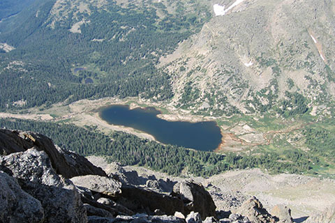
Lawn Lake from Mummy Mountain
The Adventure Guide to the Lawn Lake includes a trail description of the Lawn Lake Trail, photographs of the Lawn Lake Trail, comments from our hikes, mileage data, custom Mummy Range topo map (includes Lawn Lake), and route GPS tracklogs. The guide will familiarize you with the area and help you on your hike.
Photos from: Jul11, Jun12, Jul12, Jul13
Elevation: Lake - 10,987', Trailhead - 8,540'
Range: Rocky Mountain National Park
Trailhead Latitude: 40.40730, Longitude: -105.62555
Route: Lawn Lake Trail
One-Way Mileage: 6.2 - from trailhead to Lawn Lake
For Map, Trail Mileage, GPS, and Trail Notes go to Page 2
Pre-Hike Comments
We have walked and run this path many times through the years. The trail climbs 2,400 feet in a little over 6 miles to the Lawn Lake basin. Fairchild Mountain Hagues Peak, and Mummy Mountain surround the lake in grandeur.
The Climb
Directions: From Estes Park either:
Take Hwy 34, Fall River Road, to the Park Entrance. From the toll booths, continue on Fall River Road and it is about 2 miles to Old Fall River Road. Turn right and Lawn Lake Trailhead is a short distance on the right.
or
From Hwy 36, Moraine Ave,
go to the Beaver Meadows Entrance toll stations. From the entrance the road climbs 3 miles to Deer Ridge Junction with Hwy 34. Turn right on Hwy 34 and descend 1.75 miles to Old Fall River Road. Turn left on Old Fall River Road and Lawn Lake Trailhead is a short distance on the right.
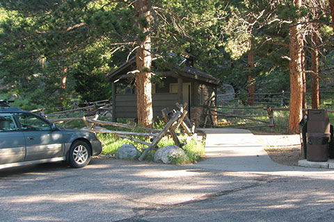
The Lawn Lake Trailhead parking area has privies, trash cans, picnic tables, and a trail kiosk. Water is not available at the trailhead.
From the kiosk, the trail snakes a bit uphill as it begins the climb. A horse trail joins the Lawn Lake trail from the right and then in a short distance another horse trail joins the trail from the left.
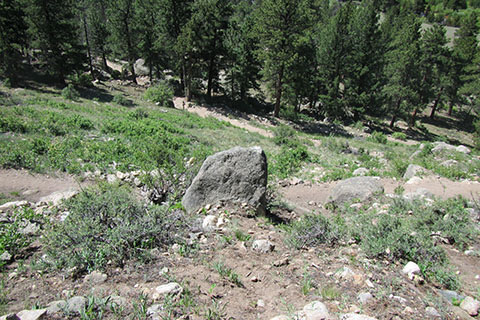
The opening section of trail is exposed to the sun and is maybe steeper than any other section of the trail.
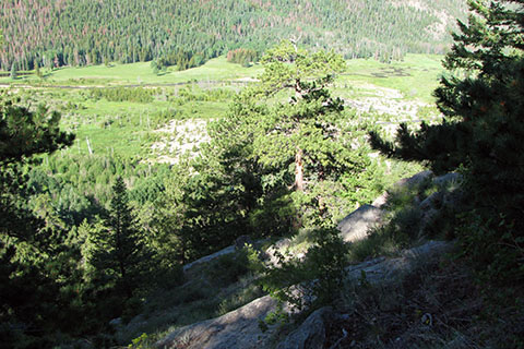
An overlook is at the top of the first series of switchbacks. Many folks only walk this far. There are good views of Horseshoe Park (the valley below) from a cliff-like overlook a short distance off the trail.

From the overlook, the trail begins a long rising traverse until it reaches the banks high above the Roaring River. The RMNP has posted a sign giving fishing specifics near the trail, but for hikers it also marks the one mile point (plus a little). Above the sign the trail's grade eases a bit as it follow along the river until the next switchbacks.
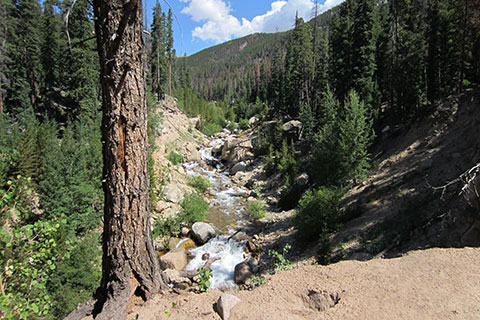
Above the fishing sign, is the first good view of the Roaring River.

At 1.35 miles, the trail comes to the Ypsilon Lake Trail junction. For a brief side trip, the Ypsilon Lake Trail crosses the Roaring River in a short distance. This is the first easy access of the river along the trail. To continue to Lawn Lake return to the junction and then follow the Lawn Lake Trail sign (left).
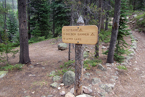
After another 1.35 miles is the junction with the side trails to Cutbank and Golden Banner backcountry campsites. The junction is 2.70 miles from the trailhead and 3.5 miles further to Lawn Lake.
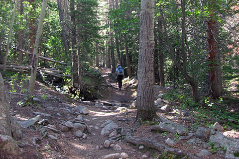
The trail along the Roaring River is a moderate grade. When the slopes grow steeper, switchbacks lead the trail to the right (sometimes a long ways!) and then back toward the river. Please stay on the trail and never shortcut the switchbacks.
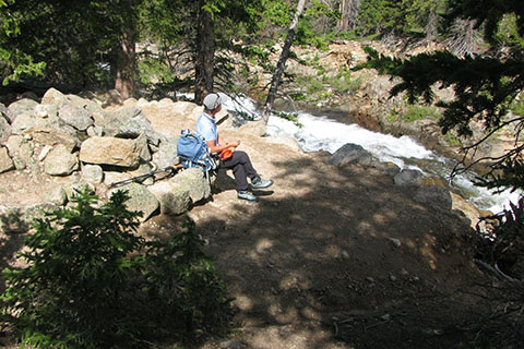
At about 4.60 miles from the trailhead is the beginning of the upper set of switchbacks. The second switchback on the river side, overlooks the Roaring River and makes a good rest stop (4.75 miles from trailhead).
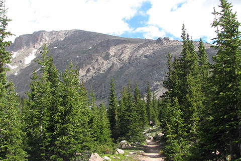
The trail levels as it approaches the Lawn Lake Basin. Mummy Mountain dominates the view.

At 5.5 miles from the trailhead the Lawn Lake Trail junctions with the Black Canyon Trail. (For a differing view of mileage - the park sign indicates it is 5.7 miles from the trailhead).

The trail continues to follow the Roaring River as it climbs around the bend and up a short steeper section of trail. The trail then climbs along the river banks until reaching the lake. The Saddle is in the center of the (above) photo and Fairchild Mountain is to the left.
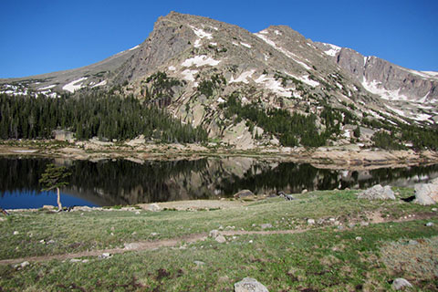
At 6.2 miles the trail reaches Lawn Lake.
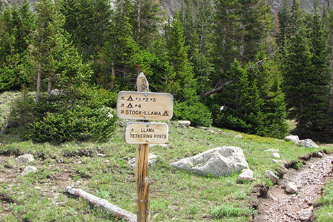
The campsites are above the lake and beneath Mummy Mountain.
Campsites have tent pads and privies.
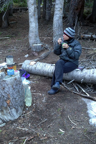
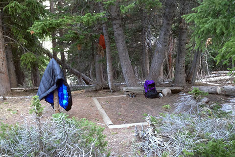
A cool breakfast at the campsite.
The total distance to Lawn Lake is 6.2 miles. The trail is rated as moderate.