

Grand Teton Loop - Grand Teton National Park
The Adventure Guide to the Grand Teton Loop includes a trail description, photographs of the trails, comments from our hike, mileage data, the Grand Teton topo map links, and Grand Teton Loop GPS tracklog links. The guide will familiarize you with the mountain and help you on your climb.
Date Hiked: 18July13
Elevation: high point - Static Peak Divide - 10,790'
Range: Grand Teton National Park
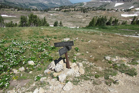
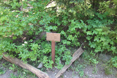
Death Canyon Trailhead
Latitude: 43.65580, Longitude: -110.78000
Route: Grand Teton Loop
One-Way Distance: 34.90 miles
For Map, Trail Mileage, GPS, and Trail Notes go to Page 2
Pre-Hike Comments
We had never hiked the Loop before our trip, but we had hiked sections of it. In the summer of '13, by the time we made it to the Tetons we had been in the mountains for over a month. We were acclimated and fit. Part of our goal was to see if we (normal human beings) could do the entire loop by dividing it into two day hikes. Day 1: Drive from Jenny Lake campground to the Death Canyon Trail Head and hike from there back to camp. Day 2: Hike from camp back to the car. We spent a good deal of time planning the trip. After storing all of our food, cooking gear, and anything else we might have needed in the bear boxes at the Jenny Lake campsite, we drove to Death Canyon Trailhead and left our car. On our first day we hiked from Death Canyon Trailhead over Static Peak Divide, Hurricane Pass, and then down Cascade Canyon and around Jenny Lake and back to our campsite at Jenny Lake Campground. The next morning we walked the Valley Trail back to Death Canyon Trailhead and our vehicle.
The Loop
Directions: From the Teton Park Road at the Visitors Center, go west on the Moose-Wilson Road for 3 miles to the Death Canyon - White Grass Trailhead Road. The trailhead is at 1.5 miles - the end of the road.
If following on the cloudhiking map (Page 2), a GTL (Grand Teton Loop) is used in conjunction with the trail name, such as GTL - Valley Trail, to specify the Loop route and the official name of the trail.
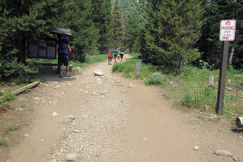
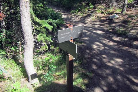
Starting at the kiosk, the trail junctions with the Valley Trail a short distance from the parking area.
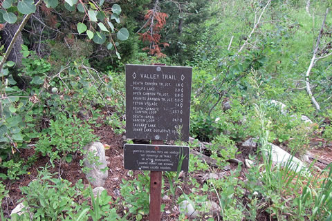
Death Canyon is to the left. Jenny Lake is to the right.
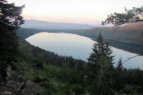
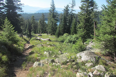
The trail climbs south gradually for 1 mile to the Phelps Lake Overlook.
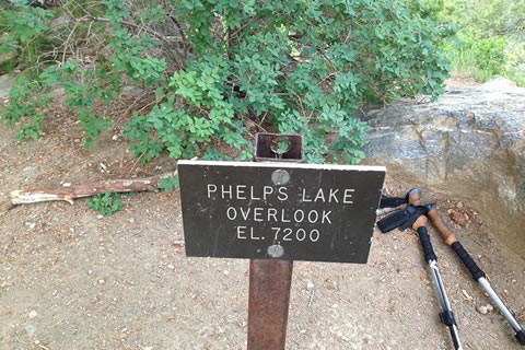
For many day hikers, the hike to the Overlook is a destination in itself. The views are outstanding, as the overlook stands 600 feet above Phelps Lake.
From the Overlook descend open slopes to the opening of Death Canyon. Remember, day users who are hiking an out-and-back will have to re-climb to the overlook on their return. At the end of the day with the sun on the slope it may seem like a difficult climb.
At .70 mile from the Overlook is the junction at the start of the Death Canyon Trail. The junction also gives access to the Phelps Lake Campsites and Phelps Lake Trail.
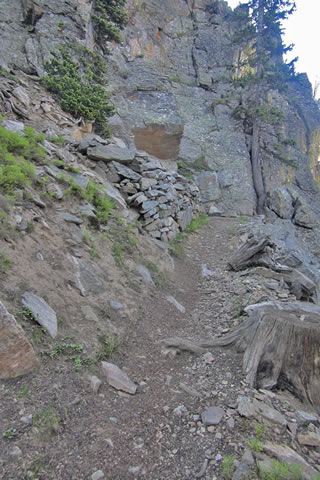
The start of Death Canyon is lush and shady. The overgrown trail makes the hiker wish they had bear bells or some means to alert bears that they are coming, especially early in the morning.
The trail climbs up through the canyon, switchbacking along the north side of the creek under the cliffs of Albright Peak.
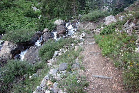
The trail is never very far from the creek and there are great spots to refill water, take breaks, or watch the rock climbers on the cliffs.
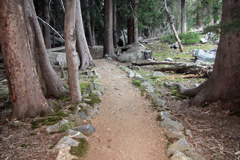
Finally the trail in the canyon eases off and passes through an enchanted area before reaching the trail junction.
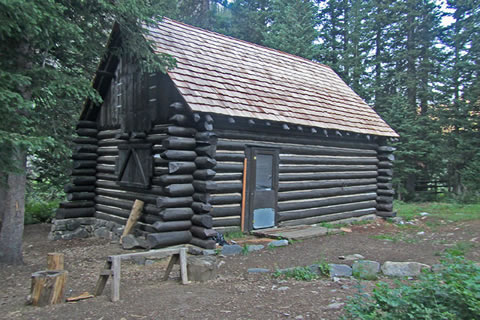
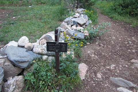
The Death Canyon Patrol Cabin is located close to the trail, near the Alaska Basin Trail junction. The Death Canyon Camping Zone is further into Death Canyon.
The Death Canyon Trail is 2.2 miles from the junction with the Valley Trail to the Patrol Cabin. It is 3.9 miles to return to the trailhead and 4.1 miles to continue on to Static Peak Divide. It is a good steady climb to the Divide. Fill up with water, eat a snack, and then set a non-tiring pace for the climb.

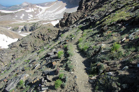
Wildflowers line the trails on the south facing slope.
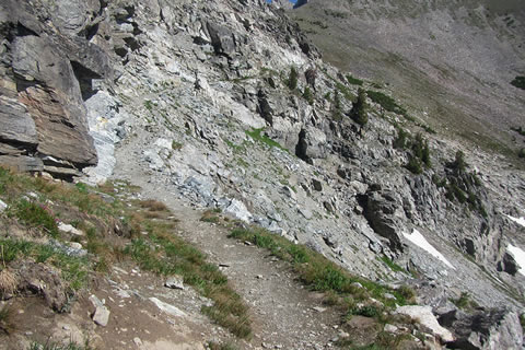
The trail makes long switchbacks across the slope. At the east end of a few of the switchbacks the trail runs next to the cliff with excellent views. The views get even better just a little bit higher.
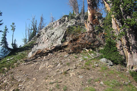
The trail comes out of the trees onto a shoulder at 2.60 miles from the Patrol Cabin.
The shoulder makes a natural rest stop for a short break before the final climb to the Divide. There are good views of the Valley.
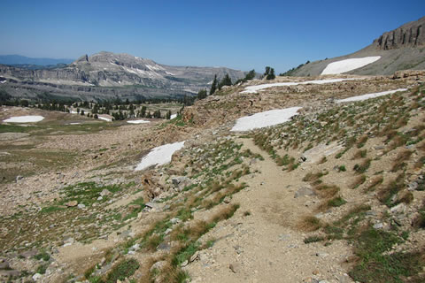
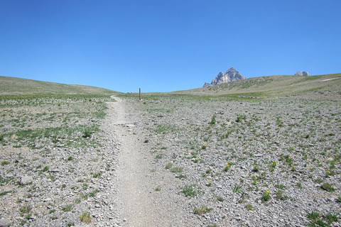
Leaving the shoulder the trail re-enters the woods and contours to the left (south) of the rising ridge. In about .60 mile the trail reaches a saddle. From the saddle, the summit of Static Peak is finally visible. The saddle is close to tree-line. The trail stays above tree-line until it enters the South Fork of Cascade Canyon. Remember to keep a weather-watchful eye to the sky.
Leaving the saddle the trail climbs through the cliffs along and to the right of the ridge. With excellent views, the trail winds and switchbacks for an easy course.
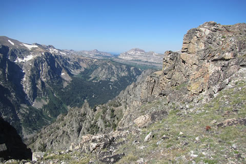
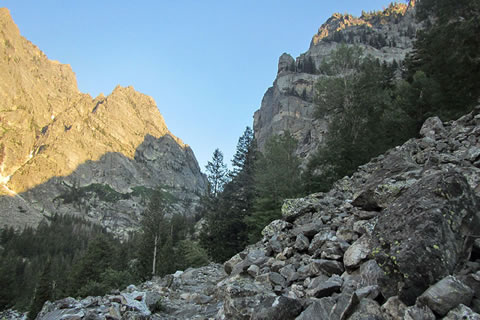
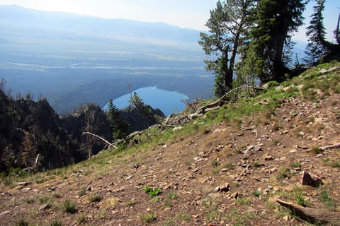
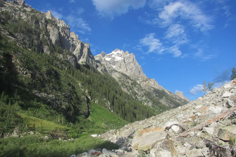
Approaching the Divide are wonderful views of Death Canyon to the South about 2,500 feet below.
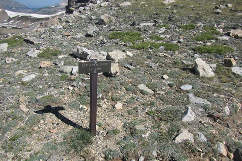
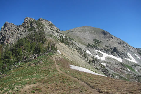
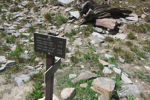
Static Peak Divide is at 10,790 feet and is the high point of the Loop. The Divide is 8 miles from the Death Canyon Trailhead and Hurricane Pass is 7.3 miles ahead.
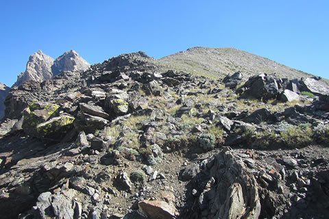
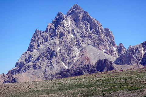
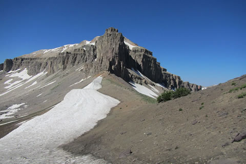
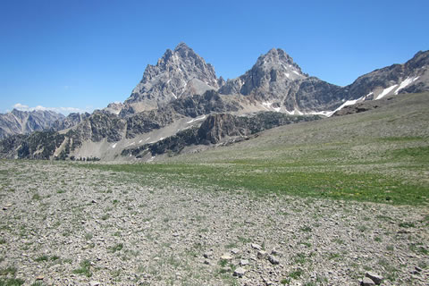
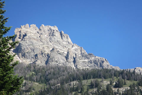
Static Peak makes a good side trip. The route climbs a good climber's trail to the top. Buck Mountain is also seen in the background of the photo.
Cross the Divide and descend the steep section of the rocky trail by a few tight switchbacks. The next destination is Buck Mountain Pass.
After descending a couple of hundred feet, the trail crosses towards the pass. In our mid-July trip, the area between the Divide and the Pass held the most snow.
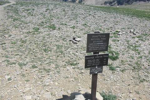
At Buck Mountain Pass the trail leaves the National Park to enter the National Forest and Alaska Basin. Buck Mountain Pass is 1.1 miles from Static Divide and 9.1 miles from Death Canyon Trailhead.
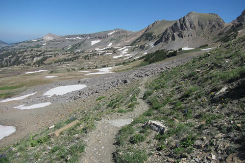
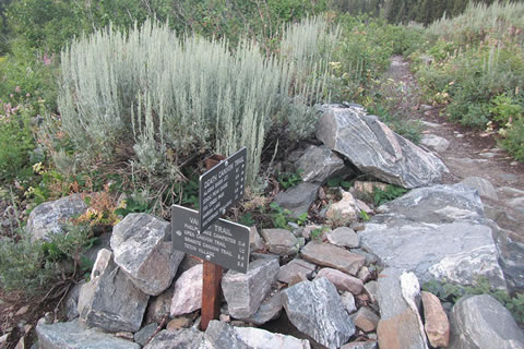
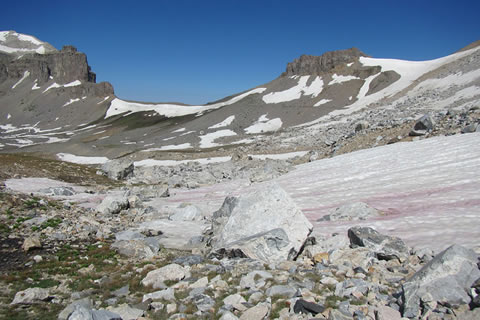
Alaska Basin is a large expanse of alpine tundra. The trail stays above the lakes (Basin Lakes) as it gradually descends to Sunset Lake.
In .40 mile the Alaska Basin Trail comes to the junction with the Alaska Basin Shelf Trail. Either trail may be taken at the junction. The Basin Lakes area is a popular camping area. The regular route following the Shelf Trail is shorter and has less elevation gains.
The Alaska Basin Shelf Trail passes through a few interesting formations, including a shelf cut across a rock outcrop. The shelf is so smooth, it is almost as if it were polished.
After 1.9 miles, the trail reaches the junction with the Teton Crest Trail coming from Basin Lakes. Follow the Teton Crest Trail toward Sunset Lake.
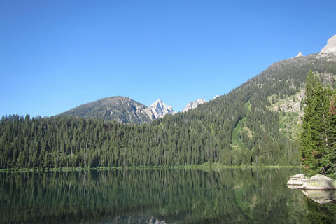
Descend a gentle slope .40 mile to Sunset Lake. The lake is one of the special places along the route. It is 3.8 miles from Static Peak Divide and 11.80 miles from the Death Canyon Trailhead.
The trail crosses the outlet and leaves Sunset Lake climbing toward Hurricane Pass. After passing through open slopes, the trail takes an agressive climb via switchbacks along a rock outcropping. Be sure to look back at the great views of Sunset Lake.
As the trail begins to reach the top of the shoulder, the Tetons begin peeking over the horizon. The views only get better!
From the top of the shoulder the views are, well ... grand. It is interesting that the shoulder with the excellent views is really not Hurricane Pass.
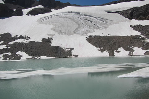
The actual pass is close, though. The trail passes over the shoulder and descends along a ridge to a saddle north of Schoolroom Glacier. This is Hurricane Pass, as marked on the USGS maps.
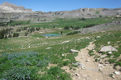
The view from the Pass is of Schoolroom Glacier and the Upper South Fork of Cascade Canyon. The pass is 1.80 miles from Sunset Lake and 13.60 miles from Death Canyon Trailhead.
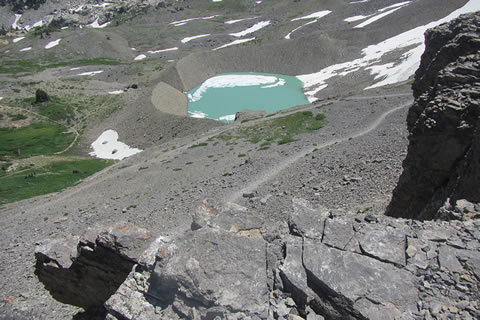
Descend through a series of switchbacks about a half of a mile to a side trail that leads to Schoolroom Glacier and Lake. The short side trip is worthwhile.
From the side trail to Schoolroom, the main trail continues to descend, entering the South Fork Camping Zone in .65 mile. Camping (by permit only) is allowed anywhere within the camping zone, but there are also a number of great designated sites. Most of the sites have bear boxes.
At .80 mile from Schoolroom Glacier Trail and 1.30 mile from Hurricane Pass, the trail reaches the junction with the Avalanche Divide Trail. The junction is 14.90 miles from Death Canyon Trailhead and 8.5 miles ahead to the Jenny Lake Trail.
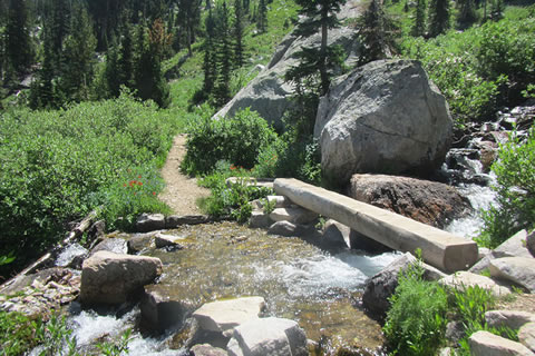
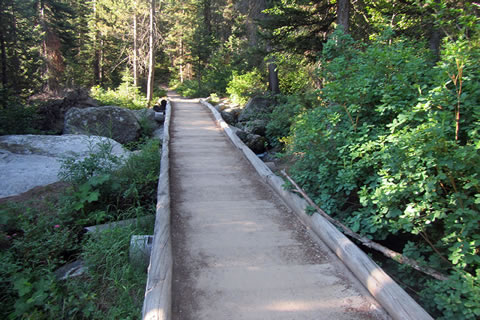
Leaving the Avalanche Divide Junction, the trail descends gradually and then after about .25 mile, switchbacks help calm a steeper section. The trail continues near the creek and enters a lush marshy meadow. At 1.20 mile from Avalanche Divide Junction the trail reaches the footbridge in the photo. (Note: Many footbridges are crossed in the South Fork area - the creek drains the south side of Table Mountain).
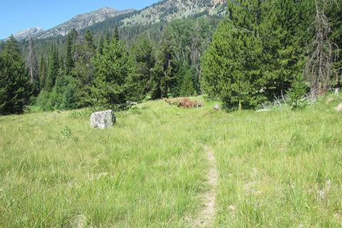
The meadow is a great place to see wildlife.
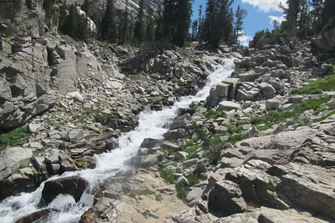
The trail continues along the upper edges of the meadow and then descends through a switchback. At .55 mile from the footbridge (1.75 mile from Avalanche Divide Jct) is a great view of the cascading South Fork.
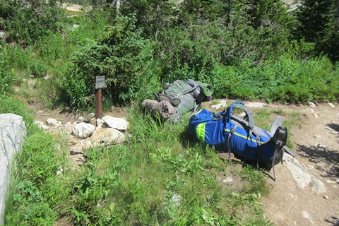
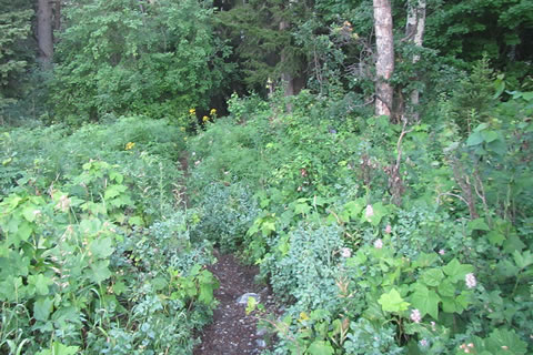
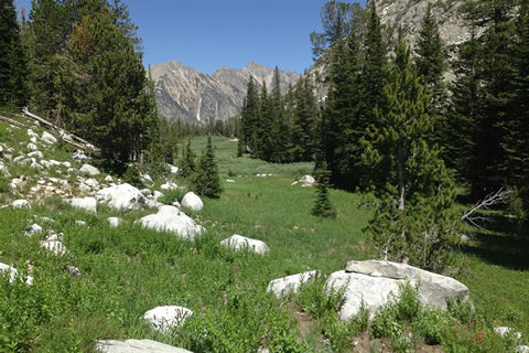
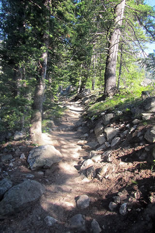
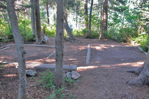
The camping zone continues for another 1.45 miles. The total length of the zone is about 3.35 miles! The photo is of one of the side trails within the zone.
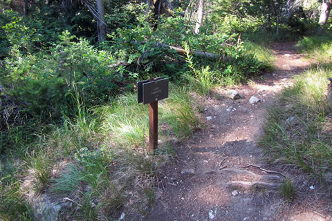
From the "Leaving the Zone" sign it is about .75 mile to the Forks junction as the trail descends through huge boulders.
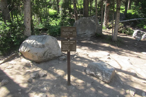
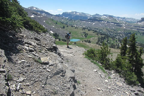
5.30 miles from Hurricane Pass (and 18.90 miles from Death Canyon) the trail reaches the Forks of Cascade Canyon, which is the junction of the South Fork and the North Fork. Continue down Cascade Canyon Trail.
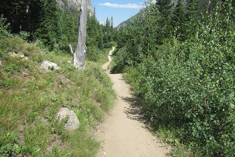
After crossing a substantial bridge the trail rolls along through the canyon. It is a very pleasant walk and very popular.
The views to the south of Teewinot, Owen, and the Grand are excellent. The trail passes through several large scree and boulder fields.
At 3.50 miles the Cascade Canyon Trail reaches the horse trail bypass (on the left). The horse trail goes to the north of the Cascade Canyon Trail. The bypass avoids the crowds around Inspiration Point and is a bit of a shortcut for those heading to the north end of Jenny Lake or String Lake. The trail also leads to the climber trails leading to Baxter Pinnacle or Symmetry Couloir.
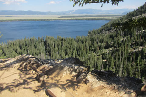
From the horse trail bypass, it is about 0.3 mile to Inspiration Point. It is a good view of Jenny Lake, but in the afternoon it is very crowded.
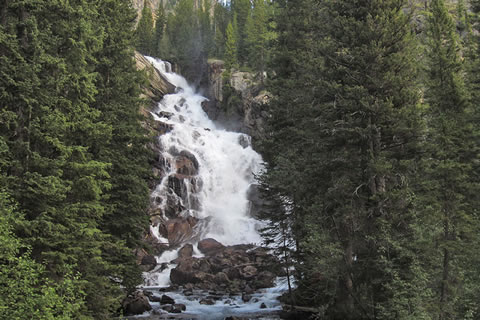
The rocky trail descends steeply .45 mile from Inspiration Point to a large bridge crossing. A junction on the other (west) side of the bridge is the side trail to Hidden Falls. Hidden Falls is quite impressive.
From Hidden Falls the trail leads (.10 mile) to another horse trail junction. The horse trail bypasses a section of the Jenny Lake Trail heading south and joins the Jenny Lake Trail near the Moose Ponds. The horse trail climbs higher (up the slope above Jenny Lake) than the Jenny Lake Trail. There is however, an excellent viewpoint of Jenny Lake along the trail. The horse trail is an optional route.
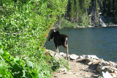
Continuing from the horse trail junction the Cascade Canyon Trail descends .25 mile to the Jenny Lake Trail. The trail to the West Boat Dock crosses the bridge, but the route follows the Jenny Lake Trail toward the Moose Ponds and the Jenny Lake Visitors Center. Yes, that is a young moose on the Jenny Lake Trail!
Follow the rolling Jenny Lake Trail for 1.2 miles to the junction with the horse trail (the other end of the horse trail that ends near Hidden Falls). At .15 mile further, the trail reaches the junction with the northern end of the Moose Ponds Trail. A good overlook of the Moose Ponds is available just a short distance on the Moose Ponds Trail. Finally after another .15 mile on the Jenny Lake Trail is the junction with the Valley Trail. Turn right. The East Boat Dock and Jenny Lake Visitor Center (restrooms, water, general store, Ranger Station, information, and campground) is from .75 to 1 (depending on where you are going) mile further on the Jenny Lake Trail.
The Valley Trail leaves Jenny Lake and heads toward Lupine Meadows. The first .50 mile is a good trail that leads to the Lupine Meadows Road near the junction with the southern end of the Moose Ponds Trail.
The next .50 mile follows along the Lupine Meadows Road past the Teewinot Parking Area and on to the Lupine Meadows Trailhead. The dust along the road can be tough from speeding vehicles.
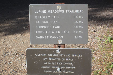
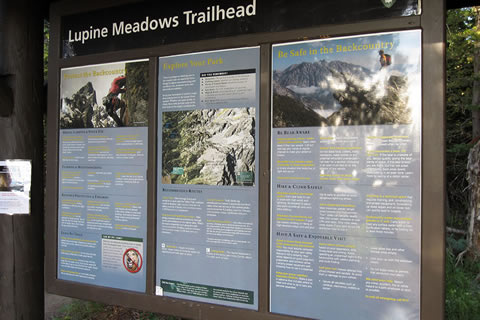
Lupine Meadows Trailhead is a bustling spot. The trailhead services Garnet Canyon and Amphitheater Lake. The parking area fills by mid-morning on nice days. There is a well used privy at the trailhead.
The first .40 mile of the trail is an easy stroll.
The trail then climbs as it traverses south and crosses a bridge. Continuing toward the south, the trail joins a ridge at 1.10 miles from the Lupine Meadows Trailhead. The ridge is between Glacier Gulch and Burned Wagon Gulch.
There are great views of Teewinot from the ridge.
At 1.70 miles from the Lupine Meadows Trailhead the trail reaches the Valley Trail Junction. The Garnet Canyon and Amphitheater Lake Trails leave the junction and climb toward the mountains. The Valley Trail turns left and heads south.
At the Valley Lake Junction the total loop distance from Death Canyon Trailhead is 27.60 miles.
The Valley Trail descends gradually to Bradley Lake.
At 1.05 miles from the junction, the trail reaches the Loop Campsite.
The Loop Campsite is only available for hikers on one of the long distance routes. It is a great campsite on the north shore of Lake Bradley.
Leave the Loop Site and continue around the east shore of Bradley Lake. The trail crosses a long bridge and at gaps in the trees there are very good views of the mountains with the lake, naturally, in the foreground.
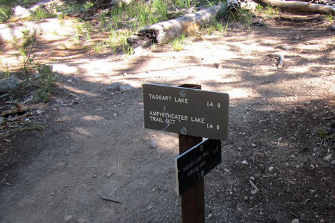
At 1.5 miles from the Valley - Amphitheater Trail Junction, the trail reaches the south shore of Bradley Lake and the junction with the Bradley Lake Trail. The Bradley Lake Trail leads to the Taggart - Bradley Lake Trailhead. Follow the sign to Taggart Lake or for the Valley Trail. (The trail stays to the right.)
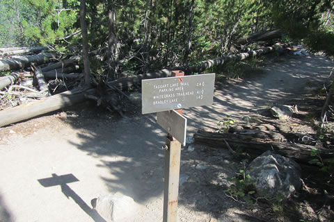
The trail leaves the junction and climbs over a moraine with good views of Taggart Lake. After cresting the ridge, the trail descends to Taggart Lake and continues along the Lake shore to another junction. The Taggart Lake Trail enters from the left (east). The Taggart Lake Trail leads from the Taggart - Bradley Lake Trailhead. It is 1.40 miles from the Bradley Lake Junction to the Taggart Lake Junction. It is a total of 30.50 miles from the start of the Loop at Death Canyon Trailhead.
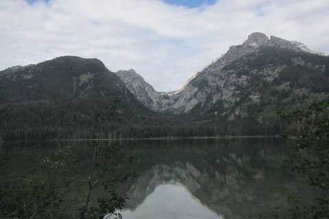
The Valley Trail continues to the south. There are good views of Avalanche Canyon from Taggart Lake.
After crossing a bridge near the outlet of Taggart Lake, the trail climbs and crosses a ridge. The descent leads into the Beaver Creek drainage.
After .80 mile from the Taggart Lake Trail Junction the trail reaches the Beaver Creek Trail Junction. The Valley Trail turns right at the junction and crosses a small bridge over Beaver Creek. Continuing straight at the junction is the Beaver Creek Trail that leads to the Taggart - Bradley Lake Junction.
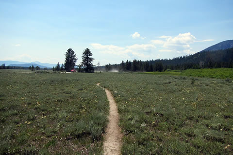
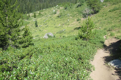
Leaving Beaver Creek, the Valley Trail continues to the south heading toward White Grass Ranch and Death Canyon Trailhead. The trail crosses the forest and fields without much elevation change. There are numerous creek crossings and at times in the fields the trail is not obvious. Nearing the White Grass Ranch utility poles may be spotted to the east (left). There is a bit of a climb before finally finishing the loop. Turn left and return to the Death Canyon Trailhead.
It is 3.60 miles from the Beaver Creek Trail Junction to Death Canyon Trailhead.
The total distance of the Loop Trail is 34.90 miles. Of course, that is the minimum distance. There are plenty of places along the trail that beg to be explored!