

Grand Teton Loop
Loop Notes
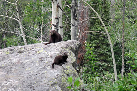
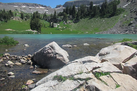
Marmots near Taggart Lake
The White Grass Trailhead Road is east of the LSR Preserve. If you start at Moose and while heading west come to the LSR, you missed the turn and went a bit too far.
The White Grass Trailhead Road is rough. High clearance vehicles are recommended. We drove slowly and picked the best path for our vehicle.
On good weather days, cars park along the upper mile of the road. If you arrive early, the parking area is not as crowded.
White Grass Trailhead and Death Canyon Trailhead are at the same location. We refer to it as the Death Canyon Trailhead, but at times in other documents and maps it might be referred to as White Grass or Whitegrass.
Parking permits are not required. We left our vehicle there overnight without a permit.
If you arrive near midday at the trailhead expect to park some distance away from the trailhead kiosk.
We started on our hike before 5 in the morning, at day break. We had no trouble finding a parking place near the trailhead.
At the trailhead there are privies and a trailhead kiosk.
In 2013 there was an ongoing conversation on the possibilities of changing the traffic flow on the Moose-Wilson Road to one way. Since the road is a primary (though small) road connecting Moose and Wilson, there were many opinions.
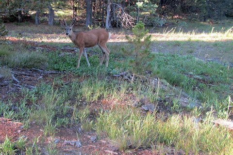
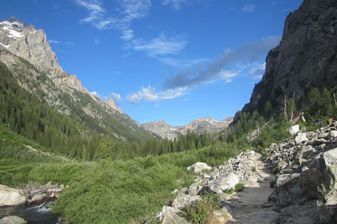
Deer along the Valley Trail
The climber's trail to Stewart's Draw is just before the third footbridge and a little less than a half of a mile from Death Canyon Trailhead.
If you are planning a big mileage day, you would have to start early in the morning. The trail is easy to follow, for humans and bears also. Be sure to make plenty of noise.
We made a mini stop at the Phelps Lake Overlook (at one mile). Then, throughout the day we made several mini stops, but none longer than ten minutes each.
Descending to Death Canyon Creek reminded us of past day hikes in the area. On those hikes we had to reclimb the hill to the overlook (returning to the trailhead) at the end of the day. If day hiking, keep a little extra in the tank for the climb back to the overlook, it can be tough.
At the Death Canyon Trail Junction with the Valley Trail, turn right to go to Death Canyon, or for the Phelps Lake campsites - continue on the Valley Trail to the junction with the Phelps Lake Trail.
The hike up Death Canyon has views out into the valley and of the rock walls on either side of the canyon. Water is available at many spots where the trail is close to the creek.
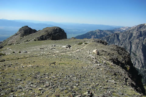
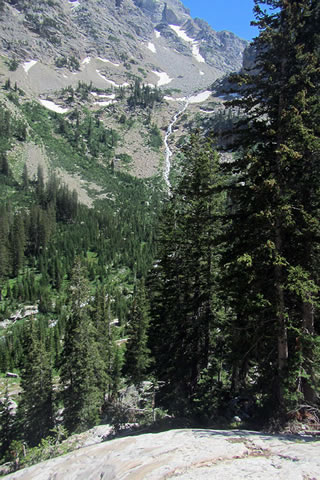
Static Peak Divide looking into the Valley
The Death Canyon Patrol Cabin is visible from the junction with the Alaska Basin Trail.
Continue upstream from the Patrol Cabin (staying on the Death Canyon Trail), if you are planning to camp in the Death Canyon Camping Zone. This side trip to the camping area would add mileage to the Loop.
We filled up with water before leaving the junction, but on our trip in early summer, there were opportunities to collect water from streams or runoffs along the Alaska Basin Trail as it climbed toward Static Peak. When in doubt, get water before the climb.
From reading various guides, we were concerned about the climb to Static Divide, but it was not overly difficult. Two great resting spots are the shoulder at about 9800' and a saddle at 10,200'. The saddle is close to treeline.
Check the skies for bad weather before climbing above treeline.
We reached Static Peak Divide at 9:15 in the morning.
A side trip to Static Peak's summit is straightforward from Static Peak Divide, if you so desire.
The most snow we found on our hike was between Static Peak Divide and Buck Mountain Pass. We hiked in running shoes. Nearing Buck Mountain Pass there was a long horizontal snowfield protecting the pass. Boots would have been more secure while climbing the short steep section of snow. It was the only time we wished that we had had boots instead of running shoes. We proceeeded with care.
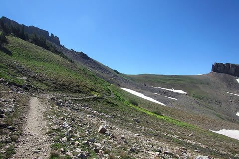
Looking back at Buck Mountain Pass
The Basin Lakes are a popular camping spot. Currently, no permits are required for camping in the National Forest sections of the route.
The side trip to Basin Lakes adds a mile distance and a few hundred feet to climb.
Sunset Lake is on the trail. It is another popular camping area. There are several good sites around the lake that can be used while still practicing minimum impact usage.
It is a good climb to Hurricane Pass. The views of the Tetons grow larger with each step.
The actual location of Hurricane Pass (to the best of our undestanding) is not on the shoulder at 10,500'. The shoulder, which is above Schoolroom Glacier, is a great spot for pictures, but the pass is actually at 10,338' and north of Schoolroom Glacier.
We reached Hurricane Pass at noon.
The sidetrip to Schoolroom Glacier is a must.
Sunset Lake
The South Fork of Cascade Canyon camping zone is very long. Hikers may camp anywhere within the zone (while following the Park's Minimum Impact rules), but the many established campsites are convenient to use. The sites also have bear boxes.
There is no registration for individual campsites within the camping zone. The hiker really does not know whether a site is taken or not until they are at the site.
The Avalanche Divide Trail is supposed to be spectacular but we did not visit the area on our trip.
Cascade Canyon is an easy stretch of trail.
At Inspiration Point, crowds of tourists are on the trail. We probably lost thirty minutes as we tried to navigate through the masses.
At 4:00 in the afternoon, we arrived at Inspiration Point.
Hidden Falls is spectacular.
The Hidden Falls Horse Trail is not a shortcut to any place. It does have a great overlook, very similar to Inspiration Point, but less crowded. The trail is more difficult than the Jenny Lake Trail.
Pay close attention to the directional signs when near Jenny Lake, there are many trails in the area.
Turning onto the Valley Trail near the Moose Ponds, the crowds will be left at Jenny Lake.
If you need to go to the Jenny Lake Visitor Center area, it is about a mile away.
Cascade Canyon
The Moose Ponds Trail may be taken instead of the Valley Trail. It is a bit longer than the Valley Trail.
The route travels along the dusty Lupine Meadows Road for about .50 mile.
Lupine Meadows Trailhead is very popular and busy.
The first 1.7 miles from Lupine Meadows Trailhead may be crowded.
At the Valley Trail - Amphitheater Lake Trail junction, once again the crowds are left behind.
The Loop Site at Bradley Lake is a wonderful campsite.
Pay close attention to the directional signs near Bradley and Taggart lakes; there are many trails in that area, too.
South of Beaver Creek (near Taggart Lake), the trail seemed hardly used. When crossing fields, we had to look for the continuance of the pathway.
South Fork of Cascde Canyon
For Mountain Data and Route Guide
go to Page
1
Loop Trail Mileage
00.00 Death Canyon Trailhead
01.00 Phelps Lake Overlook
01.70 Phelps Lake - Death Canyon Jct
03.90 Death Canyon Patrol Cabin
06.50 Shoulder - 9,800’
08.00 Static Peak Divide
09.10 Buck Mountain Pass
09.50 Alaska Basin Trail Jct
11.40 Teton Crest Trail Jct
11.80 Sunset Lake
13.60 Hurricane Pass
14.90 Avalanche Divide Trail Jct
18.90 Cascade Canyon Forks
22.40 Horse Trail (above Inspiration Pt)
23.15 Horse Trail (near Hidden Falls)
23.40 Jenny Lake Trail (near West Boat Dock)
24.60 Horse Trail (near Moose Ponds)
24.75 Moose Ponds Trail
24.90 Valley Trail
25.40 Moose Ponds Tr at Lupine Meadows Rd
25.90 Lupine Meadows Trailhead
27.60 Valley Trail Junction
29.10 Bradley Lake Trail Jct
30.50 Taggart Lake Trail Jct
31.30 Beaver Creek Trail Jct
34.90 Return to Death Canyon Trailhead
Map Link
The link opens in a new window.
Grand Teton Loop - pdf
Grand Teton Loop - geo-pdf
GPS
Control Click or Right Click for download.
Grand Teton Loop in Text Format - gt-loop.txt
Grand Teton Loop in GPX Format - gt-loop.gpx
Grand Teton Loop in KML Format - gt-loop.kml