

Lower Loop Overnight Trail - Fall Creek Falls State Park
The Adventure Guide to the Lower Loop Overnight Trail at Fall Creek Falls State Park includes a trail description of the Lower Loop Trail, photographs of the Lower Loop Trail, comments about the Trail and Park, mileage data for the Lower Loop Trail, the custom Park topo map, and Lower Loop Trail GPS tracklogs. The guide will familiarize you with the Park and help you on your hike.
Trail Data
Date Hiked: images mostly from Mar 2010 hike
Park: Fall Creek Falls State Park
Address: 2009 Village Camp Road, Pikeville, TN 37367
Trailhead Latitude: 35.67542, Longitude: -85.33742
Trail Rating: mostly moderate with difficult sections
Round-Trip Mileage: 12 miles
For Map, Trail Mileage, GPS, and Trail Notes go to Page 2
Pre-Hike Comments
We have visited the Park for many years. The Lower Loop is one of our favorite day hikes. as it tours the Park.
The Hike
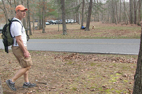
Directions: Fall Creek Falls State Park is located off Hwy 284 between Highways 111 and 30. The junction on Hwy 111 for the South Entrance is between Sparta and Dunlap. The junction of Highway 111 and 284 is between Spencer and Pikeville. Follow signs to the Park. The Overnight Trailhead is located just inside the North Entrance of the Park on Hwy 284. See map.
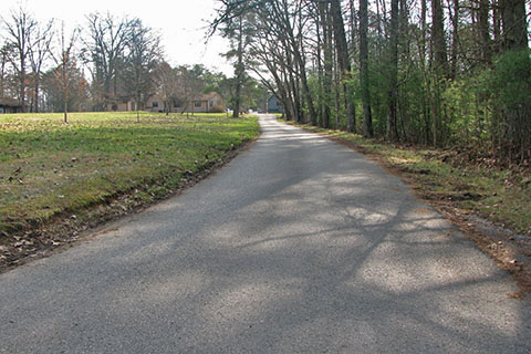
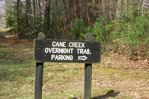
Overnight parking is behind an employee residence located to the east of Hwy 284. The drive is paved. Permits are required for an overnight hike. Permits are available at the Nature Center.
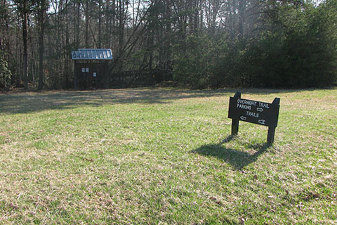
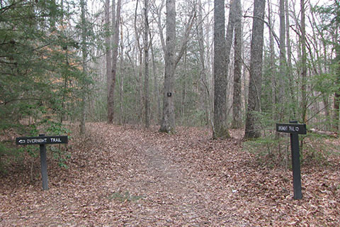
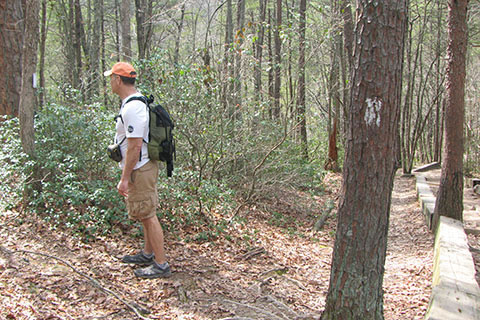
Park behind the house near a barn/shed. The area used to be the maintenance area of the Park. The Upper Loop and the Lower Loop Trails begin from the trailhead.
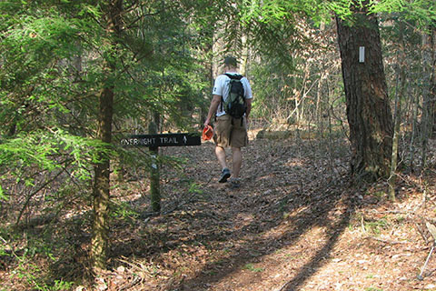
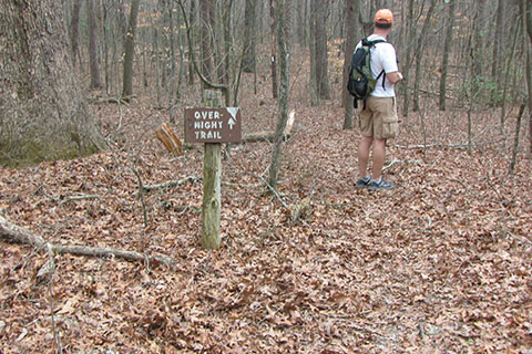
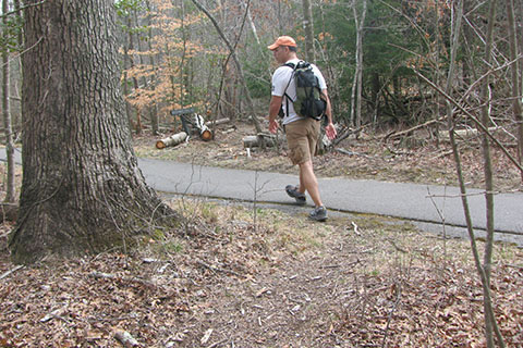
From the kiosk the Lower Loop Trail goes left at the first junction.
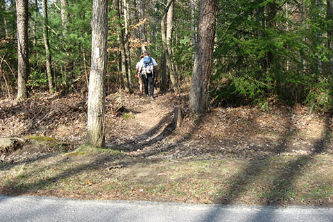
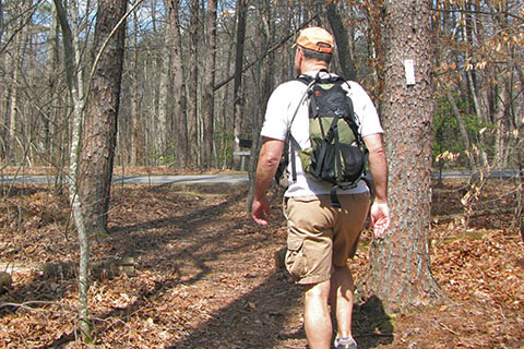
Cross Hwy 284, the Main Park Road, and continue.
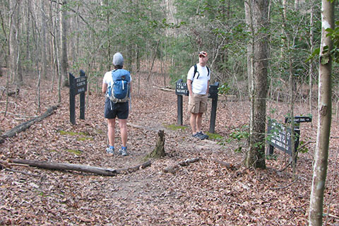
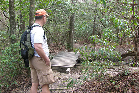
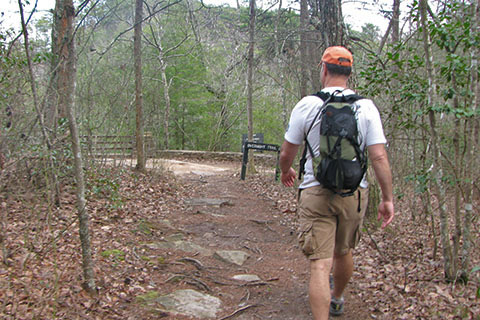
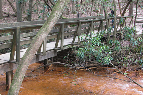
In 0.55 the trailhead spur joins the Paw Paw Trail. This is the North Junction of the Paw Paw. Turn right. The trail crosses a drainage on a small bridge and then climbs to another junction.
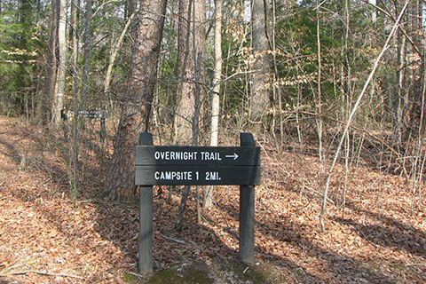
Turn right and follow the signs to Campsite 1 and the Overnight Trail.
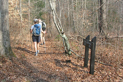
The area is criss-crossed by many unimproved roads. The crossings are obvious.
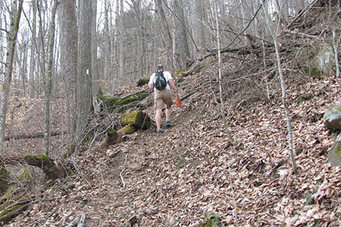
After the second dirt road crossing, the trail continues across rolling terrain.
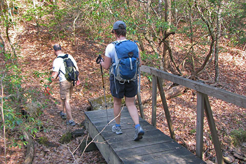
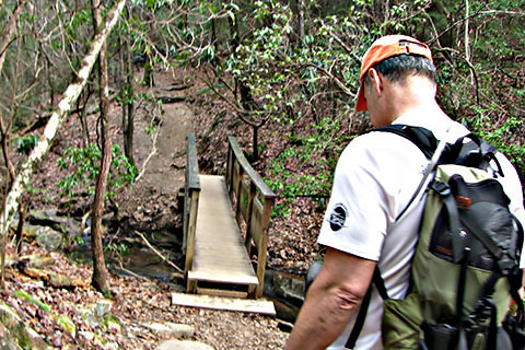
Descend to a bridge crossing a creek/drainage. The bridge is 1.20 miles from the trailhead. After crossing the bridge the trail climbs on a mostly easy grade.
After every climb there is a descent and vice versa. The trail continues the up and down trend by descending 200 feet to Walling Mill Creek, 2.10 miles from the trailhead. This is a large creek. It is the water supply for Campsite 1, but all water should be treated.
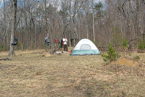
Cross the bridge, turn right and go a short distance along the creek before turning uphill to the left. A sign marks the sharp turn. Campsite 1 is at the top of the hill. The trail uses an old road.
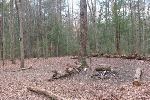
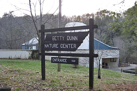
There are sites on both sides of the trail at Campsite 1. The water pump does not work, but it is only a quarter of a mile back to Walling Mill Creek. All campers must register at the Nature Center in the Park.
Remember to practice minimum impact usage. Campers must clean up after themselves. When campers leave a campsite, the area should look better than when they arrived. Carry a trash bag. Everything a hiker brings on a hike or overnight hike should return with them. Show respect.
The Camp Site is 2.35 miles from the trailhead.
Leaving Campsite 1, the trail follows the road through camp, but then turns left at a signed junction. It is an obvious turn to the left.
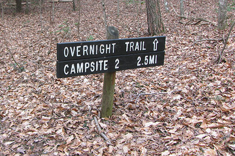
A sign to Campsite 2 is posted, just to make sure the hiker is going in the correct direction!
After about .15 mile, a rockhouse is to the left of the trail and is worthy of a side exploration. The trail is near the Park boundary and buildings are visible to the right side of the trail. Always respect private property.
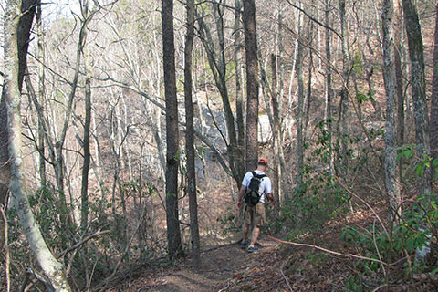
Continuing along the plateau the trail begins to descend after three quarters of a mile from Campsite 1. This is the start of the descent to Cane Creek. It is a 700 foot drop in elevation. In the fall, winter, and early spring, good views of the gorge are possible on the descent.
The trail passes by a switchback (overlook) and then through a weakness in a cliffband, before descending to near Cane Creek. The bridge is still a third of a mile to the north.
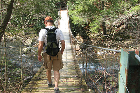
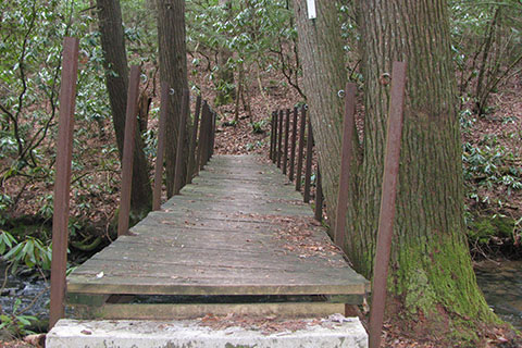
Arrive at the Cane Creek Suspension Bridge, 1.70 miles from Campsite 1. A stone wall indicating the old park boundary is visible a short distance to the north of the crossing.
After crossing Cane Creek the trail turns south and follows along the creek.
The trail turns right and then works it's way up through a field of rocks and boulders. Pay close attention to the blazes and boot marks, at times the trail is difficult to follow.
The trail then climbs steeply out of the gorge.
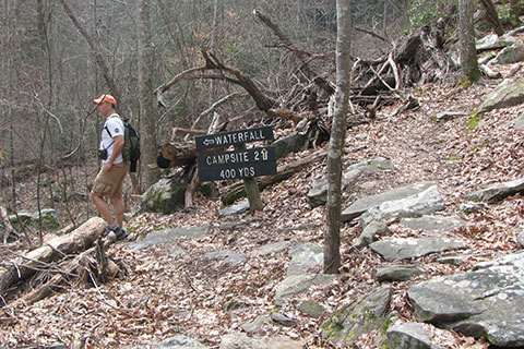
A side trail to the waterfall is reached after .75 mile. This is the water for Campsite 2. The water should be treated.
From the junction with the waterfall side trail, it is .30 mile to Campsite 2. The Piney Creek Mountain Bike Trail also goes to the camp. Reservations are required for camping.
Campsite 2 is 2.75 miles from Campsite 1 and 5.10 miles from the trailhead parking. To finish the loop it is 6.90 miles.
The trail leaves Campsite 2 following the dirt road (which is also the Mountain Bike Trail.) .20 mile from camp the Overnight Trail leaves the road and turns left.
Old farm roads criss cross the plateau lands. Signs used to help navigate at the junctions. The roads are no longer used and are barely visible, but the signs endure. This sign is near survey marker 1571' and .90 mile from Campsite 2.
In 1.50 miles from Campsite 2, the trail reaches Horsepen Branch. A bridge crosses the creek.
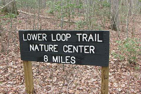
After the crossing, the trail naturally climbs as it crosses to the Piney Creek area. At .90 mile from Horsepen Branch is a sign with the distance to the Nature Center. The sign gives a destination and distance to visitors who are exploring the Piney Creek area.
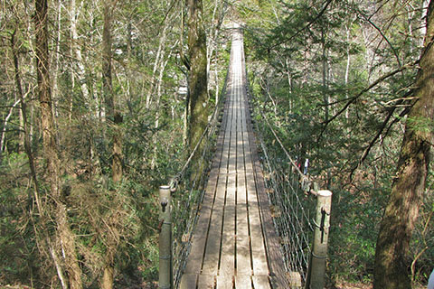
At 2.50 miles from Campsite 2 and 7.60 miles from the trailhead, the trail crosses the Piney Creek Suspension Bridge. The trail climbs steeply to the parking area. This is a popular section of the trail for motorist visitors who only want to hike short distances.
Just short of the parking area, the trail leaves the wide path and turns to the right. Blazes mark the turn.
A short side trip is the Piney Falls Overlook. Continue to the parking area and go left. Follow the obvious path to the overlook.
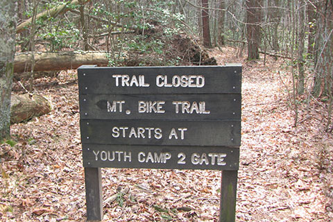
A mountain bike trail used to connect Piney Falls and Youth Camp 2 (and the Gilbert Gaul Trailhead). Continue straight at the sign.
The trail crosses the Scenic Loop Road after 0.60 mile from Piney Creek Bridge. The crossing has blazes and a sign.
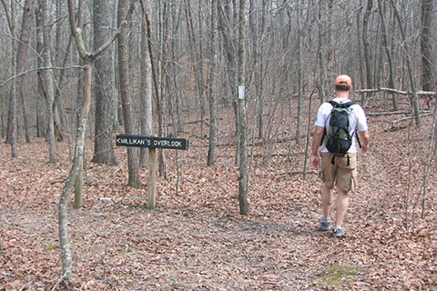
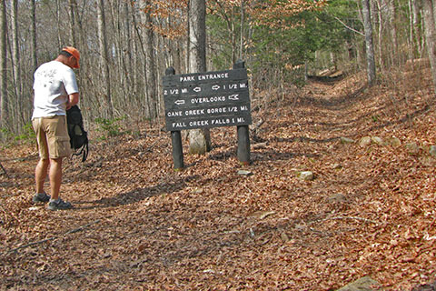
From the crossing it is .45 mile to Millikan's Overlook Trail Junction. The side trail leads .45 mile to the Overlook. It is a worthy side trip to Millikan's and neighbor Buzzards Roost.
Continuing from the Millikan's Overlook Trail Junction it is .95 mile over rolling ground to the Fall Creek Falls parking area. The trail crosses the road and re-enters the woods. Signs and blazes mark the trail.
After a hundred feet the trail junctions with the paved bike trail (from the Dam and the Inn). The trail crosses the bike path. Blazes mark the crossing.
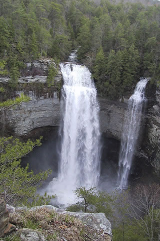
Turning left on the bike trail leads to the popular Fall Creek Falls Overlook and the Fall Creek Falls Trail that descends to the plunge pool.
Continuing on the Overnight Trail, the trail contours around the Falls area and joins the Woodland Trail after .15 mile from the road crossing. The Woodland Trail links the Nature Center and Fall Creek Falls. Turn right to the Nature Center.
The trail descends steeply to Coon Creek. Please stay on the trail. Use designated overlooks only.
After crossing the creek, the trail climbs a bit and then descends to Fall Creek.
Fall Creek is the stream that fills the lake and forms the waterfall. The rate of flow is determined by the dam.
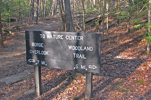
The Gorge Overlook Junction is .35 mile from Fall Creek Falls Parking Area. Another nice side trip takes the Gorge Overlook Trail instead of the Woodland. The Gorge Overlook Trail has 3 side trails that lead to overlooks.
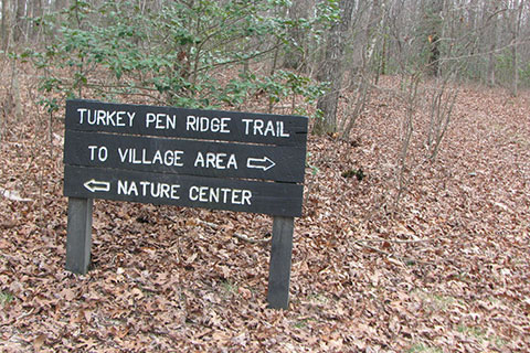
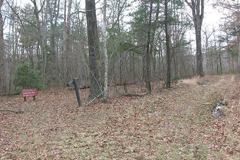
Continuing on the Woodland Trail climb a hill to the junction with the Turkey Pen Ridge Trail. The Turkey Pen Ridge Trail goes to the Village Area of the Park in .45 mile.
From the Turkey Pen Ridge Junction the trail descends to the second junction with the Gorge Overlook Trail. Follow signs to the Nature Center and descend steeply.
A side trail from the right comes from the campground.
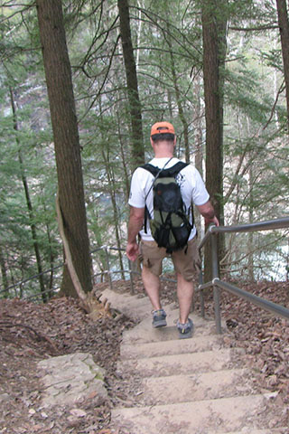
Near the Campground Trail Junction, the Woodland Trail descends steps to the left to Cane Creek. The trail crosses the creek above the Cascades on a suspension bridge.
After crossing the bridge follow the walkway around the Nature Center. Water, restrooms, and information are available in the area. Short side trips include the Cascade Overlook and Cane Creek Falls Overlook.
The Nature Center is 10.50 miles from the trailhead and 1.50 miles to go - to return to the trailhead and finish the loop.
Leaving the Nature Center stay in the grass along the left side of the road. A blaze can be seen a short distance on the left. Enter the woods and descend to Rockhouse Creek. The trail follows along by the creek to a crossing near the Park Road.
Cross Rockhouse Creek stepping on stones or climb to the road and carefully cross along the shoulder-less road.
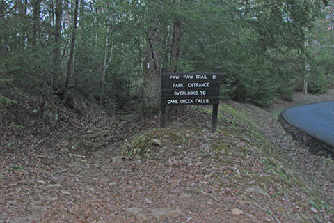
Pass the junction with the Cable Trail (a steep descent to the base of Cane Creek Falls) and follow signs for the Paw Paw Trail.
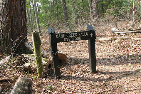
Climb steeply to the first overlook. The Cane Creek Falls Overlook is to the left after the angle of the climb eases.
The next junction is the south junction of the Paw Paw loop. It is .40 mile from the Nature Center. To the left leads to two overlooks and to the right is the standard route to return to the trailhead. It is 1.10 mile to the trailhead.
In .55 mile, return to the first junction (north junction) with the Paw Paw Trail. The return trail reverses the first .55 mile of the trail. Climb to the road, cross the road, and return to the trailhead.