

Sandia Mountains - La Luz Trail
The Adventure Guide to Sandia Mountain includes a trail description of the La Luz Trail, photographs of the La Luz Trail, comments from our hikes, mileage data for the La Luz Trail, the La Luz Trail topo map, and La Luz Trail GPS tracklogs. The guide will familiarize you with the mountain and help you on your climb.
Mountain Data
Date Climbed: 03Jun12
Elevation: 10,678'
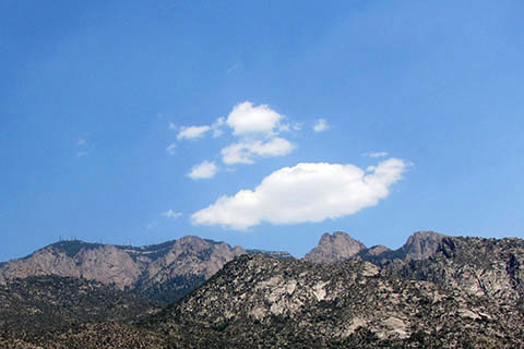
Range: Sandia Mountains
Trailhead Latitude: 35.21966, Longitude: -106.48073
Route: La Luz Trail
One-Way Mileage: 7.2 miles, from trailhead to the Sandia Crest Overlook
For Map, Trail Mileage, GPS, and Trail Notes go to Page 2
Pre-Climb Comments
We had hiked the La Luz once before and enjoyed the hike, but knew how hot the lower sections of the trail can be during the summer days.
The Climb
Directions: From Interstate 25, north of I-40, take exit 234 - Tramway Road NE (Rte 556) to the east. After about 4 miles go left (north) on Forest Service (FS) 333 Road. Follow signs as the road climbs 2.3 miles to the La Luz Trailhead.
From the trailhead parking ...
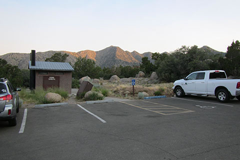
Begin the La Luz Trail by climbing a short set of steps out of the parking area.
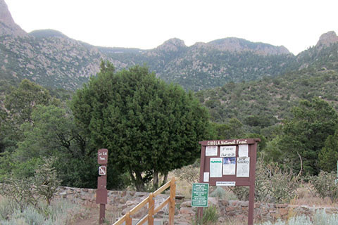
The trail contours to the south and then climbs steadily through four switchbacks before it heads south again. At .9 miles from the trailhead the trail reaches the junction with the Tram Trail. The Tram Trail traverses the lower slopes of the Sandia Mountains from the La Luz Trail south to the Sandia Tramway.
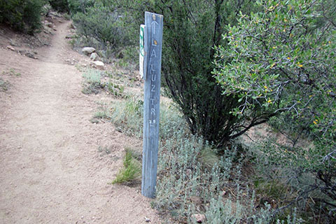
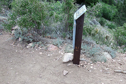
The mileages carved, etched, or painted into the existing posts, are cleaver uses of resources.
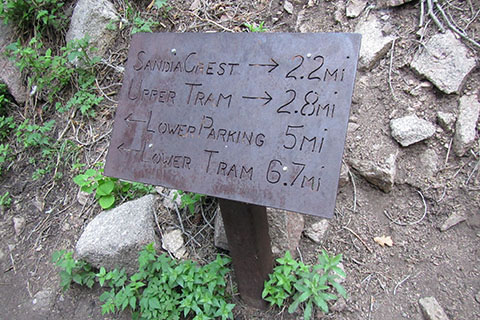
The sign's mileage to the summit - 7 Miles - is probably a little high.
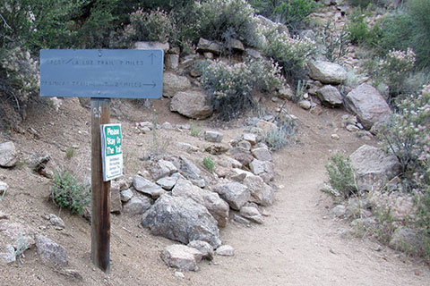
Switchbacks help tame the steep climbs. Please stay on the trail. It is tempting to cut switchbacks - especially when heading downhill, but it causes erosion and then maintenance issues.
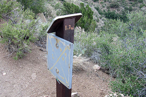
The trail climbs steadily for 400 feet through the next 5 switchbacks. In .80 miles the trail reaches Mile Post 1.7m.
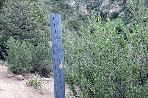
With two long switchbacks the trail climbs another 400 feet in .70 miles and comes to the junction with a trail that climbed the ridge on the other side of the drainage. The side trail started at the Tram Trail. The junction is 2.4 miles from the trailhead. The mileage is carved into the post.
From the junction the trail contours around a drainage and then traverses south and enters the Canon la Cueva drainage. After a switchback the trail reverses direction and passes mile post 2.9m. The 3.0 mile post is naturally .10 mile further up the trail. The 3.0m marker is .60m from the junction and the trail gains about 240 feet. The 3.0 is carved below the La Luz Tr directional.
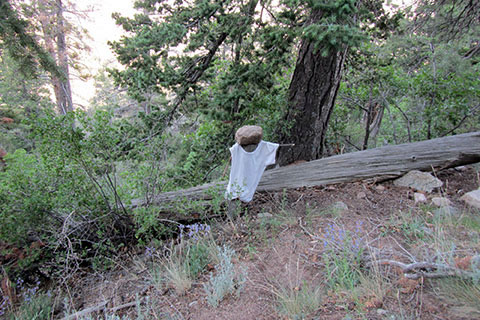
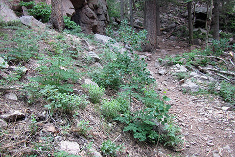
The next stretch of trail makes long switchbacks south to the Cueva drainage and then back north. After about 1.4 miles there is a shaded rest spot on the left. A well used log sits off the tree.
The route climbs about 600 feet in 1.6 miles from the 3.0 marker. The next marker, the Scenic Overlook, is 4.6 miles from the trailhead.
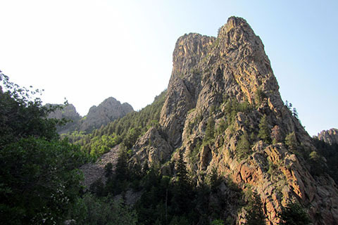
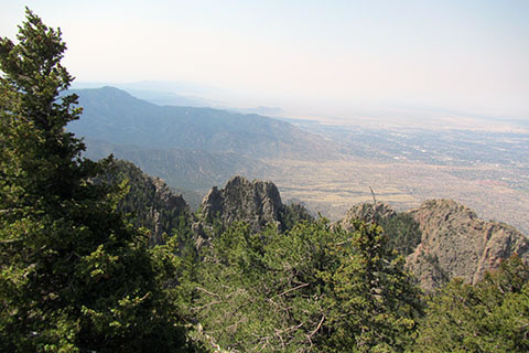
The Overlook is a view into the Cueva drainage and across the canyon to the Thumb rock formation.
From the Scenic Overlook the trail traverses across the slope to the drainage. The trail descends a bit on this easy section of .40 miles. 5.0 miles from the trailhead is a metal mileage sign. It is still 2.2 miles to the summit!
The trail crosses the drainage which makes a nice shaded rest stop.
Just beyond the drainage crossing, a Caution sign warns of the trail conditions above. In winter the trail is a frozen, snowy, cold, winter route.
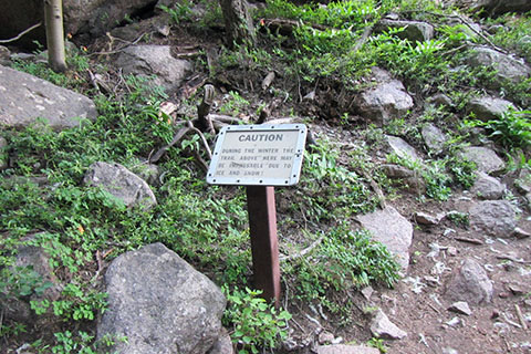
Shortly beyond the warning the trail crosses a boulderfield. The soft, sandy, path of the lower slopes changes to a rocky way as the trail climbs through the boulders. Near each switchback are good rest stops.
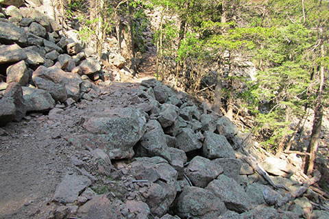
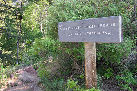
In the 1.6 miles from the 5 Mile marker, the trail makes numerous switchbacks to gain about 1100 feet. At 6.6 miles from the trailhead the trail comes to a small gap and a trail junction. To the right, the trail goes to the Upper Tram station and to the left is the summit following the Crest Spur Trail.
It is only .6 miles to the summit, but the trail climbs 600 feet! After .20 mile the trail comes to stairs. What a great effort must have been involved in constructing the passage up the cliff.
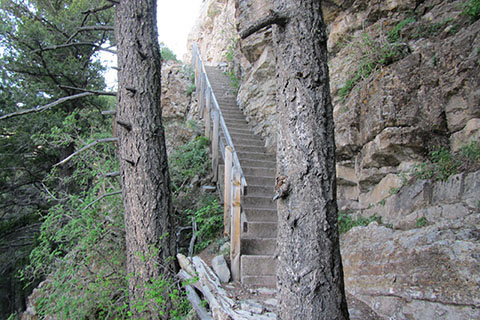
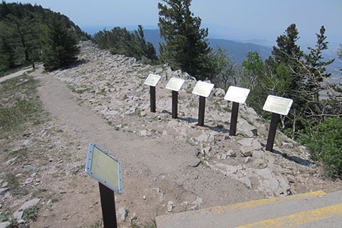
Climb the stairs and continue switchbacking the upper slopes. A great view is to the left a short distance off the trail after the first set of switchbacks, but the top is near! Continue to the Crest. After passing the Wilderness sign, the trail climbs the final feet and returns to civilization. On the Crest, the trail reaches a bank of signs. The Crest Trail continues south (right) with good views.
Privies are below ...
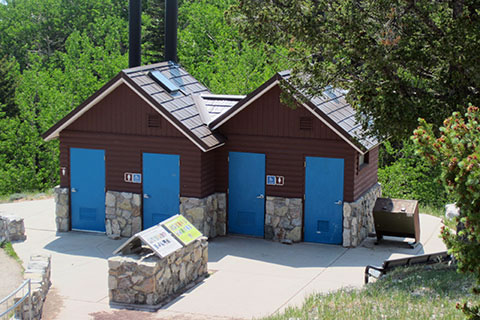
But there are also privies near the Crest House. The walkway leads uphill from the junction to the summit.
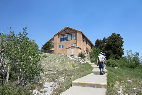
Passing the entrance to the Crest House the sidewalk winds around and finishes the climb at an overlook and the summit of Sandia Crest - 10,678 feet!
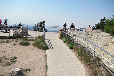
The views of Albuquerque and the surrounding areas are worth the walk.
The summit is 7.2 miles and 3,600 feet from the trailhead.