

Sandbeach Lake - Rocky Mountain National Park
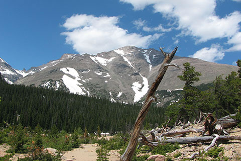
Mount Meeker from Sandbeach Lake
The Adventure Guide to Sandbeach Lake includes a trail description, photographs of the trails, comments from our hikes, mileage data, custom Wild Basin topo map, and the Sandbeach Lake Trail tracklog on a geo-pdf map. The guide will familiarize you with the Sandbeach Lake and the Wild Basin area. We hope the guide helps you on your climb.
Route Data
Photos from: 01JUL11
Elevation: 10,283'
Range: Rocky Mountain National Park - Front Range
Trailhead Latitude: 40.21985, Longitude: -105.53375
Route: Sandbeach Lake Trail
One-Way Mileage: 4.3
For Map, Trail Mileage, GPS, and Trail Notes go to Page 2
Pre-Hike Comments
We first hiked to Sandbeach Lake a few years back. We really had not done that much hiking in Wild Basin and chose Sandbeach Lake because it was the first trailhead inside the Wild Basin area.
The Route
Directions: Directions: The Sandbeach Lake Trailhead is located in the Wild Basin area of Rocky Mountain National Park (CO). The Wild Basin entrance is south of Longs Peak and even a little past Meeker Park.
Take Hwy 7 south from Estes Park. Travel over 13 miles from Estes Park (Hwy 36) to the large NPS Wild Basin sign on the West side of the road (on the right when coming from Estes). The paved Wild Basin Road curves through private land to the Park entrance. Sandbeach Lake Trailhead is to the right (north) just past the entrance.
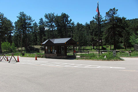
The entrance is open (unless the Park itself is closed) but it is not manned all hours. In the summer, simple trail maps are available from an info rack at the entrance station.
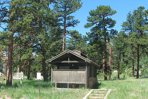
The Sandbeach Trailhead has restrooms (privies) and water. It is the only potable water in Wild Basin.
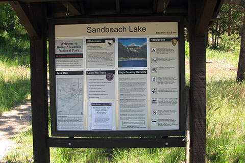
Always check on the kiosk for up to date trail information.
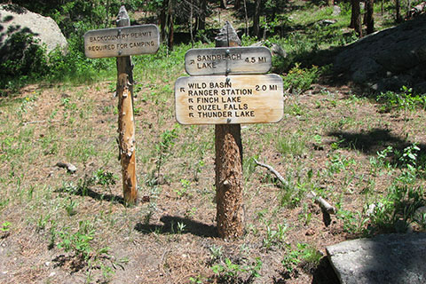
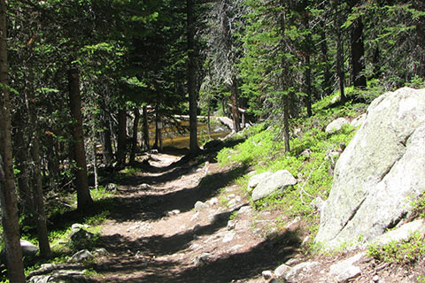
The route follows a good trail that is signed, but the Park does not use trail blazes.
Near the start of the Sandbeach Lake Trail a horse trail crosses the path and follows the road to Wild Basin Trailhead.
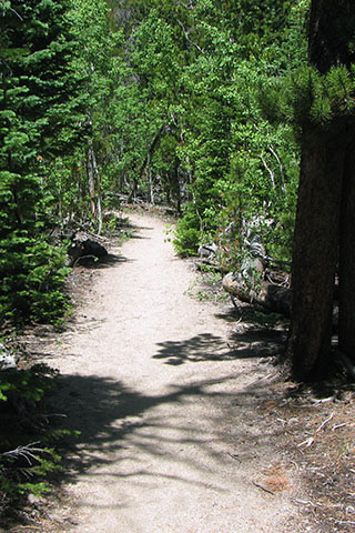
From the Sandbeach Lake Trailhead, the Sandbeach Lake starts climbing immediately. The trail switchbacks and then follows a moderate grade to the top of the lateral moraine (Copeland Moraine).
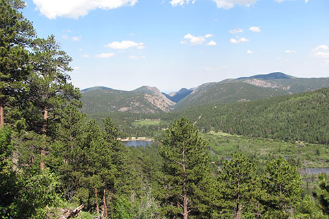
As the trail climbs there are several good views that keep the trail interesting.
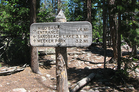
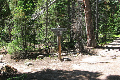
At 1.30 miles the trail reaches the top of the moraine and a trail junction with the Meeker Park Trail.
The ridgeline is just to the left (south) of the trail. An outcropping of rock a short distance from the junction is a good viewpoint and rest stop.
On reaching the top of the moraine, the trail still climbs, but then eases off after less than a .25 mile climb.
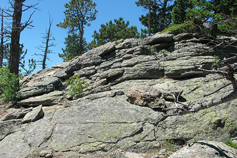
The trail passes cliffs, towers, and rock formations to the right. The formations sit on the flanks of Lookout Mountain. A trail from Meeker Park leads to the peak.
Continuing toward the west the Sandbeach Lake Trail contours into Campers Creek drainage. The first backcountry campsite is Hole-in-the-Wall (1st campsite on the trail).
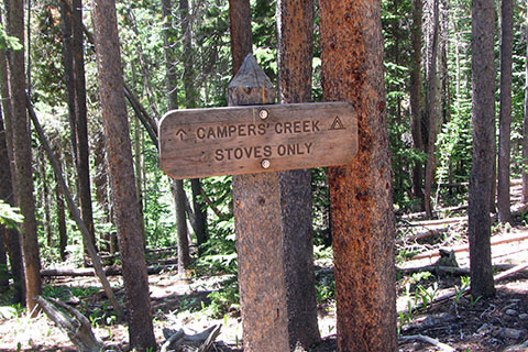
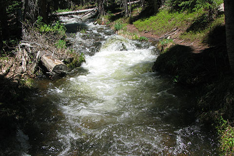
The trail follows Campers Creek and passes the Campers Creek Campsite (2nd site) before reaching the bridge.
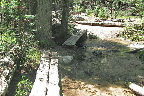
Small footbridges cross Campers Creek at 1.10 miles from the Meeker Park Trail Junction or 2.40 miles from the trailhead.
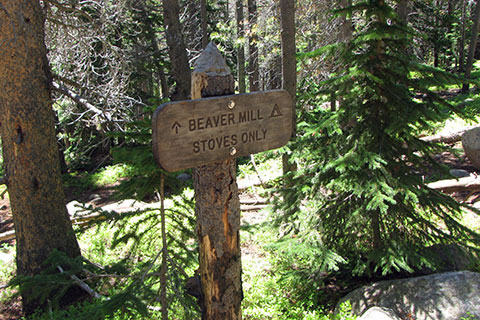
The trail switchbacks and then contours to the next drainage, Hunters Creek. A pond is passed and then the Beaver Mills Campsite (3rd site).
After passing the next campsite (4th site), Hunters Creek Campsite, the trail reaches a footbridge over Hunters Creek at 1.00 mile from the Campers Creek Bridge and 3.40 miles from the trailhead.
An unmaintained trail can be seen on the banks of Hunters Creek above the bridge. The trail provides access to the southern slopes of Mount Meeker, Keplinger Couloir, and Mount Pagoda. Good route finding skills are required as the trail grows faint.
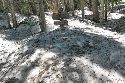
The trail climbs steadily to reach Sandbeach Lake in .90 mile from Hunters Creek Bridge.
The snow was deep in the trees, but was clear in the openings around the lake.
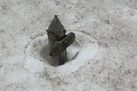
There is a privy at the lake, but it was hidden in the snow when we were there.
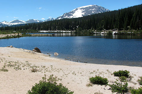
Sandbeach Lake is a good destination for day hikes or backpacking. There are 4 campsites and a group campsite at the lake.
The lake is 4.30 miles from Sandbeach Lake Trailhead.