

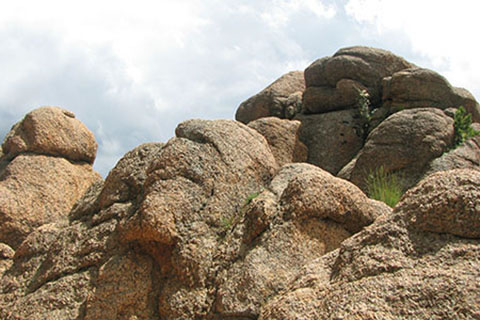
Barr Trail - Pikes Peak
The Adventure Guide to Pikes Peak includes a trail description of the Barr Trail, photographs of the Barr Trail, comments from our hikes, mileage data for the Barr Trail, the Barr Trail topo map, and Barr Trail GPS tracklogs. The guide will familiarize you with the Peak and help you on your climb.
Mountain Data
Date Climbed: July 2011
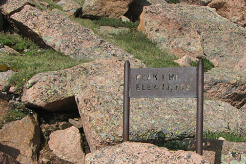
Elevation: 14,110'
Range: Front Range, Colorado, Pike National Forest
Latitude: 38.85571, Longitude: -104.93354
Route: Barr Trail
One-Way Mileage: 12.15 miles, from Manitou Springs Trailhead to the Summit Trail Sign
For Map, Trail Mileage, GPS, and Trail Notes go to Page 2
Pre-Climb Comments
We had hiked the Barr Trail twice before but as long day hikes (from car to car). This was our first ascent of the mountain while staying at Barr Camp.
The Climb
Directions to Barr Trailhead at Manitou Springs: Manitou Springs is a tourist town. It is located just west of Colorado Springs. From Interstate 25, take exit 141 and head west on Hwy 24 (W Cimarron St). After about 4 miles, exit onto Manitou Ave. Go west on Manitou Ave toward Manitou Springs. (The tourism is everywhere.) In about 1.5 miles (at a traffic circle), go around and exit onto Ruxton Ave (there should be signs to the Cog Railway). Drive past the Cog Railway Depot and Parking on Ruxton (about .75 miles) and turn right on Hydro Street. Go up the steep paved hill to parking for the Barr Trail. In 2012 the fee for parking was $5 a day. The Barr Camp site keeps hikers updated on the parking.
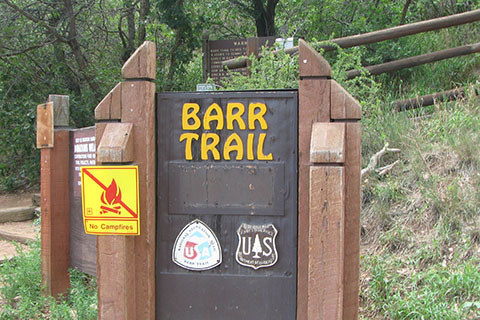
From the west end of the parking lot start on the Barr Trail. There are a few signs at the trailhead, one a serious warning sign.
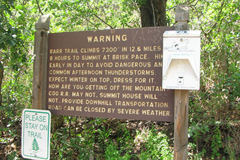
A few steps beyond the warning sign is the 13 miles to the summit sign. It is odd that the warning sign says the mileage is 12.6 and the Trail sign is 13. So the moral is, the signs are good for general information, but they may not be accurate.
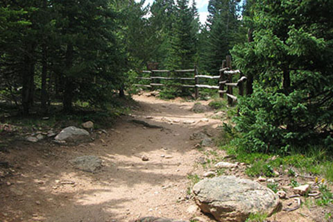
To help keep hikers from shortcutting, a fence lines the trail as it climbs the exposed slope. Please stay on the trail.
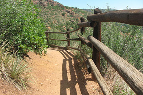
After a few switchbacks, the trail traverses a long slope to the southwest. At .50 miles (from the trailhead) there is a gap in the fence at the switchback. The Spur Trail leading from Englemann Canyon joins the Barr Trail at this junction. The Pikes Peak Marathon uses the Spur Trail.
From the junction switchback at 7,000 feet, the trail turns and heads in a general direction back to the north. After about a quarter of a mile the switchbacks return. The trail climbs through 11 switchbacks before reaching 7,800 feet and the Incline Access. Sorry, but we do not have a picture of the access point. The access is 1.10 miles from the junction switchback and 1.60 miles from the trailhead.
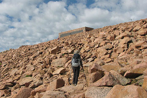
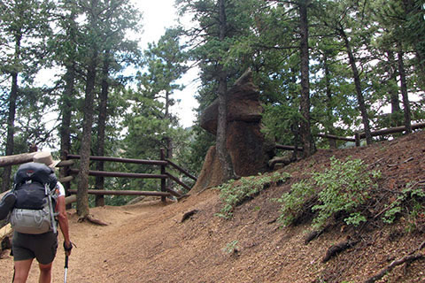
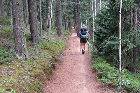
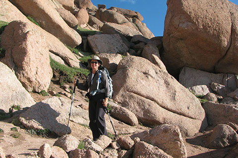
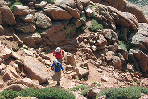
Leaving the Incline Access, the trail traverses back to the south for almost a quarter of a mile. The hiker shown below nears the end of the traverse.
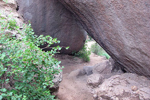
Turning to the west the trail climbs through even more switchbacks. About a mile further the trail comes to the Passage (a.k.a. Arch or Keyhole). The trail weaves through a group of boulders with rocks overhead. I am not sure if the overhead rocks should be classified as an arch, bridge, or what, but regardless, it is an identifiable feature. The Passage is 1.20 miles from the Incline Access and 2.80 miles from the Trailhead.
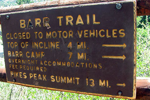
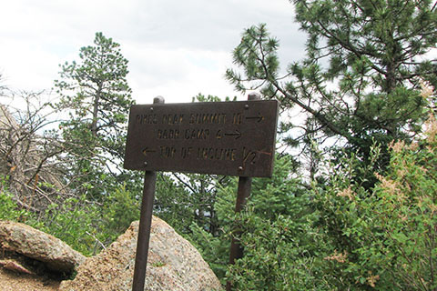
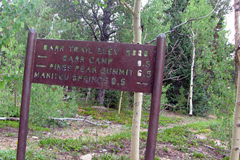
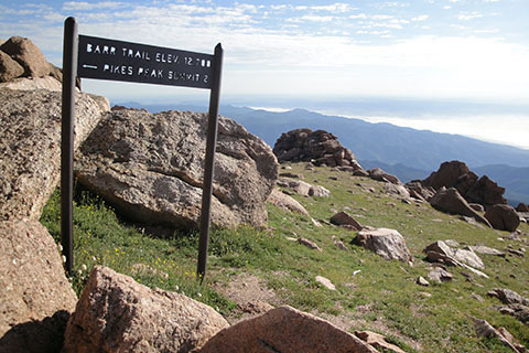
Leaving the Passage it is .20 miles to the Junction with the trail that leads to the top of the Incline. Along the way the trail passes a tunnel (large pipe) used to divert water. The Junction is three miles from the Trailhead. Oh, there are two trail signs at the junction. The photo below is of the sign on the side trail. The Sign says " Summit 10, Barr Camp 4, and Top of the Incline 1/4". The other (yellow) trail sign says, "Cog RR Depot 3" and gives arrows to indicate the direction of the Barr Trail.
In .15 miles the trail reaches No Name Creek. We have seen water in the creek in June, July and September (on our three trips). The trail crosses the creek. No Name Creek is 3.15 miles from the Trailhead.
From the Creek, the trail begins to climb and once again through switchbacks. Caution there is an unmarked road/trail coming in from the left that is sometimes confused for the trail. Stay right or straight. The switchbacks end in .30 miles but the trail continues to climb moderately for another .75 miles.
From the top of the climb, the trail levels out and even goes downhill a bit. Then, naturally the climbs return. At 1.55 miles from No Name Creek is the 7.8 Mile sign. This point is 4.70 miles from the Trailhead and 1.80 miles from Barr Camp.
Not long after the 7.8 Sign, the trail climbs to the 9,600 foot contour in about a third of a mile. Maintaining the contour, the trail traverses for a while and then climbs steeper before reaching the rock outcrop, Lighting Point, .80 miles from the 7.8 Mile Sign - 5.5 miles from the Trailhead.
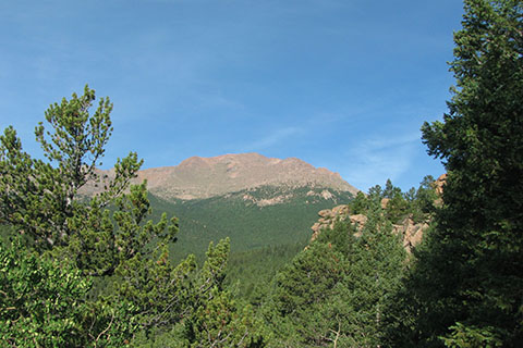
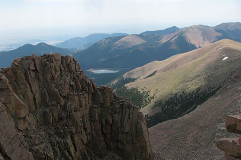
There are great views of Pikes Peak from Lightning Point, but the Peak is still a long way away.
Leaving the views from Lightning Point are difficult, but Barr Camp is only one mile away. Cross a small footbridge in .10 miles. A small creek runs a short distance off the trail to the left (south). There are a couple of places where the creek is very close, but there is also a great creek at Barr Camp to collect water for filtering. At .40 miles from Lightning Point is the junction with the Mountain View Trail. Mountain View is a stop for the Cog Railway, south of the Barr Trail. A sign indicates "Barr Camp is 1/2, and the summit is 6.5". The junction is 5.9 miles from the Trailhead.
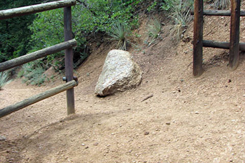
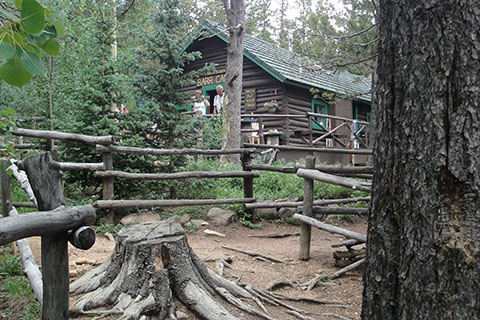
The distance to Barr Camp is more like .60 miles instead of a half of mile. The trail does climb over 300 feet in elevation and most of it in one short, steep section. On reaching a small trail bench, it is .15 miles to the Camp. The fence, shown below, is part of the Camp. Barr Camp is 6.50 miles from the trailhead.
Stopping at the Camp makes for an easier day and it is just fun. Even if day hiking, plan on stopping, filtering water, chatting with the caretakers (Renee and Anthony), signing the log, and watching with envy the lucky folks who are staying the night at the camp. The food, accommodations, and hospitality really are that good.
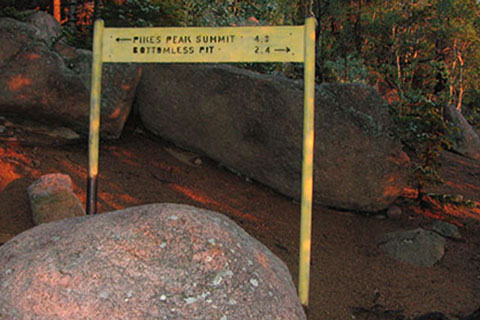
Back on the trail, a trail junction is a short distance beyond the Camp. The side trail goes to Elk Park and is an alternative approach to Barr Camp. Back to climbing, the trail starts a general trend to the north as it rises 600 feet to 10,800 feet at the junction of Bottomless Pit Trail. A sign makes this junction obvious. The junction is 1 miles from Barr Camp and 7.5 miles from the Trailhead.
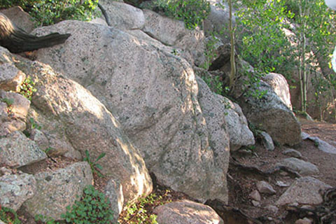
After returning south on a long leg of the Bottomless Pit Junction count the switchbacks, the fourth one is one mile from the Bottomless Pit Trail junction. The switchback is fairly noticeable by all the boulders, but there are many other boulders, so it may be best to count the turns.
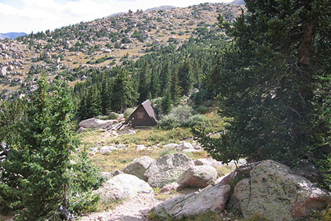
In .50 miles of shorter switchbacks, the trail emerges from the trees. The Timberline A-frame shelter is in an opening to the south (left) of the trail. The A-frame is a camping shelter available on a first come first served basis. Water is available from a creek at the site. The shelter is 9.0 miles from the trailhead. The shelter is at about 11,900 feet.
A short distance, through a switchback, is the 3 Mile Trail Sign. The sign gives a good estimate on the mileage but the elevation is nearly 500 feet too low.
Above the A-frame the trail crosses the tree line and enters the Alpine Tundra. The views are spectacular. At .40 miles the trail reaches the Roberts Memorial. The memorial states: "G. Inestine B. Roberts age 88 years died at timberline after her fourteenth ascent of Pikes Peak." The memorial is 9.40 miles from the trailhead.
Many switchbacks climb the slope toward a point near the Northeast Ridge. The final switchback of the set is reached at .80 miles from the Memorial. The 2 Mile Trail Sign is also at the switchback.
After almost reaching the Northeast Ridge, the trails turns and heads south. Climbing almost 500 feet the trail traverses the entire East Face of the Peak. There are a few short switchbacks on the .85 mile traverse.
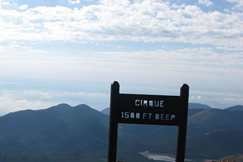
Finally, across the long traverse, the trail comes to an overlook. The view is into the Cirque, a chasm to the south of the East Face, but this is not the official viewpoint.
Continue on past two more switchbacks to arrive at the 1 Mile Trail Sign.
From the 1 mile sign the trail returns to the edge of the chasm and the official Cirque Viewpoint. The viewpoint is .95 mile from the Northeast Ridge Switchback and 11.15 miles from the trailhead.
The final mile is memorable. The trail climbs through switchbacks across the slope back to the north and then returns to the south. One more switchback leads the trail once again to the north and to the start of the Golden Stairs, .60 mile from the Cirque and 11.75 miles from the trailhead.
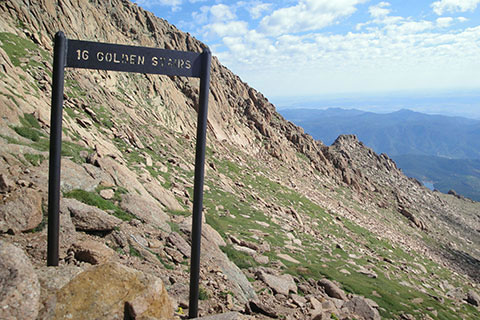
There are supposed to be 16 Golden Stairs. The short switchbacks are a nice change from the earlier, long sweeping traverses.
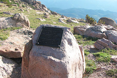
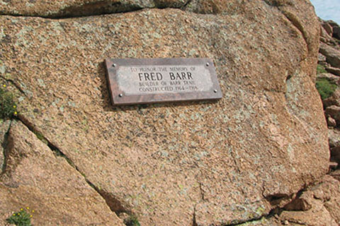
A plaque for Fred Barr, the builder of the trail, is located on a boulder .25 miles after the beginning of the Golden Stairs. The plaque is 12 miles from the trailhead.
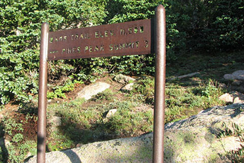
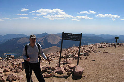
A few more switchbacks and another traverse to the south and the trail reaches the Summit Trail Sign, just before crossing the Cog Railway tracks. It is .15 mile from the Plaque to the Summit Trail Sign. The total distance from the trailhead in Manitou Springs is 12.15 miles.
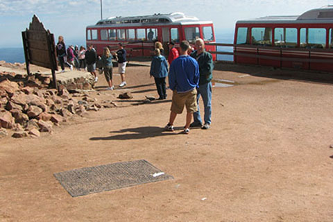
The trail ends on the summit plateau, but there is still plenty of walking to be done. Visiting the Summit House, the large viewpoint, and the actual summit adds to the overall mileage.
A few more photos ...
The Cog Railway
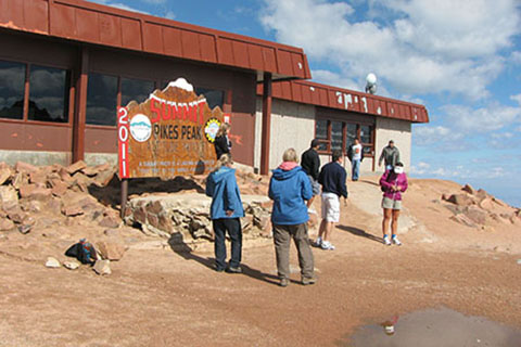
The Summit House, a souvenir shop and restaurant
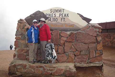
A summit sign
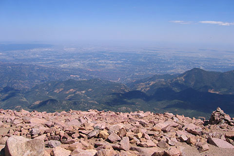
And finally the view
7,400 feet of elevation gain in 12.15 miles, hiking the Barr Trail is a worthy effort.