

North Inlet Trail - Rocky Mountain National Park
North Inlet Creek
Route Data
Photos from: July '13, July '14
Elevations: North Inlet Junction - 9,600', Lake Nokoni - 10,780', Lake Nanita - 10,780'
Range: Rocky Mountain Mountain National Park
Map Coordinate System - Geodetic Base (NAD27)
Trailhead - Latitude: 40.25661, Longitude: -105.81413
North Inlet Jct - Lat: 40.281413, Lon: -105.72068
Route: North Inlet Trail, Nanita Lake Trail
One-Way Distance: 7.5 miles from the trailhead to the North Inlet Junction and 10.90 miles from trailhead to Nanita Lake
For Map, Trail Mileage, and Route Notes
go to Page
2
Comments
We, like many other visitors to Rocky Mountain National Park, have visited mainly on the east side of the Continental Divide. We wanted to hike on the west side of the Park, but just didn't make it happen. A few years back, we made our first backcountry reservations to the west side. Our original plan was to hike over the Divide from Bear Lake, but we were sidelined because of an injury. Try number two was also canceled, but that time due to a wildfire. We were rescheduled for a trip on the North Inlet Trail to Lake Nanita. On that trip we stayed three nights in the North Inlet junction area. We hiked to Lake Nokoni and Lake Nanita and scouted the route for Ptarmigan Mountain. We then climbed Ptarmigan and returned to the trailhead. It was a great trip. We decided that we had to return to the area. It was that good.
In the winter of '14 we made reservations for the Loop once again. We were hoping everything would finally fall in place for us to hike the Rocky Mountain National Park Loop (formed by the North Inlet Trail and the Tonahutu Trail). The stars were aligned and we were able to do the hike. It was as good as expected!
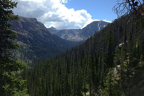
The Route
Directions: From Highway 34 (Trail Ridge Road) near Grand Lake, Colorado - go east toward the town of Grand Lake on West Portal Road. Stay on West Portal (bear left) and bypass the town. Turn left on Co Rd 663. The turn has a National Park directional sign posted. At the junction - Road 663 goes left uphill to the trailheads, Hancock St goes to the right - downhill to town. Parking for the North Inlet Trailhead is at the end of Rd 663. The location is searchable on Google Maps (terms: North Inlet Trailhead Grand Lake, CO.)
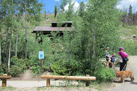
The North Inlet Trailhead does not have an entrance fee. It does have a privy and trailhead kiosk.
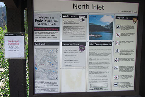
Check the kiosk for current information (on our '13 trip there was a WARNING posted concerning the Tonahutu Wildfire.) The North Inlet Trail begins by passing through the road gate. The trail follows the (dirt) road.
The trail (road) descends sharply for a short distance with the Tonahutu Creek to the right (south).
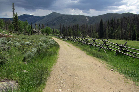
The trail/road runs along the Park Boundary. Unfortunately there seems to be some new developments on the private land.
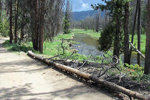
As the trail continues to follow the road, it passes along the North Inlet stream at about 0.85 mile. This area sees a lot of fishing, probably partially due to it's easy access.
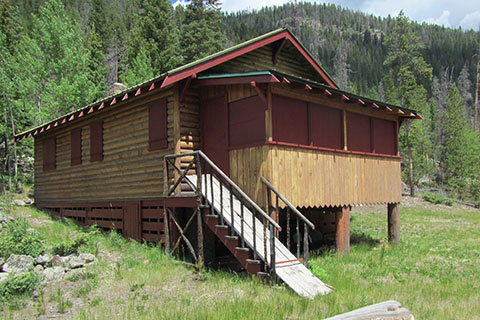
The cabin at Summerland Park is a private in-holding. Please respect the private property.
Just up the trail from the cabin is the Summerland Group campsite.
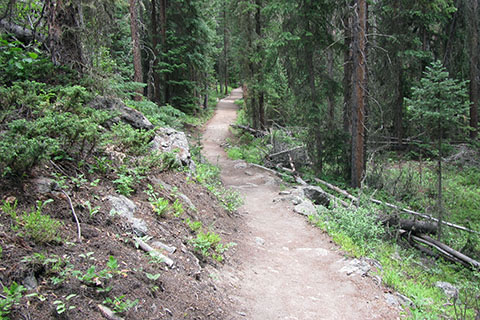
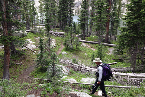
The trail leaves the dirt road at Summerland Park. The trail then enters the forest and continues at a moderate to easy grade.
The North Inlet Trail crosses several intermittent creeks (on bridges) and passes two campsites - Summerland Park and Twinberry and a dispersed camping zone on the way to Cascade Falls. Just before reaching the falls, a stock trail branches to the left.
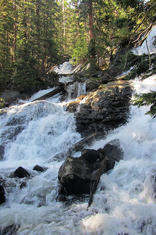
The trail descends and reaches the lower access of Cascade Falls.
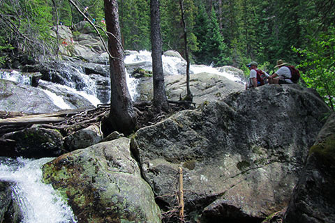
Cascade Falls is 3.50 miles from the North Inlet Trailhead and 2.30 miles from Summerland Park. The falls is a good day hike.
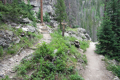
Returning to the North Inlet Trail, the trail climbs to the top of the falls and descends a bit to an obviously well used area. The area used to host backcountry campsites, but camping is not allowed now. A privy is located to the left of the trail.
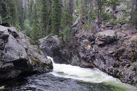
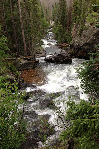
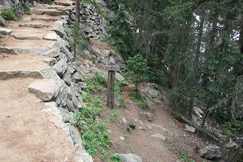
1.30 miles from Cascade Falls, the trail passes Big Pool, a short waterfall that swirls into a big pool.
There are a couple of other great views of the North Inlet stream between Cascade Falls and Big Pool that are often mistaken for Big Pool. Big Pool has a destination sign.
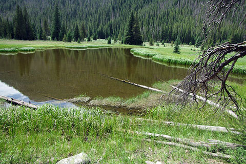
The trail leaves Big Pool and passes the two Big Pool campsites. In 1.25 miles (2.55 miles from Cascade Falls and at little over 6 miles from the trailhead), the trail reaches a pond located near the trail. The pond is a great place to watch for waterfowl.
From the pond it is about a half mile to the North Inlet Group site stock crossing. It is another .05 mile to the side trail leading to the group site. (On many maps Ptarmigan Creek crosses the trail close to where the stock crossing is located, but the creek is not there!) It is still about .20 mile to Ptarmigan Creek.
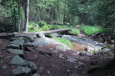
Approaching Ptarmigan Creek, first cross a tributary of the creek, which is almost equal in size as Ptarmigan Creek.
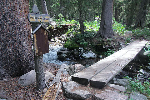
In a short distance beyond the tributary, cross the signed Ptarmigan Creek. The creek is 6.75 miles from the trailhead and 1.95 miles from Big Pool.
Secluded War Dance Falls lies a short, but difficult, way upstream from Ptarmigan Creek Bridge.
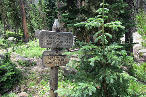
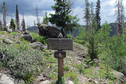
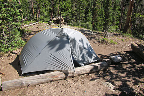
Pass Ptarmigan and Porcupine camping sites and begin climbing through switchbacks. In 0.75 mile from Ptarmigan Creek the trail reaches North Inlet Junction. The North Inlet Trail continues straight and passes North Inlet campsites and then begins the climb to July campsites and Flattop Mountain. Lake Nanita Trail begins at the junction heading to Lake Nokoni and Lake Nanita.
Note: A separate guide will cover the North Inlet Trail from North Inlet Junction to Flattop Mountain and down the Tonahutu Trail to Haynach Lake Trail Junction.
Lake Nanita Trail
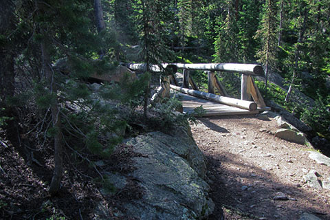
Continuing from North Inlet Junction, the Lake Nanita Trail descends to North Inlet and crosses on a good bridge.
North Inlet Falls is a small falls just upstream from the bridge. North Inlet Falls is located just across the bridge. Upstream a short distance is a great spot to filter water from a small eddy pool.
Pine Marten's two campsites are passed as the trail climbs along a rib.
After about .85 mile the trail begins climbing. Switchbacks help tame the grade. The trail climbs 1,000 feet in 1.50 miles.
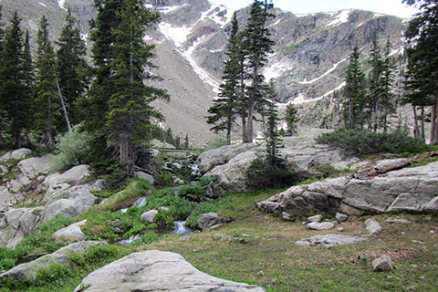
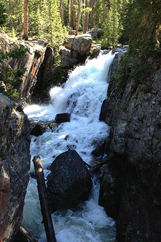
Approaching Lake Nokoni the views get big. The trail follows the outlet stream to the lake shore.
The mountain lake has a stone beach!
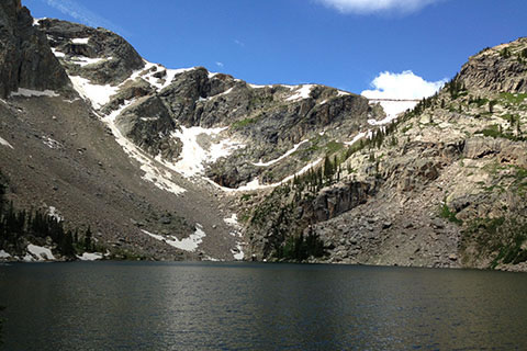
Lake Nokoni is 2.30 miles from North Inlet Junction and 9.80 miles from the North Inlet Trailhead.
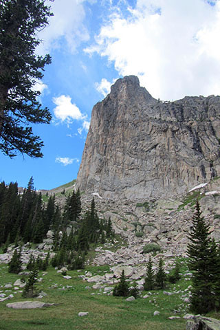
The trail continues past Lake Nokoni, it crosses the outlet and climbs almost 300 feet to the saddle between point 11218 and Ptarmigan Mountain. A good view of the Ptarmigan Towers is available from the saddle.
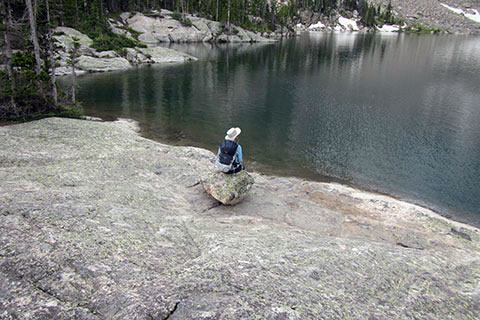
The trail then descends to Lake Nanita. Lake Nanita and Lake Nokoni are both at the same elevation - 10,780'.
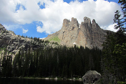
Ptarmigan Towers dominate the view from Lake Nanita as Ptarmigan Mountain is hidden from view by the towers. Lake Nanita is 1.1 miles from Lake Nokoni, 3.4 miles from North Inlet Junction, and 10.90 miles from the North Inlet Trailhead.