

Mount Elbert - South Mount Elbert Trail - East Ridge
The Adventure Guide to Mount Elbert - South Mount Elbert Trail includes a trail description, photographs of the trail, comments from our hikes, mileage data, custom Mount Elbert topo map, and Mount Elbert - South Mount Elbert Trail tracklog on a geo-pdf map. The guide will familiarize you with the Mount Elbert Trail system and the area. We hope the guide helps you on your climb.
Route Data
Photos from: JUL05, JUL14
Elevation Summit: 14,433'
Elevation South Mount Elbert Trailhead: 10,520'
Range: Sawatch Range, CO - the land is managed by the Leadville Ranger District of San Isabel National Forest
(719)486-0749
Summit Latitude: 39.11777, Longitude: -106.44475
South Mount Elbert Trailhead
Latitude: 39.10556, Longitude: -106.39463
Route: East Ridge - South Mount Elbert Trail
One-Way Mileage: 4.2 miles - from the Upper South Mount Elbert Trailhead accessible by 4WD. From the Lower Trailhead (Lakeview Campground) it is 1.85 miles to the Upper Trailhead or 6.05 miles, total.
For Map, Trail Mileage, and Trail Notes go to
Page
2
South Mount Elbert Trail Comments
Mount Elbert is the highest point of elevation in the state of Colorado, but the South Mount Elbert Trail is not technically difficult. The South Trail is similar to the North Trail in that it is steep. It will exercise your heart, lungs, and legs. Be prepared. Acclimate, be a prudent mountaineer by carrying the ten (plus) essentials (including plenty of water), and be in good physical condition.
The Climb
Directions: From Leadville head south on Hwy 24 for 15 miles to State Hwy 82 (west - toward Independence Pass). Follow Hwy 82 for about 4 miles to Lake County Road 24. The Lower Trailhead parking is at 1.5 miles on the left (west) side of the road. 4WD vehicles may continue to the Upper Trailhead by taking FSR 125.1B for 1.85 miles. The Lower Trailhead is on the north side of Lakeview Campground.
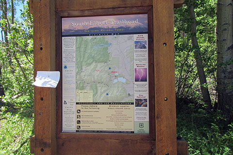
Walk or drive (1.85 miles) to the Upper Trailhead. The Upper, South Mount Elbert Trailhead has trail kiosks, but that is all. Parking is alongside the road. There are no potable water sources or privies.
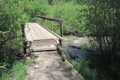
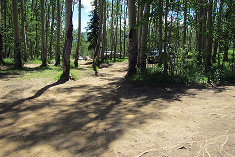
Leaving the trail kiosks a creek is crossed immediately. An old directional sign is just beyond the bridge. Stay on the Colorado Trail , which is very easy to follow.
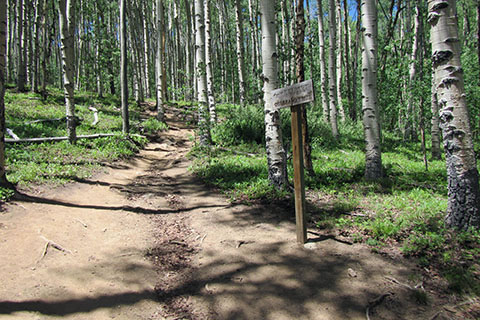
After 0.30 mile along the rolling Colorado Trail, the South Mount Elbert Trail turns left at a junction. The climbing starts immediately.
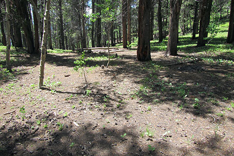
At 0.30 mile from the junction the trail reaches a small saddle. The area has seen a few tents pitched nearby.
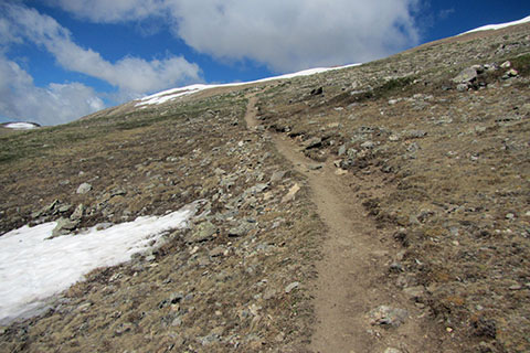
For the next mile the trail climbs steeply through the trees to treeline. Along the climb there are a few good views to the south and finally Mount Elbert's East Ridge comes into view. Tree-line is near 11,800 feet and 1.30 miles from the Colorado Trail junction.
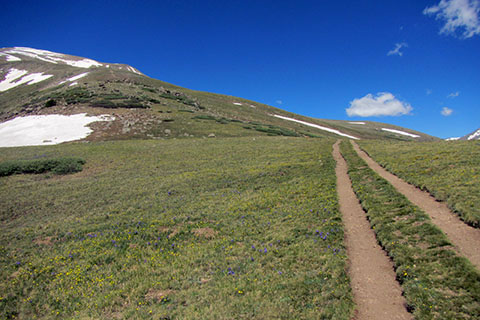
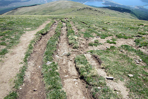
The trail climbs following multiple ruts. A steady grade leads to the East Ridge at 0.60 mile from tree-line or 1.90 miles from the Colorado Trail Junction. Nearing the ridge, a slight bulge with an exposed ridge of rocks is visible. The trail passes the bulge on the north side.
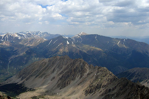
While climbing the ridge there are good views of Twin Lakes and the trail below.
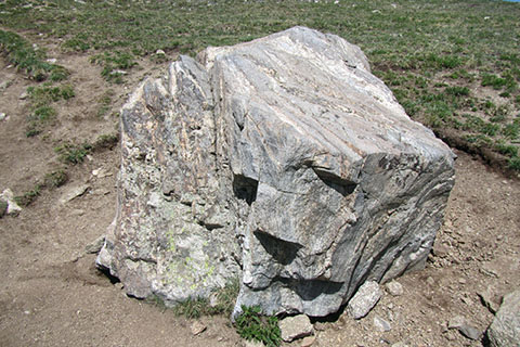
At 0.30 mile from joining the East Ridge or 2.20 miles from the Colorado Trail Junction, a lone boulder is reached.
It is 0.25 mile from the boulder to the 13,000 feet contour line indicated on the map.
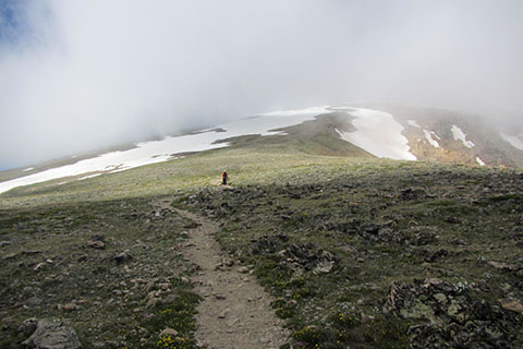
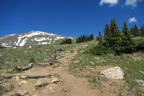
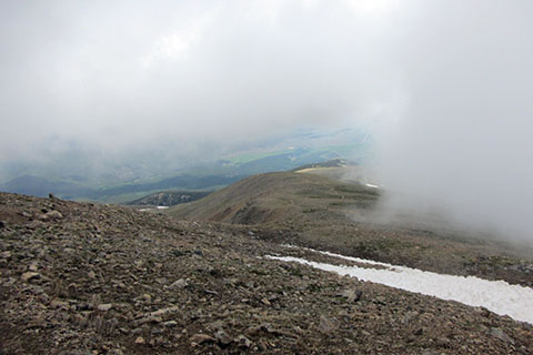
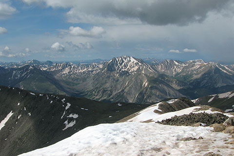
Continue up the East Ridge. Clouds cover the upper section of the ridge, but the trail stays on the crest (avoiding most of the snow in the photo.)
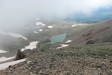
The trail rises closer to the north edge of the East Ridge. At about 13,500 feet there are good views of Box Lake and the Northeast Ridge.
The 13,500 feet contour is 0.45 above the 13,000 feet contour and 0.70 mile above the boulder.
A view back down the ridge.
After 0.90 mile above the boulder waypoint, the trail moves away from the East Ridge. This is 3.10 miles from the Colorado Trail Junction.
Leaving the East Ridge the trail crosses the South Face to the west. It is 0.35 mile to the 14,000 feet contour and 0.50 mile (0.15 mile further) to the end of the traverse and the next major switchback.
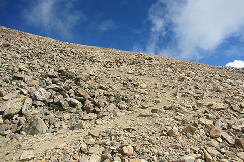
The switchback marks the end of the traverse across the South Face and the start of the upper climb (switchbacks) toward the summit.
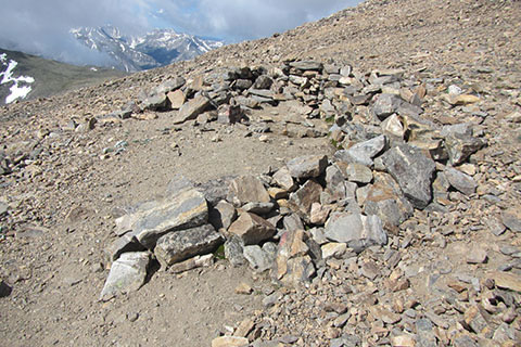
A rock stacked wind break is passed after 0.20 mile of climbing. The partial enclosure is large enough to be used as a tent platform.
From the wind break it is 0.05 mile to the saddle (and junction with the North Mount Elbert Trail.) Turn left and follow the gentle rise of the summit ridge for 0.05 mile to Mount Elbert's highest point. The distance from the Colorado Trail is 3.90 miles and from the Upper South Elbert Trailhead it is 4.20 miles.