

Mount Elbert - North Mount Elbert Trail - Northeast Ridge
The Adventure Guide to Mount Elbert - North Mount Elbert Trail includes a trail description, photographs of the trail, comments from our hikes, mileage data, custom Mount Elbert topo map, and Mount Elbert - North Mount Elbert Trail tracklog on a geo-pdf map. The guide will familiarize you with the Mount Elbert Trail system and the area. We hope the guide helps you on your climb.
Route Data
Photos from: JUL05, JUL09, JUL14
Elevation Summit: 14,433'
Elevation North Mount Elbert Trailhead: 10,040'
Range: Sawatch Range, CO - the land is managed by the Leadville Ranger District of San Isabel National Forest
(719)486-0749
Summit Latitude: 39.11777, Longitude: -106.44475
North Mount Elbert Trailhead
Latitude: 39.15233, Longitude: -106.41198
Route: Northeast Ridge - North Mount Elbert Trail
One-Way Mileage: 4.8 miles - includes new section of the Colorado Trail to the North Mount Elbert Trail junction
For Map, Trail Mileage, and Trail Notes go to
Page
2
North Mount Elbert Trail Comments
Mount Elbert is the highest point of elevation in the state of Colorado, but the North Mount Elbert Trail is not technically difficult. The North Trail is however steep. It will exercise your heart, lungs, and legs. Be prepared. Acclimate, be a prudent mountaineer by carrying the ten (plus) essentials (including plenty of water), and be in good physical condition.
The Climb

Directions: Starting in Leadville, follow Hwy 24 south for about 3 miles. Turn right (west) on Colorado Hwy 300. After 0.75 mile turn left on Lake County Rd 11. Stay straight on Rd 11 for 1.25 miles, then the road (11) makes a right hand turn (11A goes straight). It's about 5.5 miles on a dirt road to the North Elbert Trailhead (on the left - south). The road is passable by most vehicles. The trailhead is searchable on Goggle Maps.
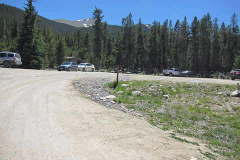
The North Mount Elbert Trailhead has parking, a privy, and a trail kiosk. The parking area fills regularly as the North Mount Elbert Trail is very popular.
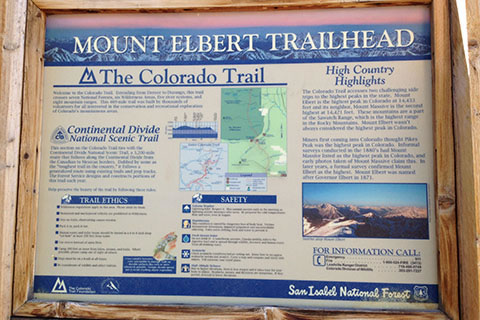
The trail kiosk contains pertinent information, including maps, descriptions, tips, and important telephone numbers. Oddly enough, the North Mount Elbert Trail is not included on the map. The North Mount Elbert Trail begins next to the trail kiosk.
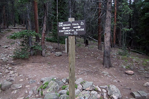
From the parking area and kiosk, the trail climbs easily for 0.15 mile to a junction with the Colorado Trail (and Continental Divide Trail.) Turn left, south. (An old path continues straight at this point, crossing the new section of trail.)
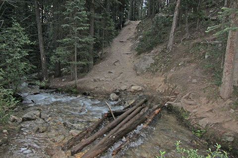
An intermittent creek is crossed a short distance beyond the junction with the Colorado Trail. We crossed the creek on a few small diameter downed trees.
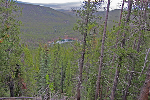
The route follows the Colorado Trail (a new section) as it climbs through switchbacks. The grade is mostly moderate, but it is enough to get your attention. From an opening along the trail, there is a good view of Emerald Lake.
At 0.85 mile from the Colorado Trail Junction the trail reaches a ridge. A switchback crosses the ridge. This upper switchback is 1.00 mile from the trailhead.
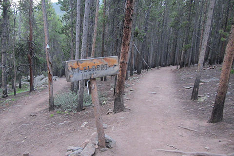
From the ridge switchback, it is an easy (descends about 100 feet) 0.30 mile to the junction with the North Mount Elbert Trail.
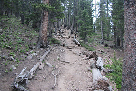
Leaving the junction (to the right) with the Colorado Trail, the North Elbert Trail is level for a very short enticing distance and then it begins to climb. It is memorable.
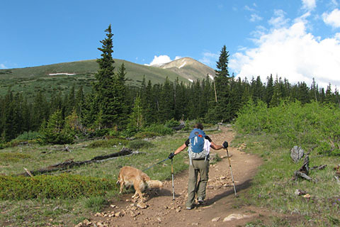
After a steep 1.25 miles the trail reaches an opening and gives the first glimpses of the upper slopes. The opening is 2.55 miles from the trailhead. (The photo at the very top of the pages is from the same location in 2009.)
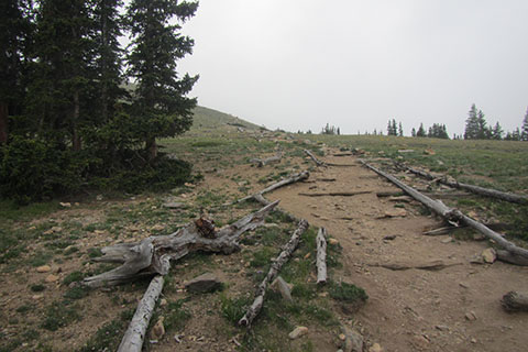
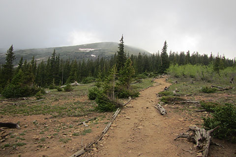
Continuing the trail re-enters the tree cover for 0.35 mile and then climbs above tree-line. It is 2.90 miles from the trailhead and at an elevation of 11,900 feet.
Once in the open alpine tundra, the good trail climbs through a series of switchbacks to reach the Northeast Ridge. The North Mount Elbert Trail follows the Northeast ridge to the summit. The ridge is 0.65 mile from tree-line.
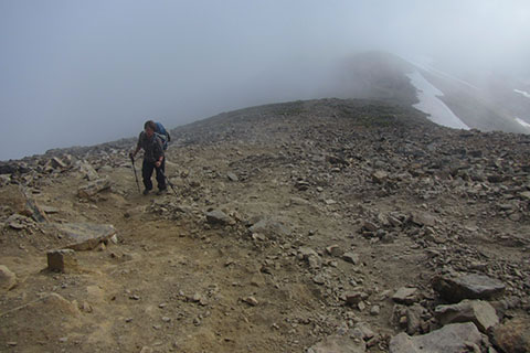
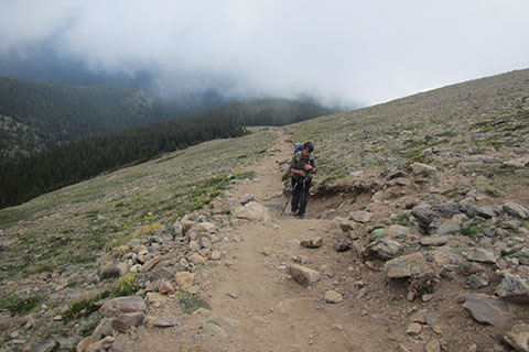
Once on the Northeast Ridge, the trail stays close to the ridge crest through the first section. Near the top of the section the trail is very steep!
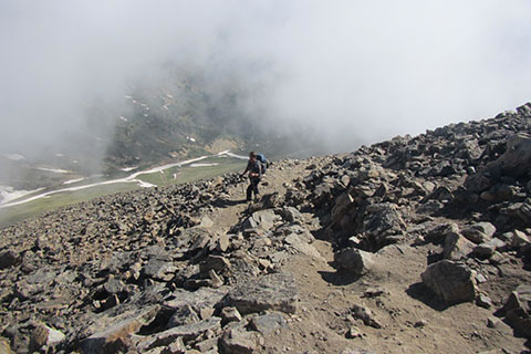
Just as it seems as if the trail is going to climb over a rise, the trail traverses to the right, away from the ridge, and climbs steeply again to reach the Upper Ridge at 13,900 feet. It is 0.80 mile along the Northeast Ridge before the Upper Ridge is gained and the Upper Ridge is 4.35 miles from the trailhead.
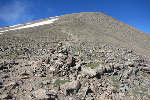
After joining the Upper Ridge, the trail continues to climb (but not quite as steeply as before). There is one more false summit, before the trail reaches the real top.
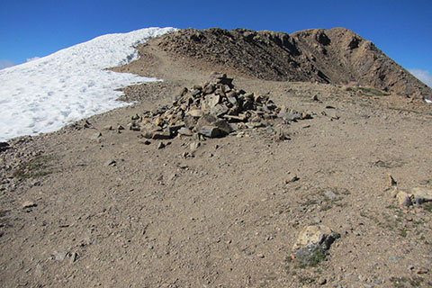
A 0.25 mile climb leads to the summit ridge. The views are spectacular as the trail crosses to the summit.
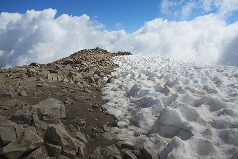
After 4.80 miles and 4,500 feet in elevation gain, the summit is reached.
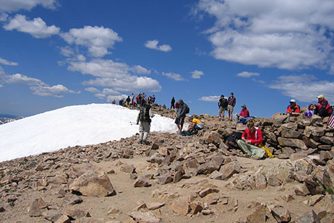
An early start (and good pace) helps avoid the summit crowds. Descend by reversing the route.