

Shelby Bottoms Greenway
Date Hiked: 11/8/09
Park: Shelby Bottoms Park
Address: 1900 Davidson St, Nashville, TN 37206
Type of Path: Paved multi-use path
Latitude: 36.16674, Longitude: -86.72491
One Way-Trip Mileage: 3.65
Other Paths Connecting to the Greenway: Downtown, Metro Levee
For Map, Trail Mileage, GPS, and Trail Notes go to Page 2
Pre-Trip Comments
Shelby Park was one of the first parks I visited when moving to Nashville. I was very familiar with the Park and Greenway before making my visit.
The Greenway
There were a lot more people using the paths than I expected. It seems to be the place to go in Nashville if you have a stroller, dog, skates, or bicycle. Many users were also just walking or running on the flat path.
To Find the Greenway: From east or west on Interstate 24, exit onto Shelby Ave, exit #49, and go toward the Titans Stadium or river. Before reaching the Korean Veterans Bridge (spans river), turn left on S 2nd St. Go a couple of blocks then turn left on Davidson St. Continue on Davidson for two miles. There are directional signs leading to the parking.
There are many access points to the Greenway. Please consult the map for more info.
Shelby Bottoms Trailhead
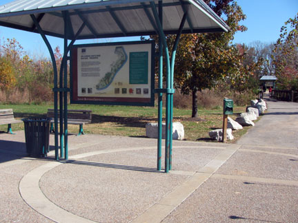
Park at the Shelby Park Trailhead (overflow parking is also available on the west side of the railroad trestle). From the kiosk at the corner of the parking area, the path starts with a junction of the walkway leading to the Nature center, then crosses a small bridge, and continues to a circle with another kiosk - all in .05 miles! There are many kiosk maps located throughout the Park.
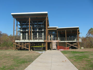
Shelby Bottoms Nature Center
Leaving the circle, head south toward the river. In .15 miles the trail comes to a tee. To the right, the trail leads back under the railroad trestle and back to Davidson Rd. The path to the left continues along the greenway.
Cumberland River Overlook
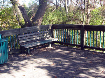
From the junction, a bridge is crossed and an overlook is on the right in .15 miles. The overlook gives views of the Omohundro Water Tower, Demonbreun's Cave, the railroad bridge and the Cumberland River.
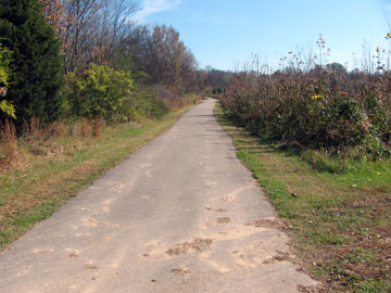
The path continues to follow the river but there really are not many views along the greenway path until close to the Cumberland River Bridge. Another .30 miles leads to the junction with the West Loop path.
For a shorter route, the West Loop turns left at the junction. After about .10 miles the path crosses a wetland on a boardwalk and continues to an overlook in .10 miles further. From the overlook the path heads north, curves to the west, and then finally south to arrive at the trailhead and parking after another .45 miles. The total distance is 1.35 miles.
Going straight at the West Loop junction, the Greenway continues .35 miles to the junction with the path to Fortland Drive Trailhead. The trailhead is .35 miles away. Continuing it is .2 miles to the next bridge.
Greenway Path
From the bridge it is .3 miles to another bridge. (Yes, there are a lot of bridges!) At .5 miles the path comes to yet another bridge. (I mention the bridges because they are great distance markers.) After .2 miles further, the path comes to the junction with the trail spur leading to Shadow Lane Trailhead. (It is .5 miles to the trailhead.) Another bridge is just beyond the junction.
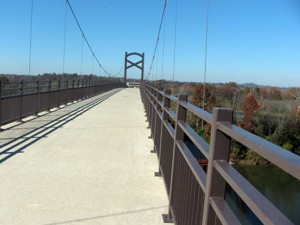
Cumberland River Bridge
After the junction (and adjacent bridge) it is .6 miles to the next bridge and then .05 miles to the next junction. This is the Cumberland River Bridge. Turn left to continue the Greenway. Spiral up the hill to gain access to the larfe, scenic bridge over the river. It is .3 miles to the first of two tunnels on the opposite bank of the river.
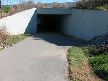
Tunnel under access road, 2nd tunnel goes under Briley Pkwy
Go through both tunnels and continue up a hill to reach Two Rivers Park in .25 miles. This trailhead provides parking, porta-potties, the Wave Pool, and Skate Park! Two Rivers Park is a total of 3.4 miles from Shelby Park Trailhead.
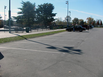
Two Rivers Park Parking and Skate Park
To travel the East Loop, back at the junction, where the trail turns left to access the bridge, go straight. It is .6 miles to the end of the loop junction on the left. There can be views of the river along this stretch. From the junction, the trail begins the loop. Continue going straight for .3 miles to access the spur to Cooper Creek. (It is .15 miles to the access at Moss Rose Dr.)
From the junction with the Cooper Creek spur it is .2 miles to Forest Green Trailhead. The trailhead is a few hundred feet to the right. There is parking at the trailhead.
Continuing on, it is .45 miles to the end of the loop. The East Loop is a total of .95 miles. Completing the loop from the Cumberland River Bridge and returning to the bridge is 2.15 miles.