

Cumberland River Greenway - Metro Center Levee, page 2
Trail Notes:
There are no directional signs to the trailheads. If you are unfamiliar with the area, be sure to bring directions. Follow the directions on Page 1 of Metro Levee or Goggle it.
The older kiosks have not been updated to reflect additions to the trail (Winter 2010)
The trailheads and kiosks looked great.
The greenway has mileage posts and benches.
The mileage posts would allow you to travel an exact distance.
The Greenway is flat.
There is one section of the Levee that is gravel. I do not know why. It is along the Levee when the first side path goes down to the left - near mileage marker "4.25".
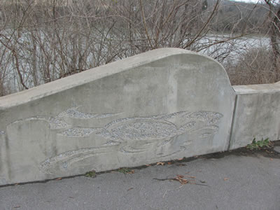
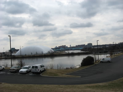
There are four rest areas, all river themed. The art makes the greenway more interesting.
We saw only one other person using the path. He was running on the Metro Center Levee. It was February.
The greenway continues from the Great Circle Trailhead to Downtown Nashville.
There are no restrooms or water along the path or at the trailheads.
Unless there is a breeze on the river, the path would be hot in the summer.
The Metro web site has not been updated lately. The map link on the left sidebar takes you to the map page. The Google Maps at the top of the page have the most current information.
A problem with Google Maps is that if you try to print the page, Google changes the Views from Satellite to Map and the path disappears.
Metro Levee Greenway Mileage from Freeland Station Trailhead to Great Circle Trailhead
.00 to .10 Freeland Station Trailhead to "4.75"
.10 to .65 4.75 to First Side Path splits
.65 to 1.00 First Side Path split to return
1.00 to 1.25 Return of First Side Path to Amulet Lake Overlook
1.25 to 1.40 Amulet Lake Overlook to Head of Fish
1.40 to 1.60 Head of Fish to Second Side Path split
1.60 to 1.90 Second Side Path split to return
1.90 to 1.95 Return of Second Side Path to Third Rest Area
1.95 to 2.25 Third rest area to view of Lock One
2.25 to 2.65 View of Lock One to Fourth Rest Area
2.65 to 2.70 Fourth Rest Area to Great Circle Trailhead
Map Link
The link below opens in a new window.
Metro Levee Greenway - pdf
GPS
Control Click or Right Click for download.
Metro Levee in Text Format - metroLevee.txt
Metro Levee in GPX Format - metroLevee.gpx
Metro Levee in KML Format - metroLevee.kml
Metro Levee in TPO Format - metroLevee.tpo