

Alum Cave Trail - Mount Le Conte
The Adventure Guide to Alum Cave Trail includes a trail description of the Alum Cave Trail, photographs of the Alum Cave Trail, comments from our hikes, mileage data for the Alum Cave Trail, the Mount Le Conte topo map, and Alum Cave Trail GPS tracklogs. The guide will familiarize you with the Alum Cave Trail and Mount Le Conte and help you on your climb.
Photos from Climbs: 19Jun10, 12May11, 11Jan13
Elevation: 6,593'
Range: Smoky Mountain National Park
Latitude: 35.62980, Longitude: -83.45114 - (trailhead - 3826')
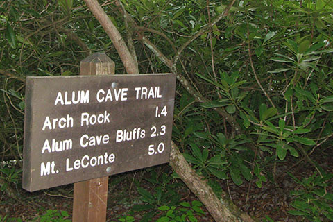
Route: Alum Cave Trail
One-Way Mileage: 5.0 miles to the junction with the Rainbow Falls Trail, 5.45 miles to High Top (summit)
Other Trail Guides: Rainbow Falls Trail
For Map, Trail Mileage, GPS, and Trail Notes go to Page 2
Pre-Climb Comments
Mount Le Conte is Tennessee's mountain and Alum Cave is the trail. I climbed it as a youngster and since have enjoyed many ascents. Alum Cave is a remarkable trail.
The Climb
Directions: From the Sugarlands Visitors Center, Great Smoky Mountain National Park, travel 8.5 miles south on Hwy 441 to the Alum Cave Trailhead. The trailhead is well signed. There are two parking areas. A deluxe privy is located in the lower parking area.
From the parking areas follow short trails that lead to the actual start of the Alum Cave Trail.
The first creek, Walter Camp Prong is crossed just ahead. The second, Alum Cave Creek is crossed not far beyond on another sturdy bridge.
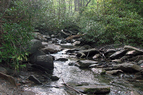
The trail continues on a gentle rise as it parallels Alum Cave Creek. After .90 mile there is a fork in the creek. The left branch is Styx Branch - the right is Alum Cave Creek. The fork is difficult to locate. The trail follows Styx Branch.

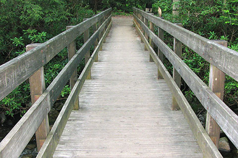
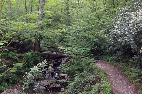
At 1.15 miles from the trailhead is the first log bridge over Styx Branch. Use care in crossing all four of the bridges.
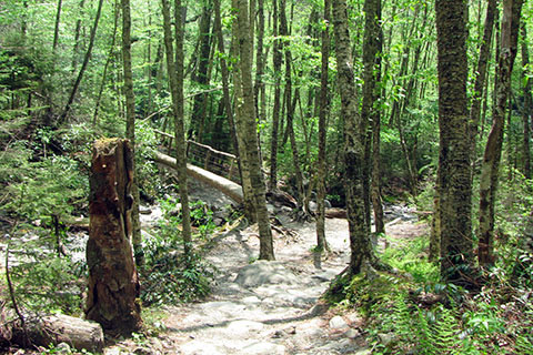
The trail climbs steadily and crosses another bridge at 1.30 miles. The above picture was taken looking down at the 2nd bridge from further up the trail.
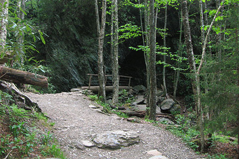
Finally the third bridge is reached at 1.40 miles. The bridge is at the base of Arch Rock. A great trail climbs through the Arch. A wire rope provides a hand rail.
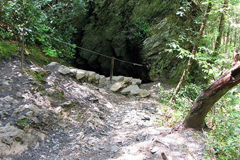
The trail climbs out of the arch ...
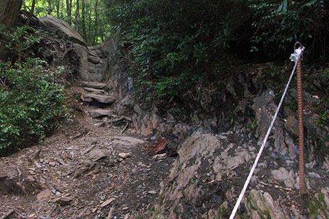
And continues steeply for a short distance before it eases back.
There is one last bridge (4th) to cross before the trail begins a traverse to Inspiration Point.

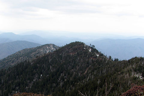
At 2.0 miles from the trailhead is Inspiration Point.
From the outcropping of rock, Inspiration Point gives a good view point. The elevation is about 4,700 feet.
.30 mile from Inspiration Point, the trail reaches Alum Cave - 2.30 miles from the trailhead. The area still smells of alum and saltpeter which were once mined there. Please stay on the trail.
The Cave is really just an overhang. The trail exits ahead and to the left.
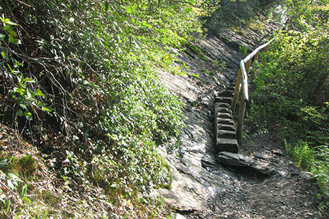
Leaving Alum Cave the trail makes a big u-turn around Peregrine Point. On the north side of the Point the trail descends to a saddle separating Peregrine Point from Le Conte. At .70 mile from Alum Cave are steps cut into a log with a handrail.
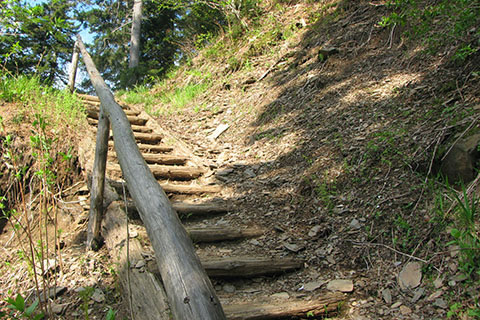
Climbing steadily the trail reaches the upper switchback and steps at 3.75 miles from the trailhead and 1.45 miles from Alum Cave. The elevation is about 4,700 feet. The cascading creek in the drainage beyond the switchback is Styx Branch.
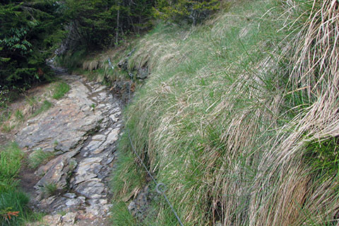
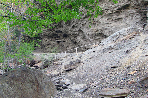
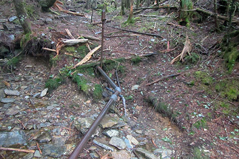
.40 mile from the upper steps the trail crosses a grassy area that covers an old slide. A wire rope helps to safeguard the crossing.
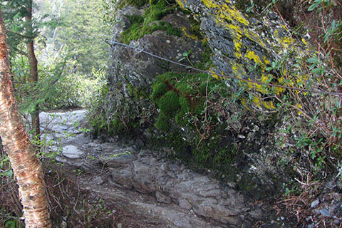
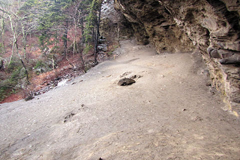
At .70 mile from the upper steps, the trail goes around a blind turn. The trail is exposed.
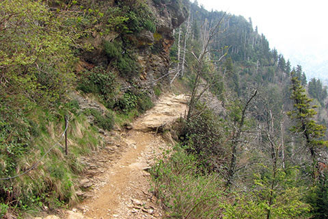
Photo is looking back at the corner. From the blind corner it is little more than a half of a mile to the junction with the Rainbow Falls Trail.
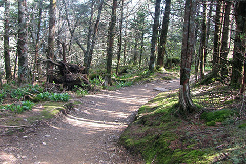
After passing beneath the rocky bluffs of Cliff Tops the trail levels out and passes through a fairy tale like forest. Even more enchanting, the trail leads a bit downhill before reaching the junction with the Rainbow Falls Trail.
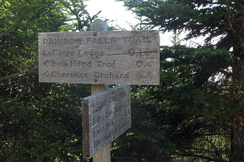
At 5.00 miles, the Alum Cave Trail ends at the junction. Most hikers continue to the Lodge, Cliff Tops, the Shelter, High Top (the summit), Myrtle Point, or all of the above!
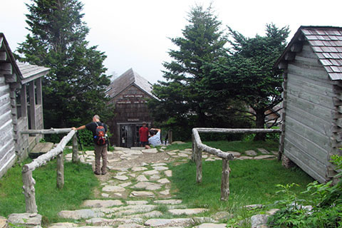
Continuing on the Rainbow Falls Trail the Mount Le Conte Lodge is just a short .10 mile away. The Lodge has water (seasonal - closed in winter months) and a nice privy for hikers. Other amenities are naturally available for registered guests.
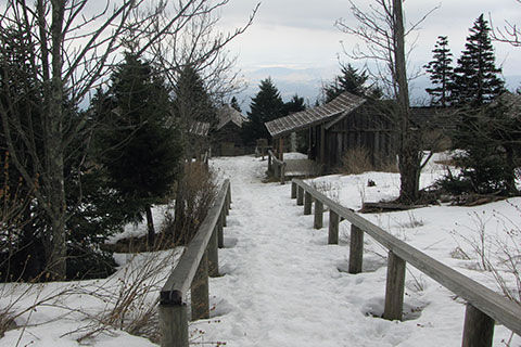
The Lodge is closed in the winter. The photo was taken from the top of the steps near the trail. Across from the stairs a trail goes steeply to Cliff Tops. Staying straight on the Rainbow Falls Trail, it is .10 mile from the Alum Cave Trail Junction to the Trillium Gap Trail Junction (right beyond the Lodge)
A source of water is available from a spring off the Trillium Gap Trail. It is about .10 mile down the trail, just past some of the cabins of the Lodge system.
At the Trillium Gap Trail Junction, the Rainbow Falls Trail ends and The Boulevard Trail begins. A short distance further on the trail (Boulevard) a second junction is reached with a trail branching off and leading to Cliff Tops. This leg of trail leading to Cliff Tops is not as steep as the direct route leading up from the Lodge.
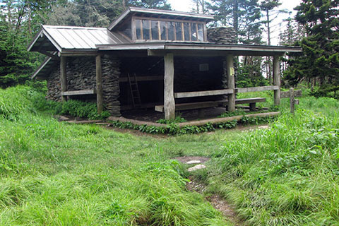
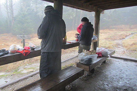
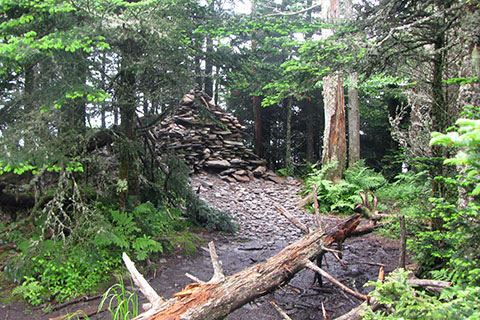
From the Cliff Tops Trail junction it is a short distance to the Le Conte Shelter. The double decker shelter sleeps 12. A new privy is nearby.
Permits are required for overnight stays at the shelter.
Continuing to the summit, the trail climbs steadily. Just below the summit the trail crosses along the top of a somewhat exposed ledge. The views are great.
At .35 mile from the Trillium Gap Trail junction, the trail reaches High Top, the summit of Mount Le Conte. It stands at 6,593 feet and the distance from Alum Gap Trailhead is 5.45 miles.