

Onahu Creek - Green Mountain Loop - Rocky Mountain National Park
The Trail Guide to the Onahu Creek - Green Mountain Loop includes trail descriptions, photographs of the trails, comments from our hikes, mileage data, custom topo map, and the Loop tracklog on a geo-pdf map. The guide will familiarize you with the Onahu Creek and Green Mountain Trail systems. We hope the guide helps you on your hikes and adventures.
Route Data
Photos from: June 2014
Green Mountain Trailhead Elevation: 8,794'
Range: Rocky Mountain National Park
Map Coordinate System - Geodetic Base (NAD27)
Trailhead Latitude: 40.307339, Longitude: -105.840632
Route: Onahu Creek Trail, Green Mountain Trail
Loop Mileage: 7.60
For Map, Trail Mileage, and Trail Notes
go to Page
2
Route Comments
Many years ago, I hiked the Onahu Creek - Green Mountain Loop with two friends. It was a fine trail system and Big Meadow was very interesting. Then, this summer we finally returned and used the trails as an acclimating hike. The Onahu Creek section of the route was a great trail. It became one of our favorites of the summer.
The Hike
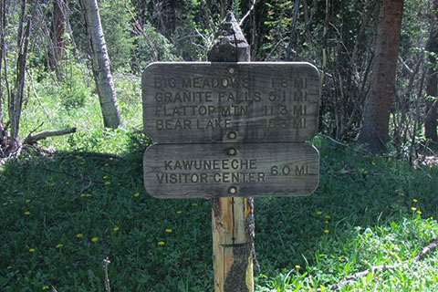
Directions: The Green Mountain Trailhead is located about 3 miles north of the Kawuneeche Visitor Center on Highway 34 - Trail Ridge Road.
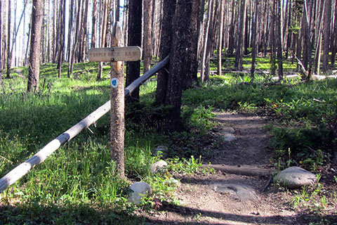
The Green Mountain Trailhead has parking, privies, and a trail kiosk.
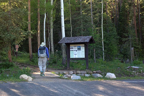
Please check the trailhead kiosk for current trail information. The trail linking Onahu Creek Trail goes north and parallels Trail Ridge Road.
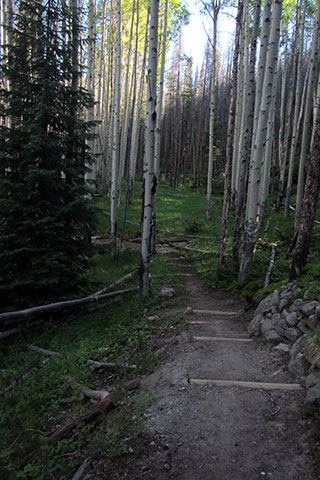
The connector trail is not the most interesting, but it is still better than walking along the road and it connects the trails to make a loop.
.70 mile from the Green Mountain Trailhead, the trail reaches Onahu Creek Trailhead. A short spur trail connects to the parking area and the trailhead kiosk.
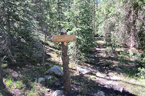
Leaving Onahu Creek Trailhead, the Onahu Creek Trail reaches the Bowen Gulch Trail Junction in .15 mile. The Bowen Gulch spur is part of the Continental Divide Trail.
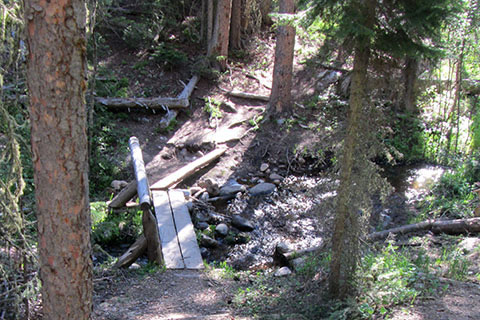
From the junction with the Bowen Gulch spur, the Onahu Creek Trail climbs a bit, contours, and descends to a footbridge over a small creek at .45 mile from the spur. The bridge is .60 mile from Onahu Creek Trailhead.
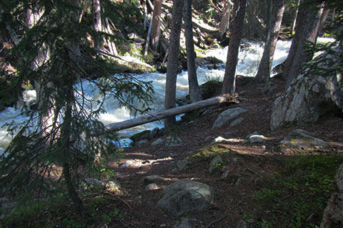
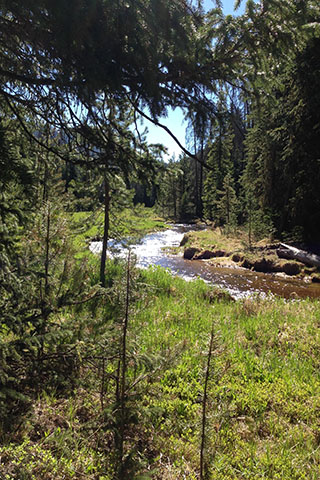
The trail climbs steadily for 200 feet (elevation) and then trends toward Onahu Creek. Finally, the trail joins the creek for a short distance.
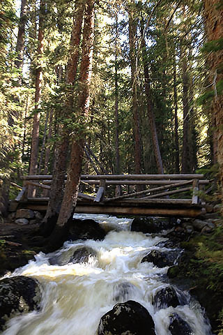
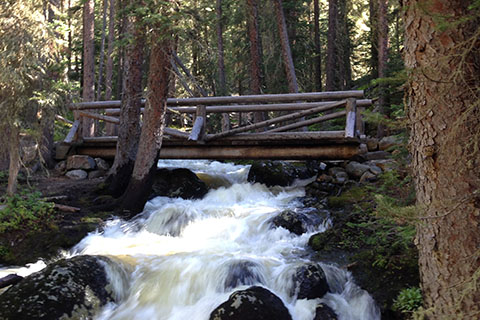
Onahu Creek Trail reaches a substantial bridge at 1.35 miles from Onahu Trailhead (.75 mile from the footbridge over the small creek). The lower Onahu Creek Bridge is 2.05 miles from the Green Mountain Trailhead.
The Onahu Creek Trail climbs steadily from the lower bridge. In .60 mile from the bridge (1.95 mile from Onahu Creek Trailhead) there is a side trail to Onahu Creek Campsite. The side trail crosses the creek. The Onahu Creek site is one of the best.
The climb eases as the Onahu Creek Trail follows near the creek for .85 mile to Upper Onahu Creek Campsite. The site is between the trail and the creek.
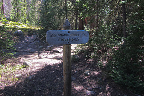
.10 mile from the Upper Onahu site, the trail reaches the Onahu Bridge Campsite. The site is 2.90 miles from Onahu Trailhead and 3.60 miles from Green Mountain Trailhead.
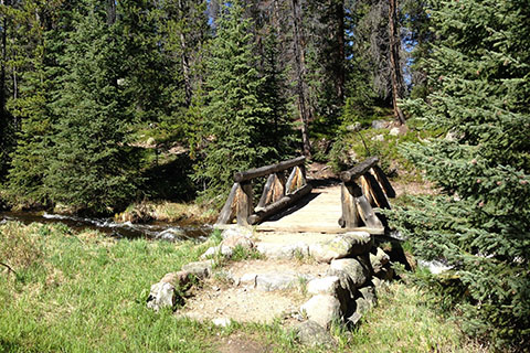
The trail crosses the Onahu Creek in .10 mile on a good bridge. The unmaintained trail to Long Meadow and on to Timber Creek also junctions near the bridge.
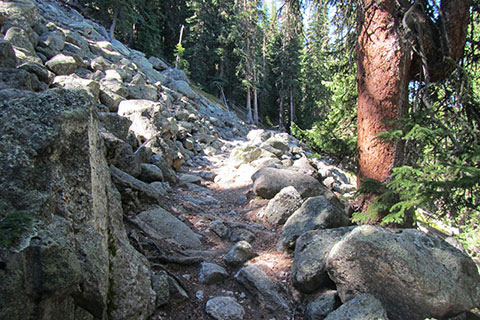
The Onahu Creek Trail leaves the creek at the bridge and climbs through a talus (rock) field, continuing to rise until a saddle is reached. The saddle is the high point of the route.
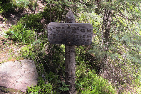
The trail then descends to the Tonahutu Creek Trail Junction. The junction is 1.60 miles from the Onahu Creek Bridge Campsite, 4.50 miles from Onahu Creek Trailhead, and 5.20 miles from Green Mountain Trailhead.
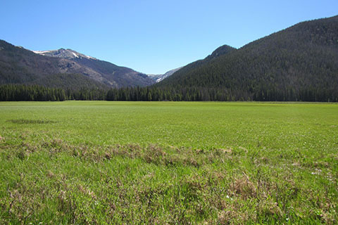
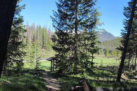
Joining the Tonahutu Creek Trail the trail passes along the western border of Big Meadow.
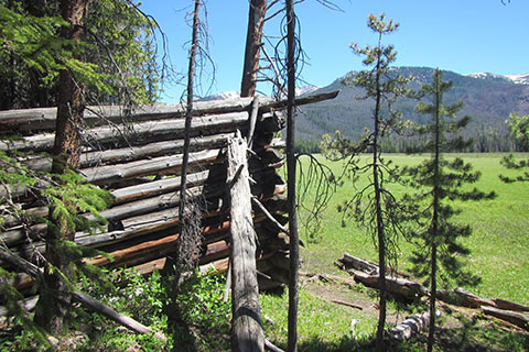
Ruins of settlers who worked the meadow are near the trail at Big Meadow.
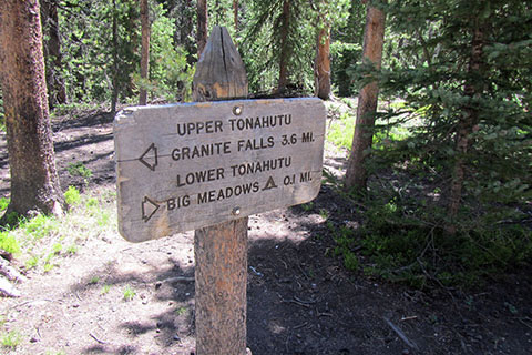
In .60 mile from the Onahu Creek Trail and Tonahutu Creek Trail Junction the trail reaches the Green Mountain Trail Junction. The junction is 5.10 miles from the Onahu Creek Trailhead and 5.70 miles from Green Mountain Trailhead.
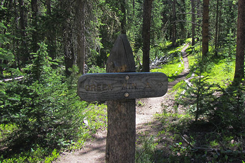
The Green Mountain backcountry site is located close to the the Green Mountain Trail Junction. The Green Mountain Trail climbs to the saddle between Kawuneeche Valley and Big Meadow. The trail then descends to the trailhead.
The Green Mountain Trail is a wide, mostly smooth trail. It used to be a road to access Big Meadow. The trail crosses drainages as it descends to the trailhead.
The Trail reaches the trailhead in 1.80 miles from the Green Mountain Junction. The Onahu Creek Trail - Green Mountain Trail Loop is 7.60 miles.