

Lake Trail - Standing Stone State Park
The Adventure Guide to Standing Stone State Park includes a trail description of the Lake Trail, photographs of the Lake Trail, comments from our hike, mileage data for the Lake Trail, the custom Park topo map, and Lake Trail GPS tracklogs. The guide will familiarize you with the Park and help you on your hike.
Trail Data
Date Hiked: 01/05/13
Park: Standing Stone State Park
Address:
1674 Standing Stone Park Hwy
Hilham , TN 38568-6610
931-823-6347
Latitude: 36.47080, Longitude: -85.41820
(from the trailhead below the dam)
Trail Rating: moderate - there are a few steep grades but they are short climbs
Round-Trip Mileage: the loop around the Lake is 4.7 miles, spur trails to the cabins, rec hall, or Park Office add distance to the total
For Map, Trail Mileage, GPS, and Trail Notes go to Page 2
Pre-Hike Comments
For several years we had been wanting to visit Standing Stone Park. The maps of the lake always interested us as the three creeks that feed the lake look like a crow's foot. Over the holidays, we found time for a visit. It was not disappointing. We walked the Lake Trail and took the time to make a quick visit to the rest of the Park.
The Hike
Directions: From Interstate 40 take exit #288 (the exit is just east of Cookeville) and head north on TN-111 to Livingston. Turn left on TN-52 (after about 21 miles). Turn left on TN-136 (after about 9.5 miles). TN-136 is the main Park road - Standing Stone Park Hwy. We found directional signs at each turn.
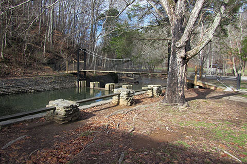
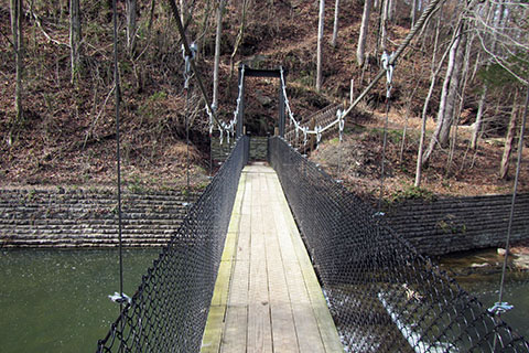
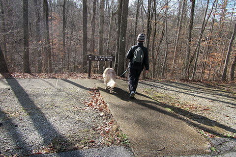
Below the dam of Kelly Lake (also called Standing Stone Lake), a suspension bridge crosses the outlet (Mill Creek). Park in the recreational area and begin the Lake Trail by crossing the bridge.
Seasonal restrooms and water are available near the parking.
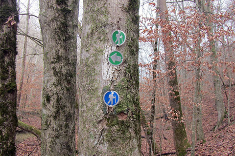
The trail begins by crossing Mill Creek and then climbing stairs to the right. At the top of the stairs, go left on an old road. In just a few feet the trail leaves the road and angles up to the right. The trail is obvious, but the turn is not marked. A trail marker is on a tree a short distance up the trail but is not necessarily obvious from below.
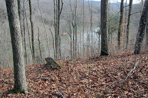
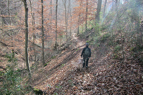
The trail climbs steeply to the top of the hill. A bench is provided at the top of the climb. After reaching the crest the trail continues along a ridge with good views of the lake in the winter season.
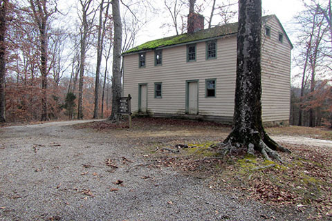
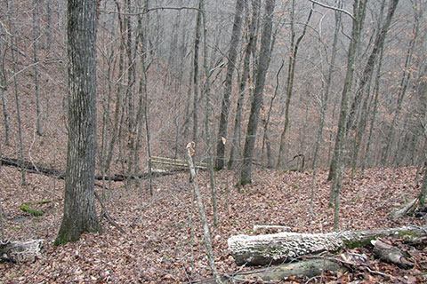
At .65 mile the trail crosses Standing Stone Highway (the main Park road - Hwy 136) at the Moses Fisk house. The trail continues to the right of the house.
![]()
Leaving the Fisk House the trail traverses hollows as it contours and then descends to Beach Road at 1.25 miles from the dam. At times the trail is narrow and the drop offs into the hollows are steep. On reaching the paved Beach Road, turn left. A trail marker is on the other side of the road just beyond the guard rail.
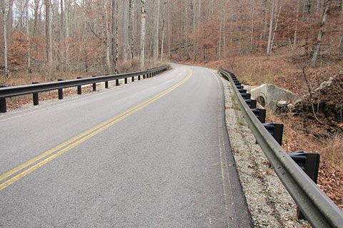
Follow the road to the end of the guard rail. The trail climbs to the right a short distance beyond. Even though the road has a double line on this short section, the road does not have a lot of traffic.
The trail climbs above the road a short distance then turns left as it follows an old road. The trail then begins to climb gradually as it traverses above the Lake. Good views are available in the winter.
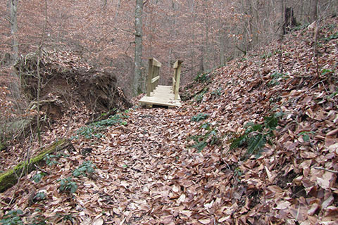
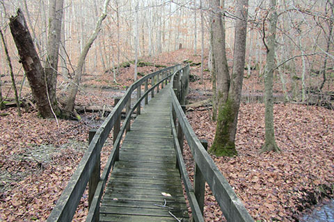
As the trail begins to descend a wooden bridge is visible down below. The trail makes a long switchback before returning to the bridge. Please, as always, stay on the trail and never try to short cut the trail.
At .95 mile from the first crossing of Beach Road, the trail meets the road again. The road-trail junction is 2.20 miles from the trailhead at the dam.
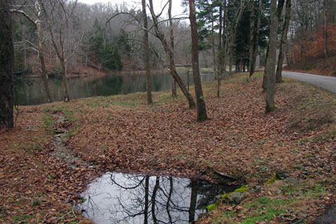
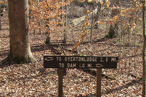
Turn right on Beach Road and follow it for .30 mile to Overton Lodge. The road passes a picnic shelter, Hawks Nest, and crosses a bridge over Morgan Creek before reaching the Lodge.
The trail goes through the Overton Lodge area. Please respect the Park visitors at the Lodge. Pass by the front of the Lodge and continue around the building. A trail marker is on a utility pole on the other side of the Lodge. Cross the nearby bridge.
The Lake Trail now, follows close to the lakeshore for the rest of the course. As the trail continues around the lake a trail junction is reached. The blue blazed Cooper Mountain Trail goes right from the Lake Trail. Continue on the Lake Trail.
At 1.05 miles from the Lodge the trail comes to a second trail junction with the Cooper Mountain Trail.
The Lake Trail goes left and crosses a long bridge over Mill Creek near the headwaters of the lake.
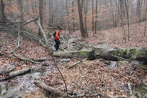
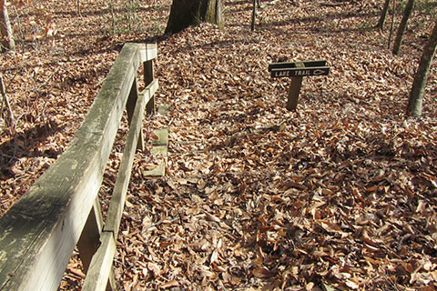
Once across the bridge the trail goes left and moves away from the lake until it crosses a drainage. Once across the creek bed, the trail moves to the left. The trail climbs above the lake for a short distance and then descends steps to enter another hollow. A junction is ahead.
The junction with the Jordan Spur (trail from the Recreation Hall) and the Cabin Spur meet the Lake Trail at this point. The junction is .40 mile from the upper Mill Creek Bridge, 1.45 miles from the Lodge, and 3.95 miles from the trailhead at the dam.
From the junction continue on the Lake Trail as the trail hugs the north shoreline of the lake.
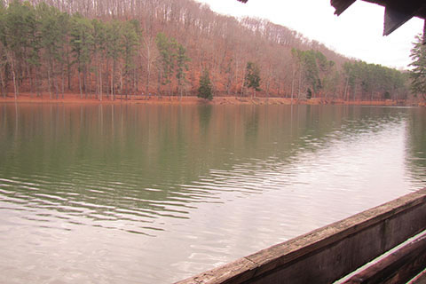
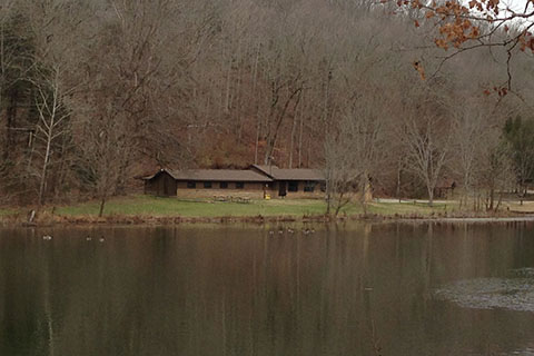
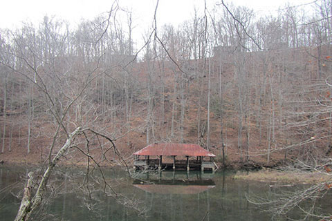
In about .15 mile, the trail passes the first of two boathouses. The second boathouse is .30 mile further. The above picture was taken from the second boathouse.
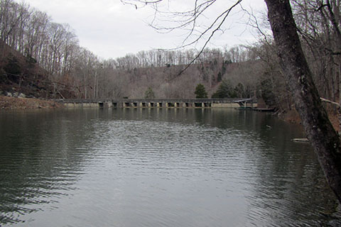
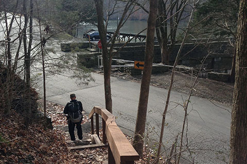
The trail continues along the shore for .20 mile to the dam.
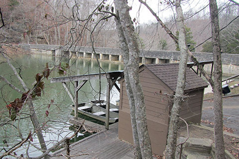
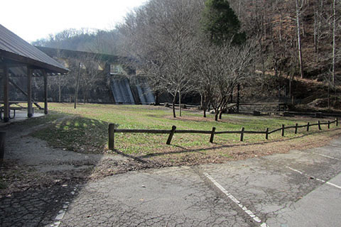
At the dam is the boat rental dock. Continue past the dock and carefully cross Standing Stone Park Hwy (Hwy 136) as it turns to go over the dam. It is a short .10 mile to the end of the loop at the trailhead below the dam.
The total distance of the Lake Trail loop is 4.70 miles.
Jordan Spur
From the Recreation Hall a sidewalk leads to a marked crossing of Standing Stone Park Hwy (Hwy 136).
Once across the road, the trail goes to the right and quickly descends into a steep hollow. It is .30 mile to the junction with the Lake Trail.
There is also a sidewalk that leads from the Campground along the road to the road crossing and a sidewalk that leads from the Conference Center to the Recreation Hall.
Cabin Spur
A .25 mile spur trail leads from Cabin 16 to the Lake Trail. The trail traverses the slope to the east and joins the Lake Trail at a junction with the Recreation Hall to Lake Trail.
Tea Room Spur
From the Park Office cross the parking area and the Standing Stone Park Hwy (Hwy 136). Near the Conference Center (north side - or right) is the Tea Room Spur trail. In .15 mile the trail descends a steep slope to the dam.
Other Walks
Check with the map to make your own shorter loop trails around the Cabin and Office areas. You could use the Jordan Spur, Cabin Spur, Tea Room Spur, the north shore of the lake, and the sidewalks from the Conference Center to the Campground.
Walking along the south shore of the lake on Beach Road is an easy alternative.