

Old Stone Fort - Wall Trail
Date Hiked: 04SEP11
Park: Old Stone Fort State Park
Address: 732 Stone Fort Drive, Manchester, TN 37355
Latitude: 35.48619, Longitude: -86.10209
Trail Ratings: easy, if taking the optional trails - moderate (steps and footing)
Round-Trip Mileage: Wall Trail - 1.25 miles, Wall Trail with optional trails - 1.40 miles, Enclosure Farm Road - 1.0 miles.
For Map, Trail Mileage, GPS, and Trail Notes go to Page 2
Pre-Hike Comments
A friend was going to the area and asked if I had done a map or guide to the area. I started researching the area and visited Old Stone Fort as soon as possible.
The Hike
Directions: From Interstate 24 take exit 110 and travel south toward Manchester on Hwy 53. In 1.3 miles turn right on Hwy 41. Turn left into the park in 1.3 miles. The trailhead and parking are located after .7 miles.
The Museum is the Park Office and Visitor's Center. Restrooms, water, and information are available inside.
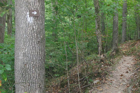
The main trail that surrounds the Enclosure is the Wall Trail which follows the wall around the old fort. There are also optional paths along the Wall Trail that lead hikers closer to the rivers. Note: the Wall Trail is also referred to as Old Stone Fort Trail.
From the west side of the Wall Trail an access trail leads to the Alternate Trails: the yellow blazed - Forks of the River Trail, the green blazed - Old River Channel or Moat Trail, and the red blazed - Little Duck River Loop which includes the Backbone Trail.
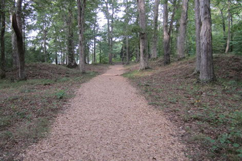
The Wall Trail (Old Stone Fort Trail) - The easy loop trail goes around the Enclosure. Sometimes it is above the wall and other times it travels below the wall. High cliffs are along sections of the trail. Please use caution.
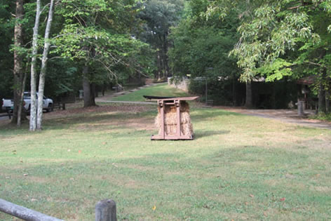
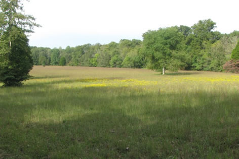
Starting at the Museum the trail goes between two mounds at the entrance of the Enclosure. After a short level distance, the path comes to the edge of the field. Bear left and slightly downhill as the trail joins a farm road for a hundred feet or so and then turns right. The trail then follows close to the top of the slope as it continues along high above the Little Duck River.
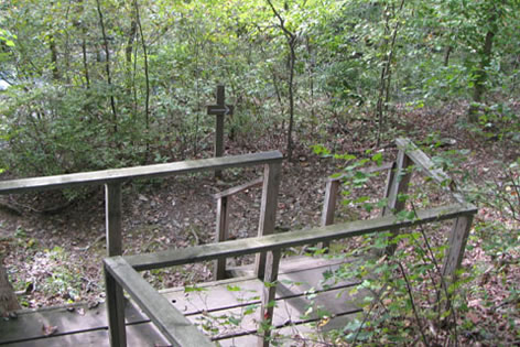
At .15 miles from the trailhead is the first optional trail - it leads to the Step Falls area. The spur descends on wooden stairs to a path below the Wall Trail. The spur trail is a bit closer to the Little Duck River; but no official path goes to Step Falls. There are however many social trails that go to the Falls. Beware the unofficial trails may be dangerous.
The spur rejoins the Wall Trail after climbing a set of stairs. After the stairs, the Wall Trail descends sharply and then returns to the same elevation. Several unofficial overlooks are near the cliffs edge. Be careful. The Enclosure field is just above the rise to the right.
The second optional trail leaves the Wall Trail at .45 miles from the trailhead.
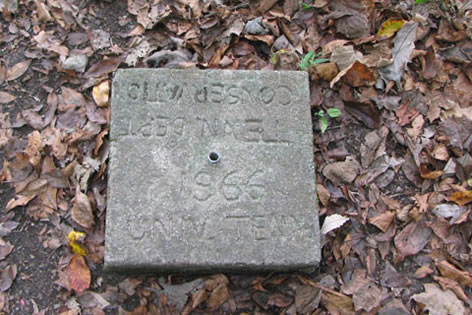
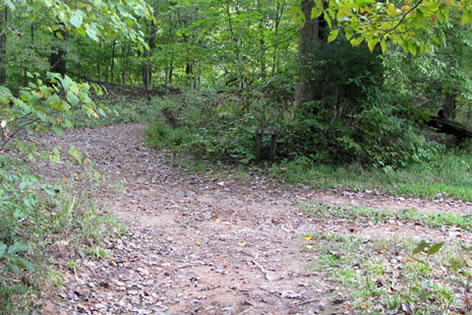
Near the beginning of the optional trail, pass a barrier on the right and a square concrete survey marker on the left. A steep casual trail leaves the optional trail and goes downhill to intersect with the green blazed, Moat Trail.
The optional trail climbs wooden stairs to re-cross the wall and join the Wall Trail.
Meanwhile, the Wall Trail enters the enclosure field and contours around edge.
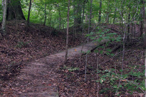
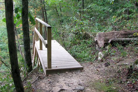
At .65 miles from the trailhead, the Wall Trail crosses a boardwalk to avoid a wet area.
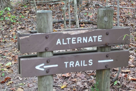
At .80 miles the Wall Trail goes down a step of wooden steps (not stairs) and sign for the Alternate Trails.
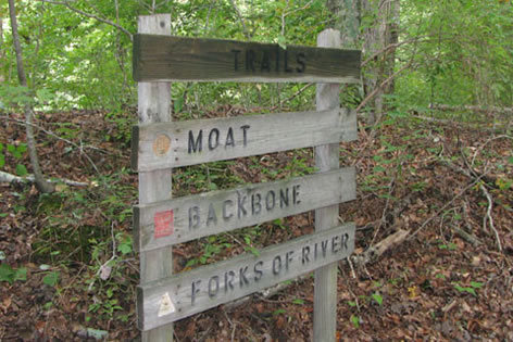
The junction is the access trail to the green (Moat), yellow (Forks), and red (Backbone) alternate trails.
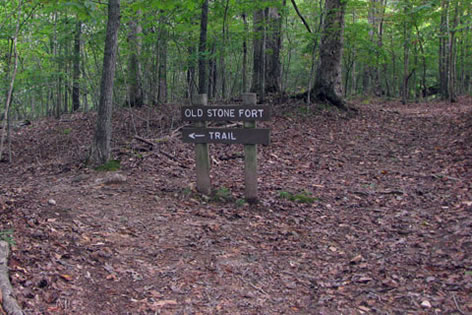
The Wall Trail continues to the right. A sign then directs hikers to the left to follow the Old Stone Fort Trail. This is just a different name for the Wall Trail.
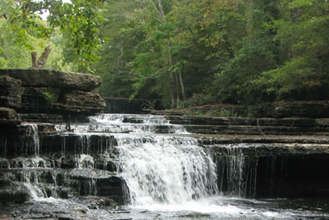
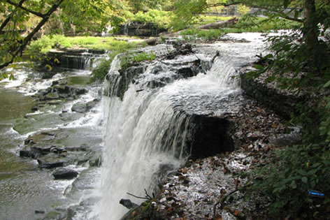
.95 miles from the the trailhead is the Big Falls area. The falls may be heard as you approach the area.
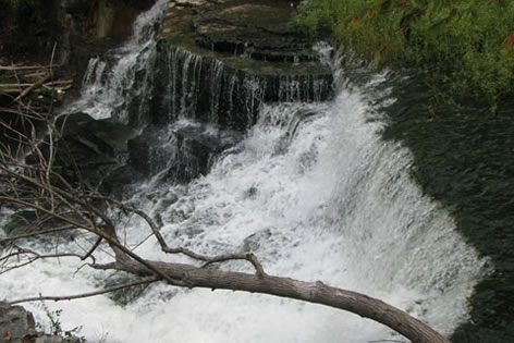
An unmarked trail goes to the Big Falls. Use the same trail to return from the falls.
A short distance beyond the Big Falls area there is another signed optional trail junction. Stairs lead down and the trail continues a few hundred feet before it climbs stairs again to rejoin the Wall Trail.
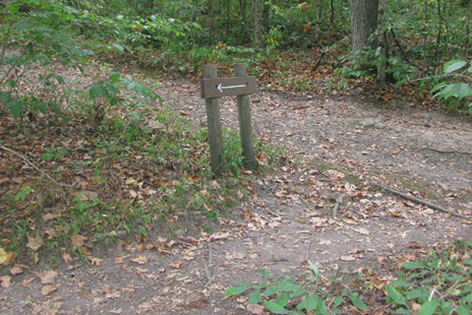
Meanwhile, the Wall Trail joins the Enclosure Farm Road and after a short distance leaves the road as directed by a long arrow to the left.
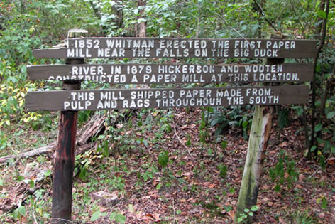
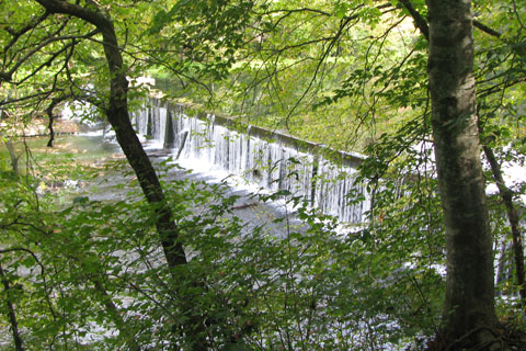
The next attraction is the paper mill. A sign gives a short history. More is found in the interpretive guide.
After the paper mill, the next optional trail is 1.15 miles from the trailhead. The optional trails goes to the left to the Blue Hole Falls area.
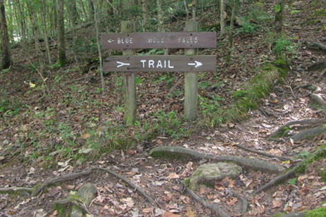
A side path leads closer to the falls. (This is a separate sign than the "optional" sign.) Follow the directional sign.
The optional trail continues for views of the dam and then the Park Museum near the trailhead.
Meanwhile, the Wall Trail goes right at the optional trail junction and travels less than a tenth of a mile before it turns right and goes through the mounds near the entrance of the Fort and joins the original trail, completing the loop.
The distance of the Wall Trail is 1.25 miles. The distance of the Wall Trail while taking all of the optional trails is 1.40 miles. The mileages given were for the Wall Trail without the optional trails.
Enclosure Farm Road
The Enclosure Farm Road starts at the regular trailhead.
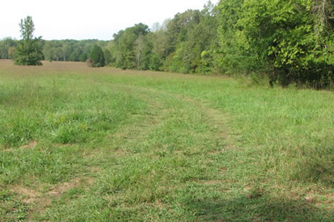
Go between the entrance mounds and into the field. The Wall Trail goes to the left but the fields of the Enclosure are still straight. At a farm road junction go left.
The farm road follows the trees along the edge of the field.
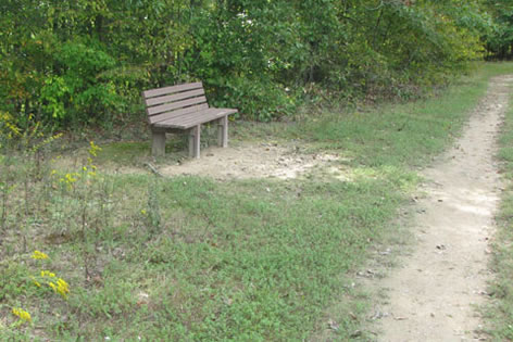
A bench is passed at .35 miles.
At the southern end of the field the road takes curves to the right and continues just a short distance from the Wall trail which is also in the field at that point.
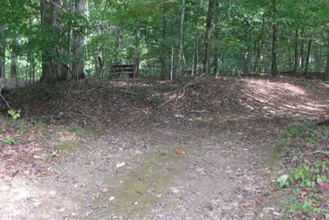
On the west side of the field, the road enters the woods. The Wall Trail joins the road near Big Falls. At .80 miles an arrow directs the Wall Trail to the left (see picture above - 9 pics up) Continue straight - do not follow the arrow.
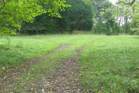
The road exits the woods and re-enters the field. Go left at the junction and return to the trailhead.
The Enclosure Farm Road is a one mile loop and 1.20 miles from the parking area trailhead.