

Ganier Ridge Trail
Date Hiked: 10/26/09
Park: Radnor Lake State Park and Natural Area
Latitude: 36.06243, Longitude: -86.80972
Trail Rating: Difficult
One-Way Trip Mileage, from first Lake Trail junction to second Lake Trail junction: 1.6
Other Trails in the Park: Otter Creek Road, Radnor Lake, South Cove, South Lake
For Map, Trail Mileage, GPS, and Trail Notes go to Page 2
Pre-Hike Comments
See Otter Creek Road
The Trail
The Ganier Ridge Trail is located in the northeast quadrant of the Park. From the east side of the Park, take the Access Trail .20 miles from the East Parking Area. At the trail junction continue straight (or veer slightly right) to gain the trail. A directional sign is located at the junction.
From the west, hike 1.35 miles on the combined Spillway and Lake Trails to the second Ganier Ridge (southern) junction. Of course, the first Ganer Ridge Trail will also work, but the description is from the second junction. Turn left at the junction and climb the hill .10 miles to the junction with the Access Trail coming from the East Parking Area (both junctions are signed).
Or, from the west, hike Otter Creek Road .95 miles to the Lake Trail junction (on the east side of the Lake). Turn left. Cross the boardwalk and turn right at the (southern) Ganier Ridge Trail Junction. The junction is at .20 miles. Climb the hill .10 miles to the junction with the Access Trail coming from the East Parking Area.
Looking at the junction of the Ganier Ridge and Access trails
From the junction with the Access Trail continue going straight (or left) as the trail weaves through ridgelets, seeks an even grade of ascent.
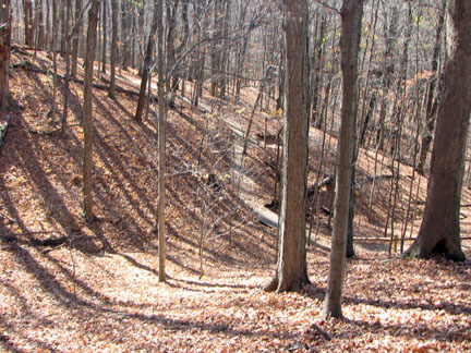
In the fall and winter good views are possible on the climb of the neighboring hills. The trail is in great shape and benches are available to tame the climb if it becomes too difficult.
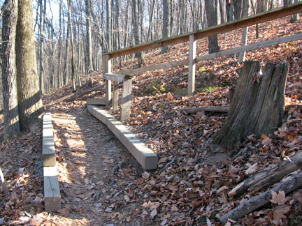
Almost to the top at the switchback
After .20 miles the trail makes a sharp curve to the right. A railing is provided to help hikers remember not to short cut the trail.
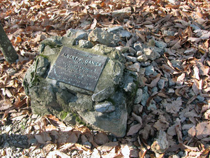
Ganier Memorial
After another .10 miles of climbing, the trail reaches the ridge. Once on the crest of the ridge the trail heads almost due north as it traverses for over .6 miles. The trail passes the Ganier Ridge memorial marker at .50 miles with interesting views of Nashville to the north. At .10 miles further, the descent begins.
At a sharp switchback the trail begins to descend. Contouring south the trail loses 100 feet of elevation in .10 miles. The trail turns back to the right and descends more steeply, over another 100 feet in .05 miles, but large steps have been created to make things a bit easier and help with erosion control.
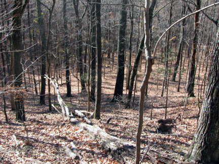
Heading down the north side, looking at the trail below.
The descent levels out and crosses a small bridge over an intermittent creek. Continuing a much more gradual descent, the trail reaches a change in direction in .25 miles. The trail turns left (if hiking in the opposite direction, the turn is more apparent as the path is blockaded and an arrow points to the right). An easy .15 miles leads back to another junction with the Lake Trail.
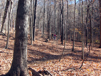
The trail on the north side
Once at the Lake Trail, turn right and hike .95 miles to return by walking west to the Visitors Center. OR, to return to the East Parking area, go left (acrtually straight) on the Lake Trail and hike another .40 miles to the (southern) Ganier Ridge Trail junction. Turn left and hike .10 mile up the rise to intersect with the Access Trail. Turn right and follow the trail .2 miles to the East Parking Area.
The Ganier Ridge may be walked in the other direction, clockwise.
The Ganier Ridge Trail is popular for a reason, it is a good, scenic trail. Hike it, enjoy it, and take care of the trail.