

Wolf Ridge Trail - Gregory Bald
The Adventure Guide to Wolf Ridge Trail includes a trail description of the route from Twentymile Trailhead to Gregory Bald, photographs of the route including all three trails used, comments from our hikes, mileage data of the route, the Gregory Bald topo map, and Wolf Ridge Trail tracklog on a geo-pdf map. The guide will familiarize you with the Wolf Ridge Trail and the mountain, Gregory Bald. We hope the guide helps you on your climb.
Date Climbed: 10Jan14
Elevation: 4,949'
Range: Great Smoky Mountain National Park
Lower Trailhead Parking - Latitude: 35.4705,
Longitude: -83.87825
Route: Twentymile Trail, Wolf Ridge Trail, Gregory Bald Trail
One-Way Mileage: 7.20 - from Twentymile Trailhead to Gregory Bald summit
For Map, Geo-Map, Trail Mileage, and Trail Notes go to Page 2
Pre-Hike Comments
For years a friend of mine had spoken of hiking Gregory Bald and in particular using the hike as a training hike for the western mountains. I had never hiked the trails, but was excited about the possibilities. On our trip we were planning to climb Long Hungry Ridge and descend Wolf Ridge.
The Route
Notes: (1) The data and directions for the route and the description of the Wolf Ridge Route from Twentymile Trailhead to the Twentymile Trail-Wolf Ridge Junction (the first .55 miles) are the same as the Long Hungry Ridge Route. The information was duplicated.
(2) The photos for Wolf Ridge Trail were taken while descending, and not climbing.
Directions: Twentymile Ranger Station is located on Goggle Maps. The Ranger Station is located in North Carolina on Highway 28 in the southwest region of the Park. It is due south of Cades Cove, but Gregory Bald and a lot of other mountains block access. Twentymile Ranger Station is on the north side of the road between the junction of highways 129 and 28 (Deals Gap Motorcycle Resort) and Fontana Village. From the 129 and 28 junction it is about 3 miles to the turn off. The turn is well signed.
Registration: There are no registration requirements for day hikes (though hikers should still leave their plans with a reliable contact.) For backcountry camping, reservations (and a fee) are required. The self registration at the trailhead is no longer available. For more information contact the Great Smoky Mountain National Park - Backcountry Page - (865) 436-1297 - (hours, 8 to 5 Eastern).
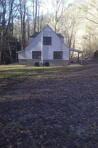
The Twentymile Ranger Station is a white house. Parking is available below the house near the trailhead kiosks and above the house closer to the road gate. An emergency phone is located on the porch of the Ranger Station near the kiosks. There are no other amenities. The elevation of the trailhead is about 1320 feet.
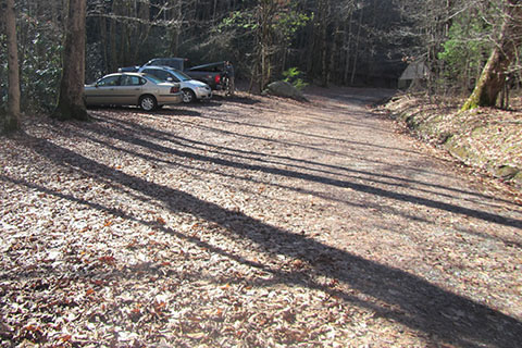
From the parking areas start hiking up the road.
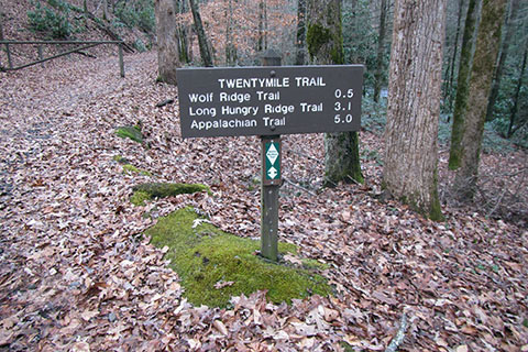
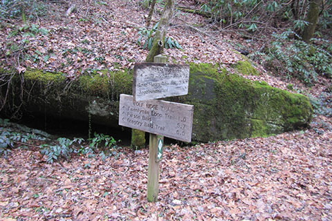
A trail sign is located just below the road gate.
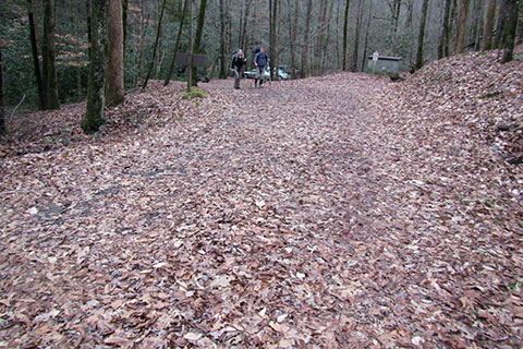
The road over the first half of a mile is an easy walk. It is not too steep and gives a good warm up.
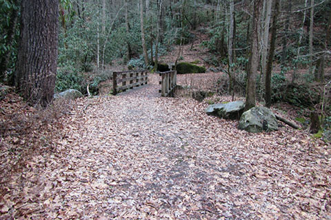
After climbing the first half of a mile is the first of many bridges. The bridge crosses Moore Spring Branch.

The lower sections of Long Hungry Ridge Trail was characterized by the stream crossings. Wolf Ridge crosses Moore Spring Branch 5 times in 1.10 miles. There is a footbridge at each crossing.
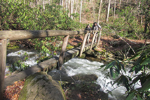
The footbridges seemed sturdy, but the tread was slippery and some of the handrails leaned away too far to provide balance. Use caution!

Near each of the bridges are horse crossings also.
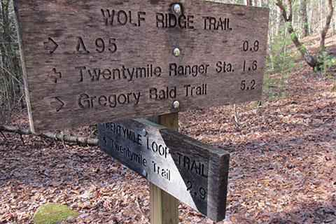
1.60 miles from Twentymile Trailhead the trail reaches the junction with the Twentymile Loop Trail. The Twentymile Loop Trail travels east to Proctor Field Gap in 2.9 miles.

Near the Twentymile Loop Trail Junction , the Dalton Branch flows into the Moore Spring Branch. The Wolf Ridge Trail follows the Dalton Branch. The trail never crosses the creek, but stays to the north.

After 0.80 mile from the Twentymile Loop Trail Junction the Wolf Ridge Trail reaches the junction with the side trail to the Dalton Branch Campsite (#95). The trail climbs about 400 feet along the creek to 2,360'.

Leaving Dalton Branch, the trail climbs steadily up the slope leading to the actual Wolf Ridge. The trail crosses a couple of seasonal creeks, including a rather large creek at 0.80 mile. About 0.45 mile from the creek, the trail makes a sharp switchback. The switchback is 1.25 miles from Dalton Branch. On the next leg of the trail, a small spring is passed to the north of the trail.
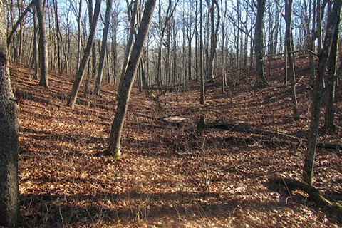
The trail climbs along the steep ridge on a good trail. The trail uses three sets of switchbacks as it climbs. (Switchbacks are almost rare in the Smokies!) At 2.40 miles from Dalton Branch, the Wolf Ridge Trail comes to a small saddle. The trail does not cross the saddle. The saddle is really a depression on the ridge and leads to the east of the trail. The trail continues north toward Parson Bald.

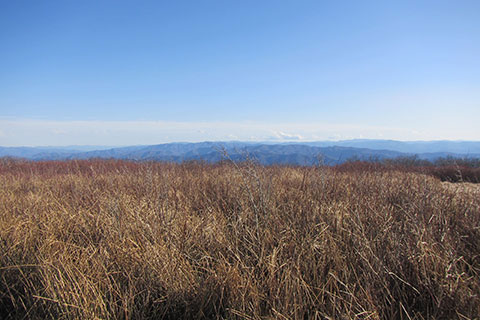
Parsons Bald is 1.20 miles from the small saddle and 3.60 miles from Dalton Branch. The elevation at Parson Bald is 4732 feet. The views from the summit are good. Gregory Bald can be seen to the northeast.

From Parson Bald, the trail descends about 130 feet (to the real Sheep Pen Gap) then ascends about 40 feet to Sheep Pen Junction.

The trail reaches the junction with the Gregory Bald Trail at 0.75 mile from Parson Bald, 4.35 miles from Dalton Branch, and 6.80 miles from Twentymile Trailhead. The junction is also the location of Sheep Pen Gap Campsites at 4640'. As mentioned before the actual 'gap' is located on the Wolf Ridge Trail about a tenth of a mile toward Parson Bald.

The Sheep Pen Campsites (#13) are on the west shoulder of Gregory Bald mountain and adajcent to the Sheep Pen Junction. The camping area is quite large. Water is available down the Gregory Bald Trail a few hundred feet. The creek crosses the Gregory Bald Trail.

From the Sheep Pen Gap Junction, the Gregory Bald Trail leads east for 0.40 mile to the Gregory Bald summit.

After 7.20 miles from Twentymile Trailhead (via Wolf Ridge), the Gregory Bald Trail reaches Gregory Bald - elevation 4,949 feet.
The large bald area offers good views in all directions. It is a worthy destination.