

Timber Lake - Rocky Mountain National Park
The Guide to the Timber Lake Trail includes a trail description, photographs of the trails, comments from our hikes, mileage data, custom Mount Ida & Timber Lake topo map, and route GPS tracklogs. The guide will familiarize you with the area and help you on your hike.
Date Hiked: 27Jul13
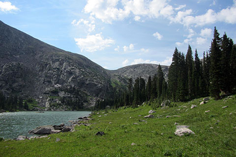
Lake Elevation: 11,040'
Range: Rocky Mountain National Park
Trailhead Latitude: 40.39983, Longitude: -105.84696
Timber Lake Latitude: 40.37602, Longitude: -105.79730
Route: Timber Lake Trail
One-Way Mileage: 5.0
For Map, Trail Mileage, GPS, and Trail Notes go to Page 2
Pre-Hike Comments
Timber Lake is on the west side of the Continental Divide in Rocky Mountain National Park. Rated as moderate, the trail to the lake is only 5 miles long (one way) and it stays below treeline. The area is recommended for hiking, trail running, backpacking, peak bagging, and fishing.
Timber Lake Trail
Directions: the Timber Lake Trailhead is on the west side of the Park on Trail Ridge Road. The trailhead is located a little less than 11 miles from the Alpine Visitor Center and about 10 miles from the Kawuneeche Visitor Center.
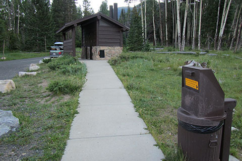
At Timber Lake Trailhead there is ample parking area and a modern privy.
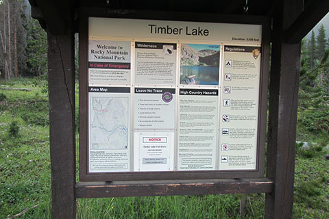
The trail kiosk marks the beginning of the trail. Check the kiosk for current information. For more information, check with one of the Visitor Centers.
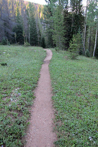
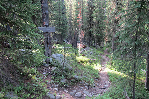
The trail leaves the trailhead and climbs easily for a short distance and then descends. Remember to save a little energy for the climb on the return hike!
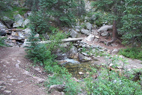
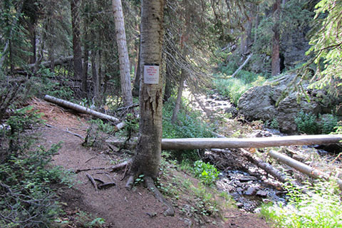
At .65 mile the trail reaches Beaver Creek. A good bridge crosses the creek.
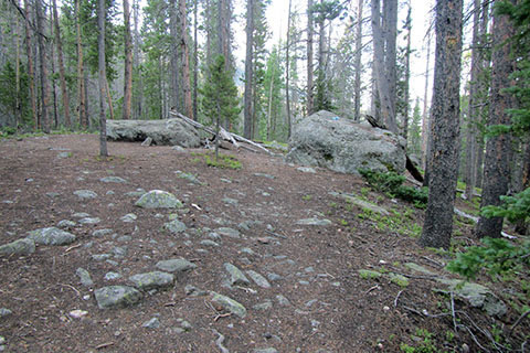
Leaving Beaver Creek the trail climbs steadily to the south. The trail runs almost parallel to Trail Ridge Road. A couple of large boulders sit to the west of the trail making a nice rest stop. The boulders are .75 mile from Beaver Creek and 1.40 miles from the trailhead.
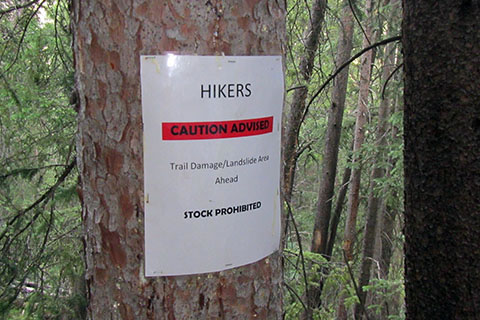
From the boulders the trail heads south-east and along the Timber Creek drainage. In a mile, the trail reaches an area damaged from the 2012 landslide.
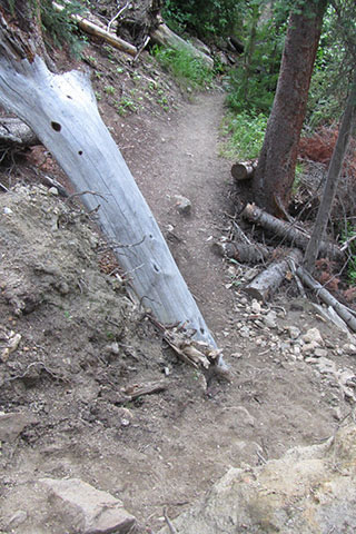
The landslide debris area is large. The passing is not difficult as longer as hikers use care on the uneven tread.
From the landslide, the trail continues to climb above Timber Creek. Slowly the distance between the creek and the trail lessens and the creek noises are louder. At .70 mile from the landslide, the trail reaches the Timber Creek backcountry site. The trail junction to the camp site trail is 3.1 miles from the trailhead.
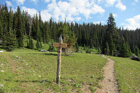
Leaving the side trail to the Timber Creek campsite it is .20 mile to another junction where the Long Meadows Trail crosses Timber Creek and joins the Timber Lake Trail - 3.3 miles from the Timber Lake Trailhead.
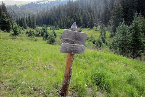
The lower section of the trail (from the trailhead to the Long Meadows Trail Junction) is a walk through the woods. It is interesting, but not spectacular. Ah, but after the trail leave the Long Meadows Junction, things change. The trail climbs steeply to a rib above Timber Creek. Following the rib it is a little more than .25 mile to more switchbacks. Finally, after climbing 800 feet in .90 mile, the trail reaches an open meadow (or park). The first Jackstraw Campsite is near the start of the meadow. The side trail junction is 4.2 miles from the trailhead and .80 mile to Timber Lake.
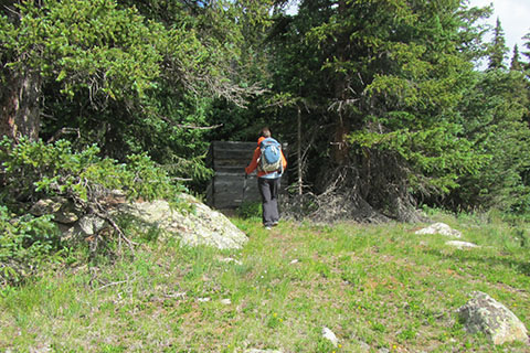
Just beyond the first Jackstraw site is a privy.
The second Jackstraw site is a few hundred feet beyond the privy.
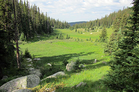
There is a great view of the meadow after walking around the perimeter.
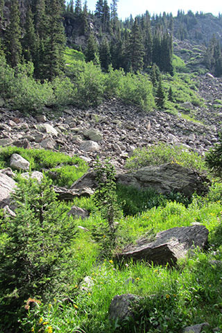
Pass the rockslide about .20 mile from the meadow view. The Rockslide Backcountry site is just beyond the rockslide.
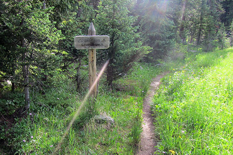
After the rockslide the trail continues to climb and passes Snowbird Camp at .65 mile from the first Jackstraw camp and 4.85 miles from the trailhead. Snowbird is the highest of the five, Timber Lake Trail, campsites.
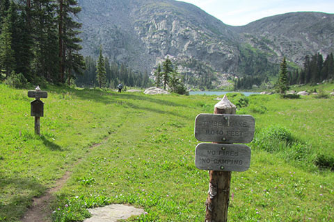
From the Snowbird Campsite it is but a stroll to Timber Lake, 5.00 miles from the trailhead.