

The Loch, Glass Lake, Sky Pond -
Rocky Mountain National Park - page 2
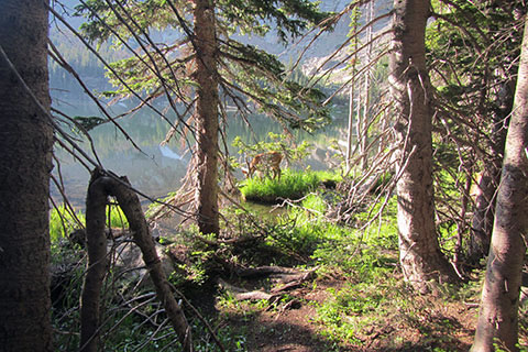
Deer along the shore of The Loch
Route Notes
Rocky Mountain National Park has many good trails. The Trail to Sky Pond is one of the best.
The trail is not overly steep, but it still climbs 2,600 feet in almost 5 miles to Sky Pond.
There are many ways to shorten or extend the trip.
The route is in the mountains. Pack the essentials and be prepared for afternoon thunderstorms.
Mountain routes require mountain sense.
The parking at the Glacier Gorge Trailhead is very limited. The spaces are usually taken by 7 on any morning of the summer.
It is possible to park at Bear Lake Trailhead instead. The alternate parking only adds .20 mile (.50 mile from Glacier Creek Junction to Bear Lake and .30 mile from Glacier Creek Junction to Glacier Gorge Trailhead) to the trail, but on the return, it is uphill.
Another alternative is to park at the Park and Ride (near Glacier Basin Campground) and ride the shuttle bus to Glacier Gorge Trailhead.
The Glacier Gorge Trailhead has privies, trash and recycling, trailhead kiosk, bus waiting area, and parking. During the summer, a Park volunteer is usually staffed in the peak hours.
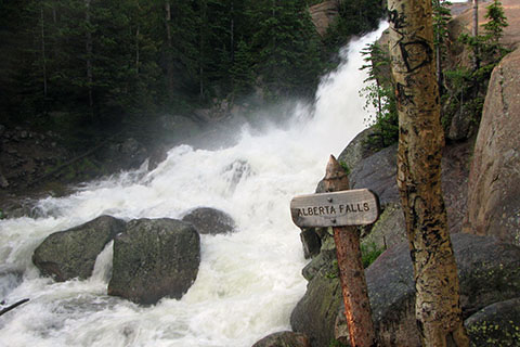
Alberta Falls
Unless starting in the early morning hours the hike to Alberta Falls is very crowded.
There is an alternate fire trail (check the map) which shortens the route but the trail is unmaintained. In the early morning we hiked the regular route (by Alberta Falls) in about the same time as it took us to hike the fire trail.
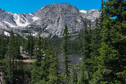
View of Loch Vale (the gorge) from The Loch
At the Glacier Gorge, Haiyaha, The Loch - junction take a second to make sure you are on the intended path. Twice while doing a very early approach (dark), I went left instead of right and I really don't know why. I was very familiar with the trail.
There is a series of switchbacks just below The Loch. As with all other sections of the trail, stay on the trail and never shortcut the switchbacks.
The Loch is a great rest stop or destination.
Many times on the section of trail between Andrew Creek Footbridge and The Loch, I have been caught in an afternoon thunderstorm. At least the area is below treeline!
Andrews Creek is another good rest stop.
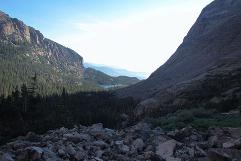
Looking down Loch Vale toward The Loch
The climb to Timberline Falls is a bit harder than the rest of the trail. The loose rocky slope has been improved by steps.
Timberline Falls really is at timberline. Heed the signs of changing weather.
In dry conditions the scramble is supposed to be fairly easy. I have never seen the rock dry.
As you are climbing up the rock, reverse your path, so that you are also acquainted with the down climbing moves.
If the climb seems uncomfortable, Timberline Falls is a good destination.
The trail around Glass Lake is not as direct as the rest of the route. If the route doesn't look good, be sure and look for paths leading away from the lake. There are no more scrambles (similar to the one at Timberline Falls) on the route to Sky Pond. If the path leads to a scramble, then it is probably going the wrong way!
Glass Lake is also called Lake of Glass.
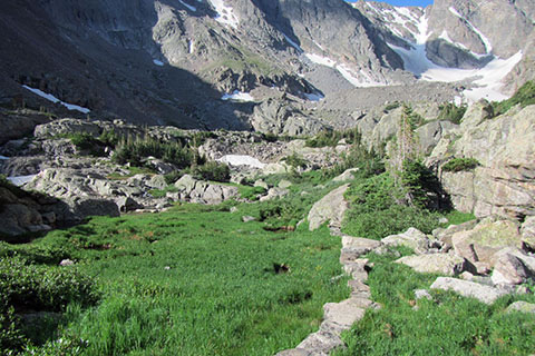
Stepping stones crossing the wet land
The trail crews did some amazing work on the path to Sky Pond.
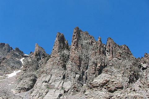
Sky Pond sits in a cirque of mountains. To the north the spires of Sharkstooth, Petit Grepon, and the Saber dominate the sky.
Climbers are often seen (or heard) on Petit. It is a somewhat famous, classic, technical rock climb.
Mosquitoes seem to be fairly active at Sky Pond.
For Mountain Data and Route Guide
go to Page
1
Sky Pond Route Trail Mileage
0.00 Glacier Gorge Trailhead
0.30 Glacier Creek Trail Junction
1.80 Glacier Gorge - The Loch Junction
2.30 North Longs Peak Trail Junction
3.10 The Loch
3.90 Andrews Creek footbridge (and trail)
4.40 Glass Lake (Lake of Glass)
4.80 Sky Pond
Map Link
The link opens in a new window.
Glacier Basin Trail Map - pdf