

Mount Massive - Mount Massive Trail - East Slopes
The Adventure Guide to Mount Massive - Mount Massive Trail includes a trail description, photographs of the trail, comments from our hikes, mileage data, and a custom Mount Massive topo map. The guide will familiarize you with the Mount Massive Trail and the area. We hope the guide helps you on your climb.
Route Data
Photos from: JUL05, JUL07, JUL09, JUL14
Elevation: 14,421'
Elevation: Mount Massive Trailhead: 10,050'
Range: Sawatch Range, CO - the land is managed by the Leadville Ranger District of San Isabel National Forest
(719)486-0749
Mount Massive Trailhead
Latitude: 39.15173, Longitude: -106.41928
Map Coordinate System - Geodetic Base: NAD83 (1986)
Route: Mount Massive Trail - East Slopes
One-Way Distance: 6.70 miles, Colorado Trail to Mount Massive Trail then Mount Massive Trail to summit of Mount Massive
For Map, Trail Mileage, and Trail Notes
go to Page
2
Mount Massive Trail Comments
Mount Massive is one huge mountain and is the second highest peak in Colorado. It is one of our favorite Class 2 fourteeners. There is a good trail all the way to the saddle at 13,900'. From the saddle a path leads across the rocky ridge to the summit. The ridge is an easy (relative of course), fun, scramble. Along the way there are great views of the Arkansas Valley including Leadville, Turquoise Lake, and the Arkansas River. The summit ridge has views in all directions.
The Climb
Directions: Starting in Leadville, follow Hwy 24 south for about 3 miles. Turn right (west) on Colorado Hwy 300. After 0.75 mile turn left on Lake County Rd 11. Stay straight on Rd 11 for 1.25 miles, then the road (11) makes a right hand turn (11A goes straight). It's about 5.5 miles on a dirt road to the North Elbert Trailhead (on the left - south). Continue on Halfmoon Rd (Rd 11a) for 0.40 mile to reach Mount Massive Trailhead (on the right). The road is passable for most vehicles. Note: North Elbert Trailhead is searchable on Goggle Maps - Massive Trailhead is just down the road.
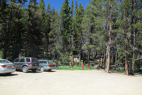
The Mount Massive Trailhead is a parking area with a few Forest Service signs. Privies are available at the North Elbert Trailhead. It is not a bad idea to stop by the privies on the way to the trailhead.
Begin the hike north bound following the Colorado Trail.
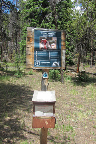
Shortly after starting the hike, the trail crosses the boundary into the Mount Massive Wilderness Area. Sometimes there are registration forms and other times there are not. If possible, please register.
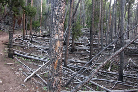
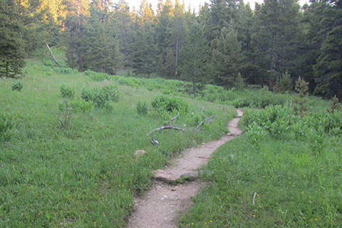
The Colorado Trail starts with a gentle rise. Dead trees (from the pine beetle infestation) litter the sides of the trail.
After a third of a mile on an easy grade, the trail begins to climb. The trail climbs over 300 feet in elevation to a switchback at about 10,500', 0.75 mile from the trailhead. The switchback is the most easterly point of the route.
From the switchback the trail follows an easier grade as it contours to the north. In 0.50 mile (from the switchback) the trail reaches a clearing.
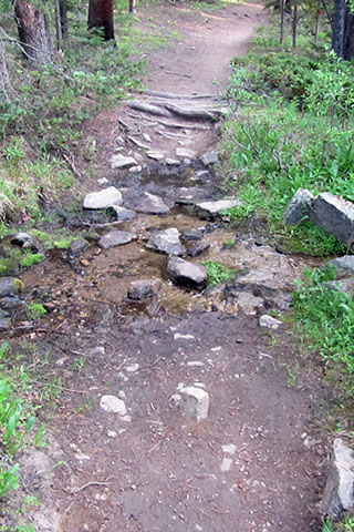
A small stream is crossed just beyond the opening. Two more streams are also crossed while on the Colorado Trail section of the route.
At 0.50 mile from the opening, the trail reaches a small side trail that leads to an old miners cabin. The side trail is 1.75 miles from the trailhead. In the dark (early morning) the side trail might be difficult to locate.
At 2.25 miles the trail reaches South Willow Creek. There is no bridge, but under normal conditions, the crossing is not overly difficult.
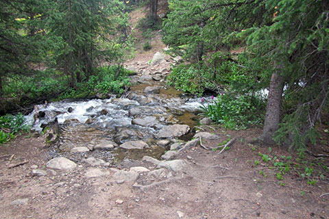
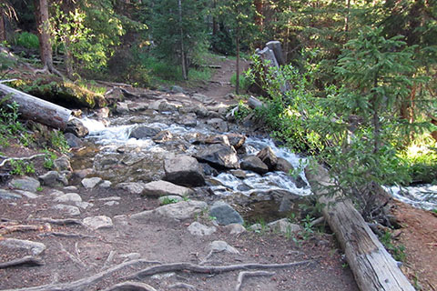
0.70 mile further the Colorado Trail crosses Willow Creek. The creek is a good place to filter or treat water.
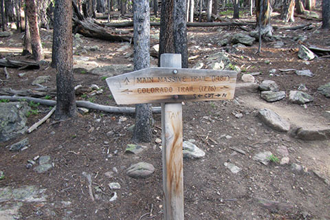
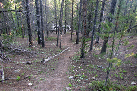
From Willow Creek the Mount Massive Trail junction is just a short distance away. The junction marks the end of the Colorado Trail section of the route. In 3 miles from the trailhead, the trail gains a bit over 1000 feet. The Mount Massive Trail still climbs 3,300 feet in 3.70 miles to gain the summit.

The Mount Massive Trail climbs steadily through the trees. In 0.75 mile (from the Colorado Trail - CT) the trail reaches an opening with a good view of Mount Massive.
At 1.25 miles from the Colorado Trail, the Mount Massive Trail enters the willows. The trail switchbacks through the shrubs.

Pass a "Closed for Restoration" sign. The old trail went through a marshy area to the north (right) of the current trail.

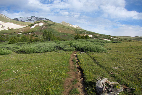
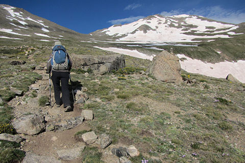
The trail climbs through the willows in short order - about 0.30 mile. Now above treeline, the trail contours to the right around a knob.
1.75 miles from the trail junction an upper "Closed for Restoration" sign is passed at about 12,300'.

The upper "Closed for Restoration" sign marks the entrance to the fragile alpine environment of the upper basin. Please practice Minimum Impact Usage.
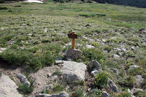
One mile from the willows the trail passes the 'flat rock'. This unofficial marker is at 12,860 feet elevation and 2.25 miles from the Colorado Trail Junction.

The 'flat rock' is a great rest stop.

The trail heads toward the saddle between Mount Massive and South Massive. The saddle is at 13,900 feet.
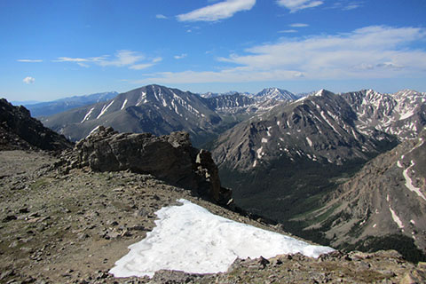
The saddle is 3.15 miles from the Colorado Trail Junction and 6.15 miles from the trailhead. There are good views to the south and west. The saddle is a spectacular location and a worthy destination.

From the saddle the path picks a route through rocks as it climbs toward the summit. The route generally stays on the east side of the ridge.

A quarter of a mile above the saddle the route reaches a trail junction. The Southwest Slopes Trail joins the Mount Massive Trail at 14,250 feet. The junction is at 3.40 miles from the Colorado Trail.

Snow lingers into July on the ridge. Sections of the path, are covered by snow. Crossing the snow may require snow climbing skills and tools. Please see Page 2 for more on snow travel.

The route finds a Class 2 path along the ridge. Cairns (rock piles) and boot prints mark the path. Use care with every move.

The route climbs toward the summit, but first it must go over a false summit and then descends on the west side of the ridge to a saddle. Finally, the summit comes into view and the remaining route is just a simple walk and scramble.

The 14,421 feet summit is 3.70 miles from the Colorado Trail and 6.70 miles from the trailhead.
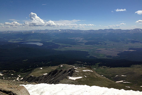
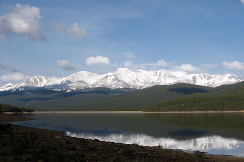
Views from the summit are great. To the north, Turquoise Lake and Leadville are visible.

The round trip from the Mount Massive Trailhead to the Mount Massive summit is at least 13.40 miles. It is a classic route but the length of the route demands respect.