

Mount Massive - Mount Massive Trail - East Slopes
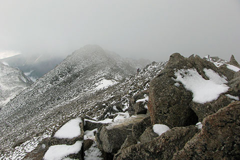
Late July on the South Ridge
Route Notes
The parking area at the trailhead is rather small for busy weekends. Arriving early makes parking easier. There is also a signed overflow parking area on the left before reaching the creek.
The first 3.00 miles of the route are on the Colorado Trail. The trail does not use painted blazes to mark the route but there are an occasional icon marker.
The wilderness area registration is not checked on a daily or even weekly basis. Do not assume anyone will be checking at the end of each day for overdue hikers.
Mount Massive is in a Wilderness Area. The list of rules that govern the Wilderness Area include limiting group size, dogs must be on a leash, and avoid shortcutting. The rules are listed at the trailhead and online.
The round trip distance to the summit is at least 13.40 miles. During the summer daily thunderstorm cycle, an early (alpine) start is advisable.
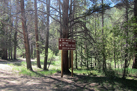
Sign for the Overflow Parking and Trailhead
The Colorado Trail section of the route is in great condition.
There are no bridges at the creek crossings.
If you choose to visit the miner's cabin at 1.75 miles (from the trailhead), use care. The cabin is not maintained. We were happy just viewing it from the Colorado Trail.
Willow Creek (the creek near the Mount Massive Trail Junction) is a good spot to top off your water storage. All water should be filtered or treated.
Near Willow Creek, the trail has changed a bit through the years. The Mount Massive Junction has moved closer to the creek crossing.
The start of the Mount Massive Trail did not feel as steep to us as the North or South Mount Elbert trails did.
The route through the willows seemed like a maze. We really could not see where the trail was going.
The route through the upper basin is straightforward. The saddle is visible for the entire way.
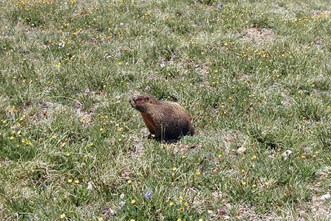
Marmot in the Basin
Above treeline keep a close eye on the weather.
Snow lingers on the slopes of the upper mountain. Snow is slippery and ice is even more slippery. Sure, most folks have had to walk on a snow covered sidewalk in town, but snow in the mountains is different. Safe passage might require tools, skills, and experience. A slip or fall on snow or ice may produce a slide and possible injury or death.
The South Ridge that leads from saddle to the Summit is mostly a walk, but at times passage requires a bit of scrambling. The scrambling on the ridge is limited to a couple of moves in a few steeper sections of blocky rock. There really is not much exposure on the ridge, but still care should be given while moving over rock. The scrambler must find the route (the easiest path), test the holds before weighting them, and stay centered - in balance.
If you try to avoid snow along the ridge the scrambling may be more difficult than the Class 2, standard route.
If the snow or scrambling seems too difficult, either search for a different route or turn around and try it another day.
Crossing the ridge the weather conditions may be very windy.
Snow can be expected any time of the year.
The summit is actually the second summit along the ridge from the saddle. On our first trip to the peak, we climbed the false summit and really were not sure if it was the true summit or not. The next summit along the ridge looked to be about the same height, but then we saw other hikers. to reach the true summit, you have to descend a bit and then climb to the true summit. Sorry, if we ever designed a mountain, it would never have a false summit! :-)
Once we saw a group of scantly dressed high school runners on the route. They were not acclimated and were about as cold as Popsicle sticks. Massive is a mountain and requires mountain sense to climb it safely!
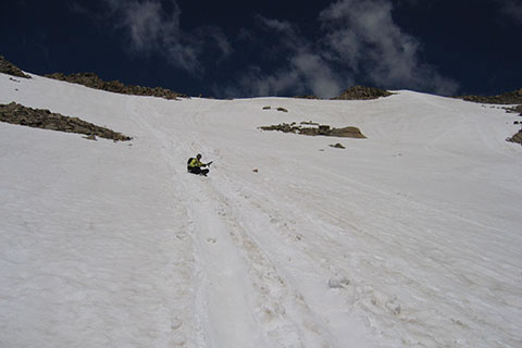
Glissading on Massive
We have glissaded the East Slope to the trail below, but the snow was in really good shape and the line we took had a good run-out at the bottom. On other descents, the snow did not look as good and we had to reverse the ridge.
From the summit it is about 2.5 miles to return to treeline. During the summer, we try to be in the trees before the storms hit, usually early afternoon.
For Mountain Data and Route Guide
go to Page
1
Mount Massive Trail Mileage
0.00 Mount Massive Trailhead
0.75 Last switchback of initial climb
2.25 South Willow Creek
3.00 Willow Creek and Mount Massive Trail Junction
4.25 The Willows
5.25 Flat Rock
6.15 Saddle
6.40 Southwest Slopes Trail Junction
6.70 Summit Mount Massive - 14,421'
Map Link
The link opens in a new window.
Mount Massive Map - pdf