

Laurance S Rockefeller Preserve's other Trails
The trails from the main Laurance S Rockefeller Preserve - Phelps Lake Trails page are the Lake Creek Trail, Phelps Lake Trail, and Woodland Trail. The other trails in the Preserve are the Aspen Ridge Trail, Boulder Ridge Trail, Connector Trail, and the Phelps Lake Trail.
The Trails
All trails start at the LSR Preserve Trailhead. See directions to the trailhead and other information on the Laurance S Rockefeller Preserve and Phelps Lake Trails page.
Aspen Ridge Trail
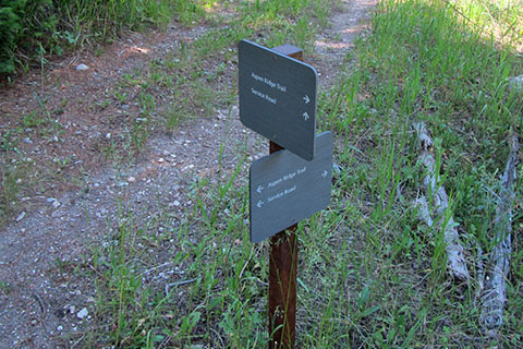
Follow the Lake Creek Trail from the Interpretive Center, cross Moose-Wilson Road and continue 0.10 mile to the junction with the Connector Trail and Aspen Ridge Trail.
The sign indicating the Aspen Ridge Trail is oriented toward hikers coming from the lake.
Turn left and climb as the trail crosses to ridges. At 0.75 mile from the junction the trail reaches a creek.
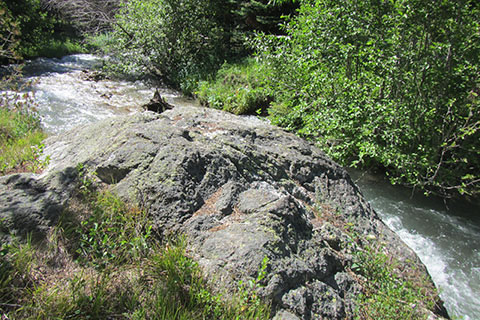
The trail follows the creek upstream for about 0.25 mile. A boulder is passed just before the trail leaves the creek.
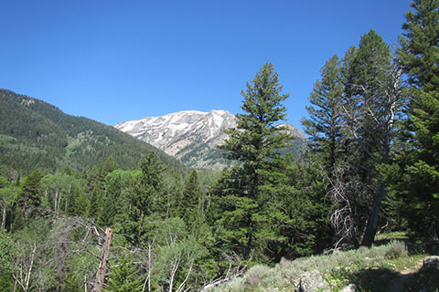
A moderate climb of 250 feet covers the next 0.75 mile. There are good views to the west in the open meadows.
Topping the ridge the trail descends 0.75 mile to a Service Road. The trail turns left (signed) and follows the Service Road for about 0.20 mile where the Aspen Ridge turns left (again) off of the Service Road.
It is a short distance from the Service Road to the Phelps Lake Trail and the end of the Aspen Ridge Trail. The Phelps Lake Trail is joined by the Lake Creek Tr shortly. this is the Phelps Lake view point.
The total distance of the Aspen Ridge Trail is 2.50 miles from the first junction on the Lake Creek Trail.
Phelps Lake Trail from Lake Creek Trail to Woodland Trail
From the Phelps Lake Viewpoint follow the Phelps Lake Trail to the right and signage that directs toward the Woodland Trail.
The short trail section offers plenty of views of Phelps Lake and the mountains.

At 0.15 mile the restroom is to the right.

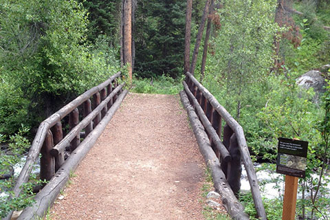
Continuing the trail crosses the outlet of Phelps Lake, Lake Creek. The bridge has benches and many views.

After crossing the bridge it is 0.15 mile to the Woodland Trail.
The total distance of this Phelps Lake Trail section is 0.40 mile.
Note: Continue on the Phelps Lake Trail (do not turn onto the Woodland Trail) for 0.10 mile reach the Boulder Ridge Trail.
Boulder Ridge Trail
From the junction with the Phelps Lake Trail the Boulder Ridge Trail climbs gradually. At 0.10 mile is the grave of David Spalding. Spalding once homesteaded the area and was also known for making an early ascent of Grand Teton with Owen by the Owen-Spalding route.

Continuing the trail climbs a bit then crosses to the east. At 0.50 mile a directional/distance sign is reached. The sign was for a trail that was no longer being used when we walked the trail.
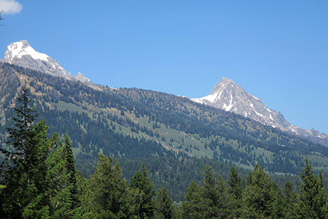
On reaching 0.65 mile is a good view to the north of the mountains. Buck Mountain is dominant.

A short distance beyond the view is another directional/distance sign. It is the other end of the trail that is no longer in use.
The Boulder Ridge Trail then rolls along through forests and fields. In 0.25 mile another directional/distance sign is reached. The sign is at an old road crossing. The Boulder Ridge Trail continues straight.
After another 0.40 mile the trail reaches the junction with the Woodland Trail. Turn left to return to the Interpretive Center or cross the Woodland Trail to complete the LSR Trails by hiking the Connector Trail.
The Boulder Ridge Trail is 1.30 miles.
Connector Trail
From the junction of the Boulder Ridge Trail and the Woodland Trail cross the Woodland Trail and join the Connector Trail. Signs direct hikers toward the Lake Creek Trail and Aspen Ridge Trail.

Bridge over Lake Creek on the Connector
The Connector Trail descends to Lake Creek with a good view of the bridge below.
Though the Connector is scenic, the trail is also important for linking other trails.
The Connector Trail is 0.40 mile.
Note: Turn left on the Lake Creek Trail to return to the Interpretive Center or chose a different loop.