

The Loop - Rocky Mountain National Park
The Trail Guide to the Loop - the North Inlet Trail and Tonahutu Creek Trail includes trail descriptions, photographs of the trails, comments from our hikes, mileage data, custom topo map, and the Loop tracklog on a geo-pdf map. The guide will familiarize you with the North Inlet and Tonahutu Creek Trail systems. We hope the guide helps you on your hikes and adventures.
Route Data
Photos from: July '13, July '14
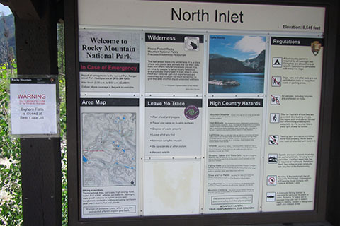
Elevation: North Inlet Trailhead - 8,545', North Inlet Junction - 9,600', Flattop Mtn - 12,324', Tonahutu - Haynach Lake Junction - 10,340'
Range: Rocky Mountain National Park
Map Coordinate System - Geodetic Base (NAD27)
Trailhead - Latitude: 40.25661, Longitude: -105.81413
North Inlet Jct - Lat: 40.281413, Lon: -105.72068
North Inlet - Tonahutu Tr Jct - Lat: 40.30933, -105.69425
(Flattop Mtn)
Tonahutu - Haynach Lake Tr Jct - Lat: 40.281413,
Lon: -105.72068
Route: North Inlet Trail and Tonahutu Creek Trail
Loop Mileage: 26.95
For Map, Trail Mileage, and Trail Notes
go to Page
2
Comments
We hiked the Loop in three days. Day 1: North Inlet Trail to North Inlet Junction area. (We would have liked to have gone to the July site, but it was full.) Day 2: From North Inlet to Flattop Mountain and down the Tonahutu Creek Trail to Haynach Lake (Haynach Lake was our first choice.) Day 3: Down Tonahutu Creek Trail (and a short road section) to finish the Loop.
Note - we actually parked and started at the Kawuneeche Visitor Center rather than the North Inlet Trailhead.
We have completed the guides to North Inlet Trail and Tonahutu Creek Trail. In looking at the climb to the Continental Divide and Flattop Mountain section, we decided to include brief descriptions of the North Inlet and Tonahutu Creek trails, because you can't do one without the other! For full coverage consult the guides to the individual trails.
The Route
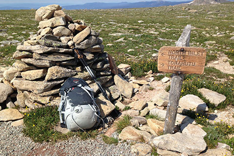
Directions to North Inlet Trailhead: From Highway 34 (Trail Ridge Road) near Grand Lake, Colorado - go east toward the town of Grand Lake on West Portal Road. Stay on West Portal (bear left) and bypass the town. Turn left on Co Rd 663. The turn has a National Park directional sign posted. At the junction - Road 663 goes left uphill to the trailheads, Hancock St goes to the right - downhill to town. Parking for the North Inlet Trailhead is at the end of Rd 663. The location is searchable on Google Maps (terms: North Inlet Trailhead Grand Lake, CO.)
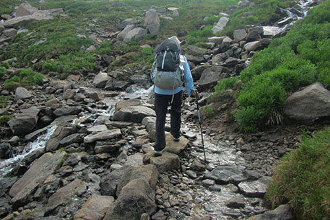
From the North Inlet Trailhead, Grand Lake, CO, take the North Inlet Trail east to Summerland Park.
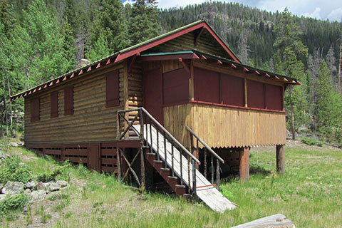
At 1.20 miles from the trailhead reach, Summerland Park and the private cabin.
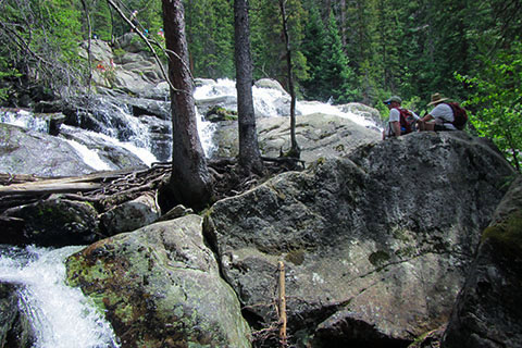
Continuing, Cascade Falls is reached in 2.30 miles, or 3.50 miles from the trailhead.
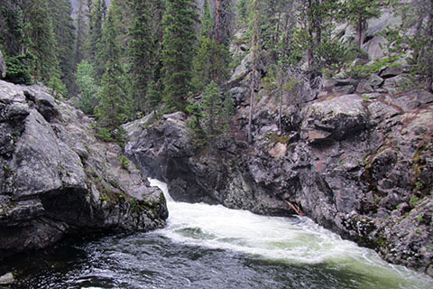
Next, comes Big Pool, located 1.30 from the Cascades or 4.80 miles from the trailhead
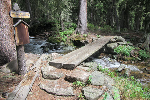
Reach the signed Ptarmigan Creek Bridge at 1.95 from Big Pool or 6.75 miles from the trailhead.
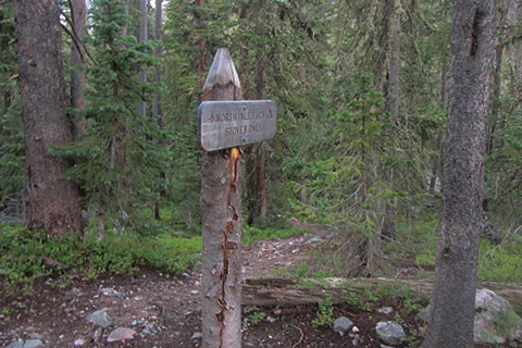
North Inlet Junction is .75 mile from the signed Ptarmigan Creek and 7.50 miles from the trailhead.
From North Inlet Junction, continue on the North Inlet Trail.
A short distance beyond the junction the trail reaches the North Inlet Junction Campsite. In just over a quarter of a mile the trail reaches Hallett Creek at the first switchback. The climb begins.
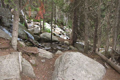
Hallett Creek is a great spot for water (needs to be treated as normal.) Several of the switchbacks make good rest stops. The photo is from the third Hallett switchback (fifth if you count both ends of the sets.)
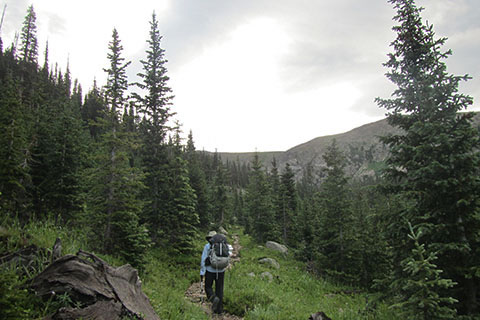
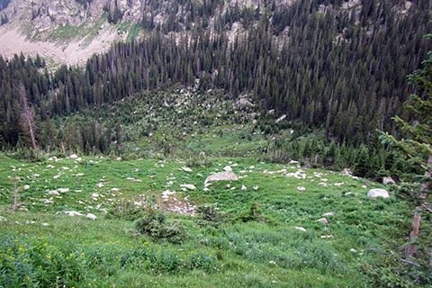
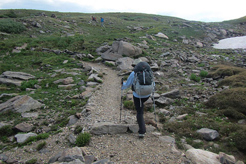
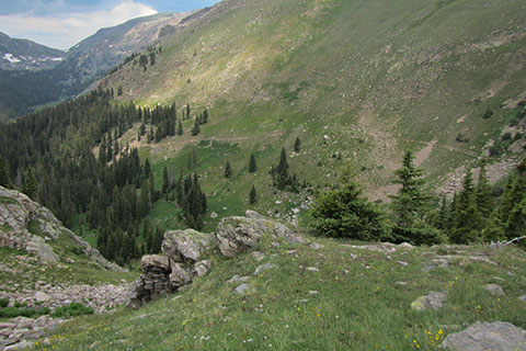
After ten switchbacks (5 sets) the trail traverses higher in the valley. The views improve through the thinning trees.
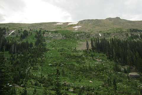
Nearing the upper reaches of the valley, is a good view to the Upper Slopes on the other side of the valley.
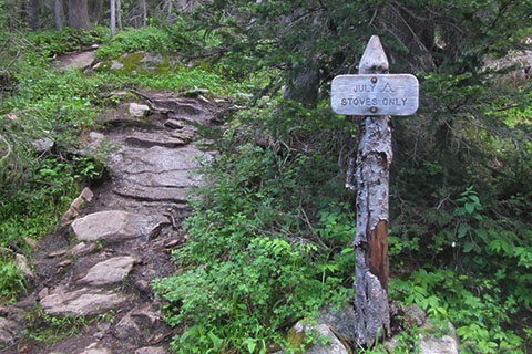
The trail passes the "Mountains Don't Care" sign and then the July group and regular campsites at 1.75 miles from the North Inlet Junction. July is the uppermost campsite on the North Inlet Trail. The campsite is well positioned for the climb to Flattop, but it makes a hard one day hike from North Inlet Trailhead.
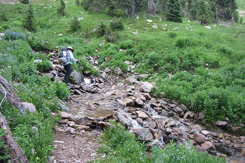
Cross Hallett Creek on a footbridge and move up the slope. Two more drainages cross the trail. These crossings do not have bridges.
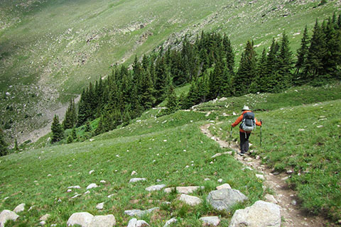
There are seven switchbacks that climb 850 feet in a mile distance. The views help ease the climb. The above photo is the view down the same avalanche chute that was seen from below in an earlier photo.
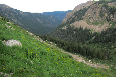
The view down the North Inlet drainage from the switchbacks.
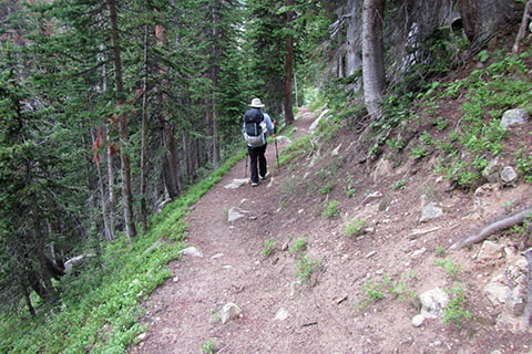
At one mile above Hallett Creek the trail reaches the top of the switchbacks. The trail begins to traverse the slopes toward Flattop and soon crosses the last drainage again.
The trail continues to traverse as it crosses wet drainages and climbs through short sets of switchbacks.
One mile from the top of the seven long switchbacks the trail crosses beneath the southwestern slope of Hallett Peak. The southwest slope of Hallett is two miles from the July backcountry sites and 3.75 miles from North Inlet Junction.
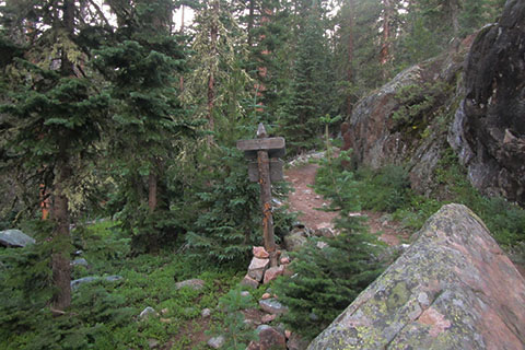
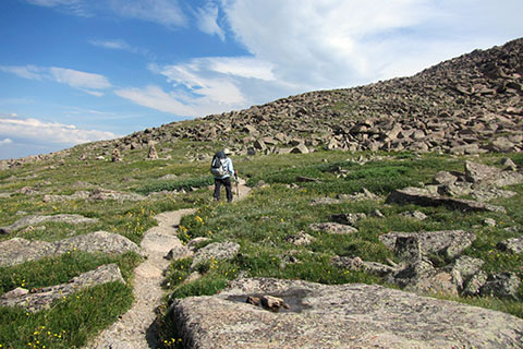
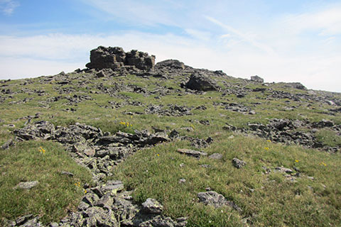
The trail continues to climb passing through cairns until it rounds the shoulder of Hallett Peak.

Approaching Flattop Mountain Junction, the trail flattens out.
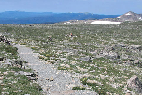
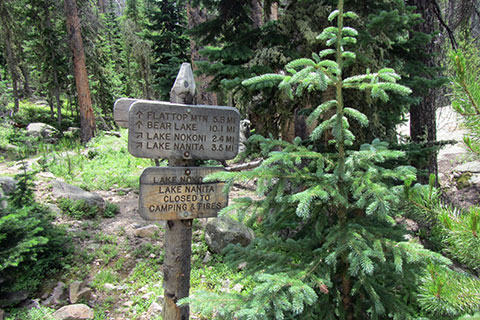
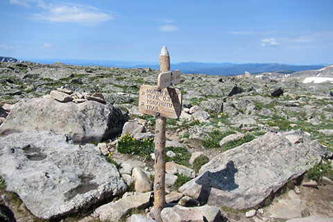
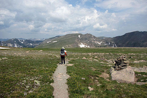
3.25 miles from the July campsites, 5.00 miles from North Inlet Junction, and 12.50 miles from the North Inlet Trailhead, the North Inlet Trail reaches the junction with the Tonahutu Creek Trail and the Flattop Mountain Trail. In the above photo, the hiker (in an orange jacket) is at the junction and the photo is taken from the Flattop Mountain Trail.
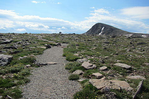
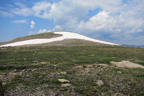
The .30 mile Flattop Mountain Trail crosses mostly flat terrain as it reaches near the top of Flattop. In the background Hallett Peak is a more fun climb. The West Slopes of Hallett is a short side trip to adventure, if the skies are clear.
At the junction, which most call the summit of Flattop, it is only 4.40 miles to the Bear Lake Trailhead.
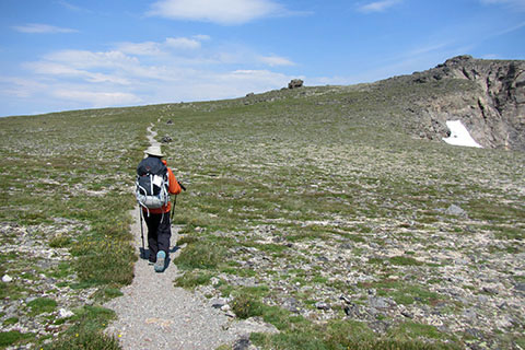
Continuing from the North Inlet, Tonahutu Creek, Flattop Mountain Trails Junction, the trail climb a bit more as it approaches Ptarmigan Point.
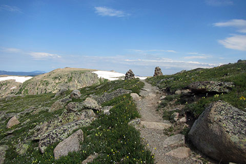
Cresting the shoulder near the rock outcroppings of Ptarmigan Point, the descent begins.
The trail descends marshy (during the snow melt) grasses as it traverses to the knob, Peak 12,277'. The peak is to the left of the trail.
The Tonahutu Creek Trail crosses the flats of a saddle between Peak 12,277' (left) and a rim of mountains to the east (including Notchtop Mountain and Knobtop Mountain.) The saddle is 1.45 miles from the North Inlet - Tonahutu Creek Junction.
The trail. situated on the western edge of Big Horn Flats, begins dropping steadily. At 11,640' the trail passes an old sign. The sign has been damaged, but marks, (possibly) Wonderland Lake. The trail continues to descend toward the rim of the slopes of Tonahutu Valley.
At 11,300' the trail reaches a rock outcropping. From this point the trail is visible across the drainage. This point is 1.50 miles from the saddle and 2.95 miles from the North Inlet and Tonahutu Creek Trail Junction. The combinations of trails in the alpine tundra is 5.20 miles (at least!)
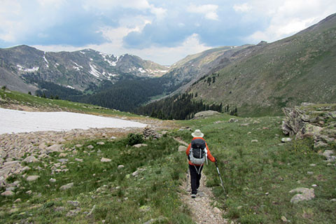
The trail descends sharply. Crossing drainages and going in and out of tree stands.
The trail reaches treeline at about 11,000' elevation and continues to traverse toward Tonahutu Creek.
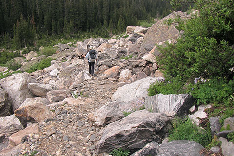
A large boulderfield is crossed just before reaching the creek.
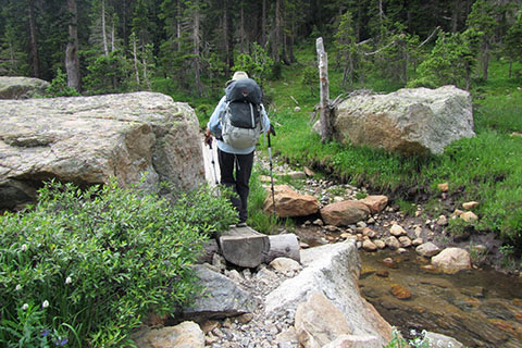
Finding passage through the boulders Tonahutu Creek is passed on a footbridge.
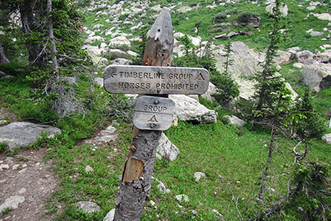
Downstream a short distance, the trail reaches the Timberline Group Campsite. The campsite is located 1.05 miles from the start of the descent into the drainage at 11,300' elevation. It's 4.00 miles from the North Inlet - Tonahutu Creek Junction and 9.40 miles (or 10.00 miles if you go to the summit of Flattop.) from North Inlet Junction to Timberline Campsite.
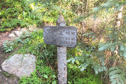
Pass Renegade Campsite and then reach the junction with the Haynach Lake Trail after .40 mile.
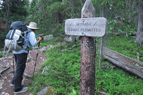
Haynach Lake Trail is at the end of this section. Haynach Lake Trail is 17.50 miles from the North Inlet Trailhead and 10.00 miles from North Inlet Junction (including the side trail to Flattop Mountain. It is 1.50 miles to Haynach Lake.

Granite Falls is reached in 1.75 miles from Haynach Lake Trail Junction.
In 2.75 miles Tonahutu Creek Trail reaches Onahu Creek Trail Junction. The junction is 4.50 miles from Haynach Lake Trail.
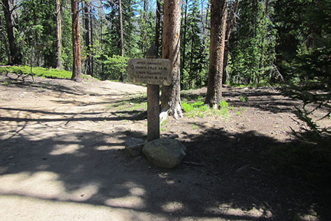
Pass Big Meadow and at .60 mile the Tonahutu Creek Trail reaches Green Mountain Trail Junction. It is 1.80 miles to Green Mountain Trailhead. The junction is 5.10 miles from Haynach Lake Trail.
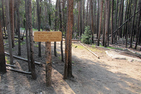
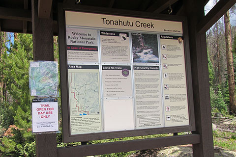
The trail continues to follow Tonahutu Creek on an easy downhill grade. In 3.40 miles the trail reaches the Kawuneeche Visitor Center Spur Trail. It is .65 mile to the Visitor Center. The junction is 8.50 miles from Haynach Lake Trail.
Tonahutu Trailhead is reached in .85 mile. The trailhead is 9.35 miles from Haynach Lake Trail.
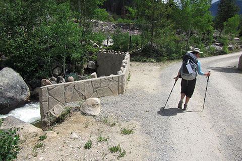
Once at the Tonahutu Trailhead turn left on the gravel road (Road 663) and follow the road for less than .10 mile to the North Inlet Trailhead.
North Inlet Trailhead is 9.45 miles from Haynach Lake Trail.
The distance of the Loop is 26.95 miles.