

Keyhole Route, Longs Peak - Rocky Mountain National Park
The Adventure Guide to the East Longs Peak Trail and Keyhole Route includes a trail description, photographs of the trails, comments from our hikes, mileage data, the Longs Peak topo map, and East Longs Peak Trail and Keyhole Route GPS tracklogs. The guide will familiarize you with the mountain and help you on your climb.
Mountain Data
Photos from: 2005, 2006, 2007, 2010, 2011, & 2012
Elevations - Trailhead: 9,400', Summit: 14,255'
Range: Rocky Mountain National Park, Colorado Front Range
Trailhead Latitude: 40.27200, Longitude: -105.55645
Route: East Longs Peak Trail, Keyhole Route
One-Way Mileage: 7.3, from trailhead to summit
For Map, Trail Mileage, GPS, and Trail Notes go to Page 2
Comments
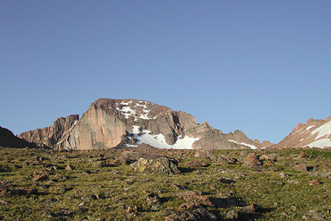
The Keyhole Route is one of the best scrambling routes on any of the Colorado 14,000' peaks. From the end of the East Longs Peak Trail in the Boulderfield, the Keyhole Route begins. The Keyhole Route is not a trail. In ascending the Keyhole Route the climber will be exposed to height and could be exposed to many other dangers including: cold, wind, snow, avalanches, ice, icy rocks, hail, sleet, lightning, rain, slick rocks (even when dry), loose rocks, falling rocks, scrambling, difficult rock climbing (relative), route finding, down climbing rock, and acclimating (a long list and we probably omitted a few). The Keyhole Route is a great experience and adventure for seasoned mountaineers.
The Climb
Directions to the Trailhead: From the town of Estes Park, Colorado, take Hwy 36 east toward Boulder. From the 34/36 jct, it is about a third of a mile to Hwy 7 (South Saint Vrain Ave) on the right. Travel a little less than 9 miles on Hwy 7 to Longs Peak Road, turn right (the turn is signed). Longs Peak Road climbs for about a mile to the parking area at 9400 feet. The parking area does fill. The Park enforces parking restrictions. Parking is allowed along sections of Longs Peak Road.
It is advisable to visit the area the day before the climb to check on conditions and gain other advice from the knowledgeable Park Staff.
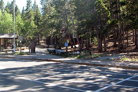
From the Ranger Station - Trailhead - take a few seconds to read the information on the kiosk before heading up the trail. The Ranger Station is not open in the wee hours of the morning. The elevation at the building is 9,405'. Restrooms and water are nearby.
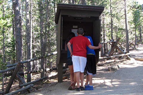
Up the trail a short distance is a log book. The register provides important and current information on the route. It is helpful to read the comments of others who have climbed the route.
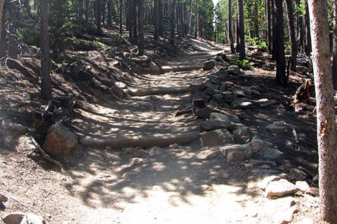
The trail is well maintained and easy to follow. Signs are at each junction and blazes are not used. Beware, the trail is steeper than it seems.
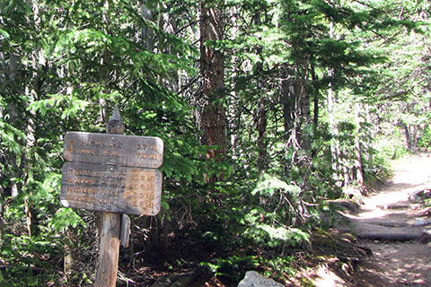
At .50 miles the trail reaches the Eugenia Mine Trail Junction. The East Longs Peak trail continues straight.
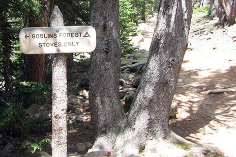
Soon after the Eugenia Mine Junction the trail switchbacks and then climbs steadily as it crosses to another switchback next to Alpine Brook. The brook is .95 mile from the trailhead. From Alpine Brook the trail crosses the slope again to another switchback and junctions with the Goblins Forest Backcountry Campsites at 1.20 miles from the trailhead.
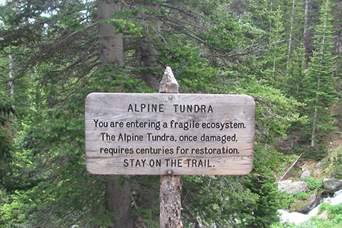
Leaving Goblins Forest the trail climbs easily for about .40 mile to a log bridge crossing of Larkspur Creek (in low water, the bridge is not necessary). The trail then begins a series of four switchback. Exiting the forest the trail passes a sign concerning the fragile alpine tundra.
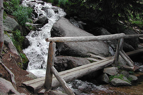
In a short distance the trail crosses Alpine Brook. The elevation is 10,690 feet and the bridge is a bit over two miles from the trailhead. Many hikers seem to take a break at this spot.
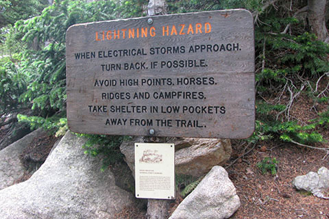
On the south side of the bridge is the Lightning Hazard sign, warning of the lightning danger while traveling in the mountains. Heed the signs advice!
The trail leaves the creek. In a short distance the trail reaches the first view of the lights of the Front Range suburbs. A switchback is .25 mile from the bridge.
After changing direction the trail crosses back across the slope. The climb is not steep, but there are a few big steps. At 2.5 miles from the trailhead is the junction with the Jims Grove Trail. The creek, Alpine Brook, is close by.
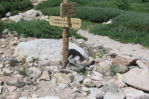
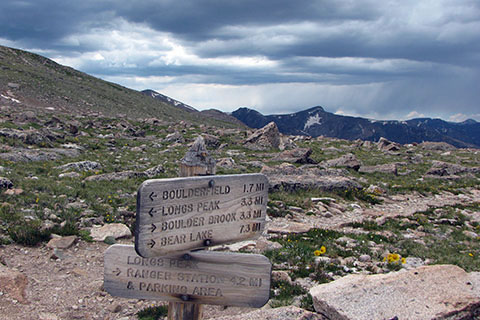
From the junction, the lights from hikers who started really early can be seen crossing under Mount Lady Washington. The next goal is reaching the crest of Mills Moraine and the Chasm Lake Trail Junction. In .80 mile of steady climbing from Jims Grove the junction is reached. The junction is 3.3 miles from the trailhead and 4.0 miles to the summit. The elevation is 11,540'.
The junction is a popular rest stop. A privy is located in the area. Make sure you follow the sign to Longs Peak summit or to the Boulderfield. The other trail goes to Chasm Lake, a good side trip but it is not part of the Keyhole Route.
The trail makes a mile long traverse from Chasm Lake Junction to Granite Pass.
Granite Pass is the junction of the East Longs Peak Trail and the North Longs Peak Trail. The elevations is 12,080'. It can be very windy in the pass.
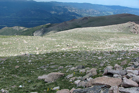
From Granite Pass it is 1.5 miles to the Boulderfield. The trail makes very long switchbacks up the moderate slope.
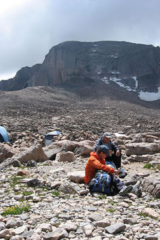
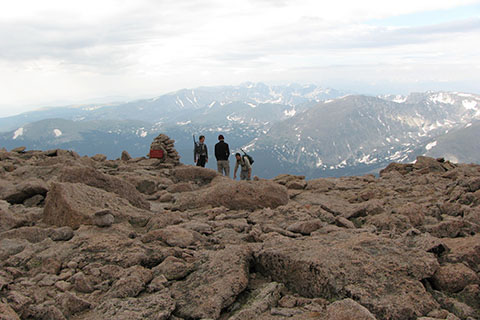
The East Longs Peak Trail ends just beyond the Boulderfield camp sites and the Keyhole route begins. Reservations are required for the overnight camp sites. A creek runs through the area, draining the snowfields on the north face of Longs. Water should be treated or filtered. Privies are located to the north of the camping area. The Boulderfield is 5.8 miles from the trailhead and the elevation is 12,660'.
Continuing, follow the trail until it ends and then begin the hunting cairn game. There are many cairns that go in different directions. No route through the Bouldfield is more correct than any other. Just aim for the hole!
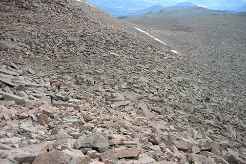
Be careful crossing the sea of boulders. Many of even the largest rocks and almost all of the smaller rocks are unstable. For many hikers, the Boulderfield is the hardest part of the route.
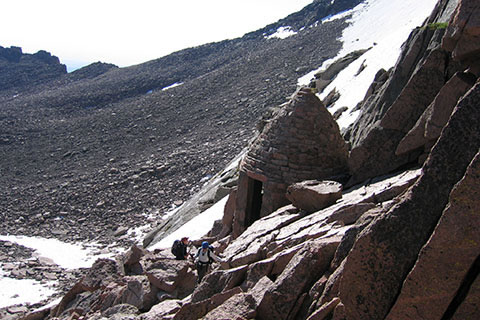
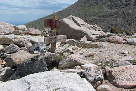
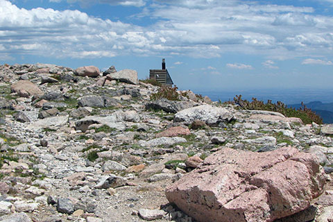
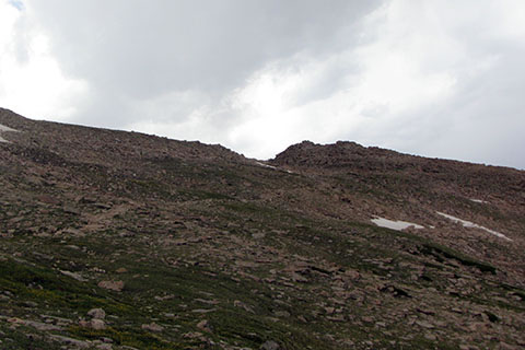
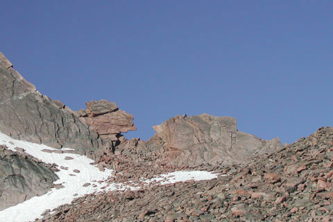
Nearing the Keyhole the Agnes Vaille Shelter is located just below the gap. The Keyhole is .60 mile from the Boulderfield and less than a mile from the summit. The elevation is 13,150'. The wind blows hard through the Keyhole.
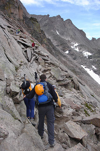
On the other side of the Keyhole is the Glacier Basin drainage a couple of thousand feet below. The route follows red bullseyes painted on the rock. This section of the route is called the Ledges.
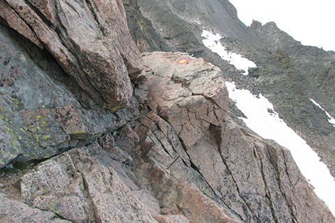
The first obstacle on the Ledges is the bar dihedral (there are a couple of bent metal bars in the slab). The rock on the slab has been worn smooth so be cautious!
Just beyond the bar dihedral is the V slab. Once again it is very slick. Going down it is like a sliding board and well, for that matter, going up is like climbing a sliding board.
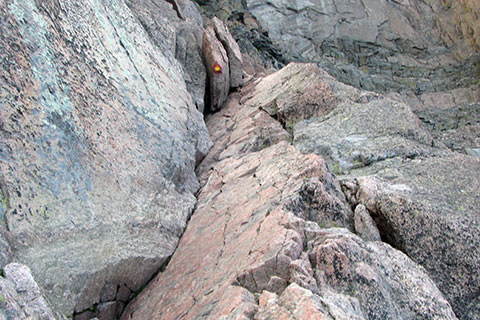
The Keyhole is an obvious landmark from the Boulderfield, but when returning across the Ledges to the Boulderfield, some hikers mistake another gap, the False Keyhole, as being the route. A sign helps to direct the returning hikers away from the False Keyhole and towards the Keyhole. The route leaves the V slab, climbs up to the sign and then descends around a corner.
Looking back across the Ledges.
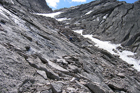
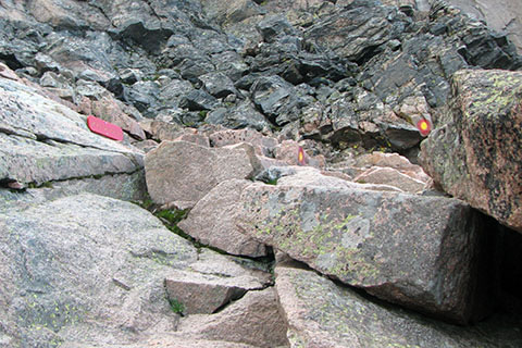
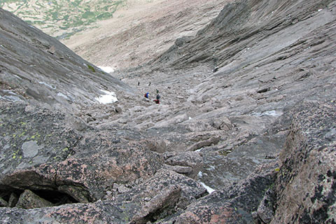
After .30 mile, the route finally reaches the Trough. The Trough is basically a scree gully. Loose rock is everywhere. It takes an experienced mountaineer to climb the gully without disturbing the rocks. Practice. Avoid climbing under other climbers. Entering the Trough the elevation is 13,300'. The Ledges traverse only gained 150'.
Looking down the Trough. The bullseyes are mostly close to the center of the trough, but to avoid climbing under others, it is sometimes necessary to move to the left side a bit.
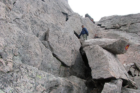
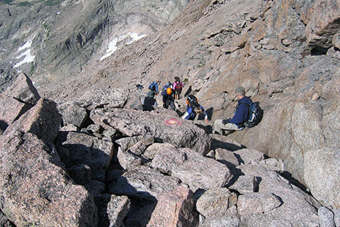
At the top of the Trough, easy passage is blocked by a short broken wall.

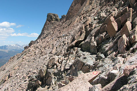
Climb over the block to the top of the Trough and a great resting spot. The Trough is about .35 mile - depending on the route taken. The elevation is 13,850' and the top is about a quarter of a mile away.
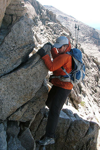
The next section of the route is the famous Narrows. The climber is returning, but the move is about the same in either direction. Passage behind the bulge is also possible and less airy.
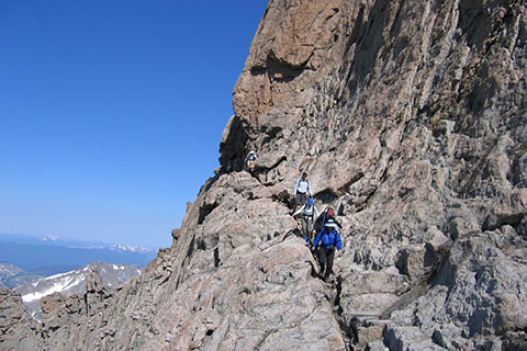
Climbers moving carefully along the Narrows.

After angling down with a traverse, the climbing returns. A block must be passed then the climbing eases as the route traverses into the Homestretch.
At the end of the Narrows and the beginning of the Homestretch is another directional sign. The Narrows were a couple of hundred meters long, but not without excitement. The elevation is 13,980'.
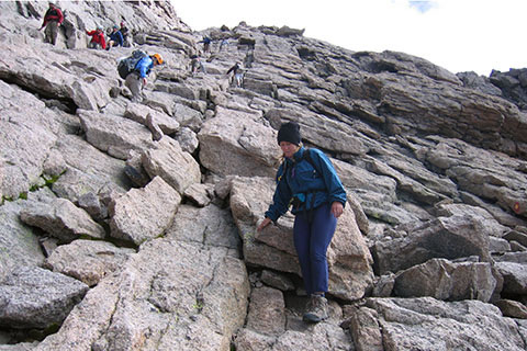
The Homestretch is the last section of the route. Some folks think it is the hardest while others think it is the most fun. The easiest line is on the left, though many options are available.
Looking down from the top of the Homestretch, there are usually several lines moving up and down on busy days.
The Homestretch climbs 275' in elevation. The summit of Longs is massive.
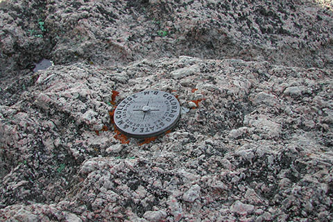
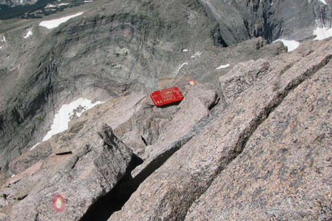
The benchmark and register are across the summit. Congratulations, but remember the summit is only halfway.
The total distance is 7.3 miles with an elevation gain of 4850'.