

Jenny Lake Trail - Grand Teton
National Park
The Adventure Guide to the Jenny Lake Trail (Grand Teton National Park) includes trail descriptions, photographs of the trail, comments from our hikes, mileage data, custom topo map, and the Jenny Lake Trail tracklog on a geo-pdf map. The guide will familiarize you with the Jenny Lake Trails system and the area. We hope the guide helps you on your hike.
Route Data
Photos from: July 2003, 2004, 2010, 2012, 2013, 2014
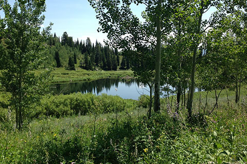
Elevation of Jenny Lake: 6,798'
Range: Grand Teton National Park
Map Coordinate System - Geodetic Base (NAD27)
Latitude: 43.75166, Longitude: -110.72461
Route: Jenny Lake Trail
Loop Mileage: 7.10, with no side trips
For Map, Trail Mileage, GPS, and Trail Notes go to Page 2
Comments
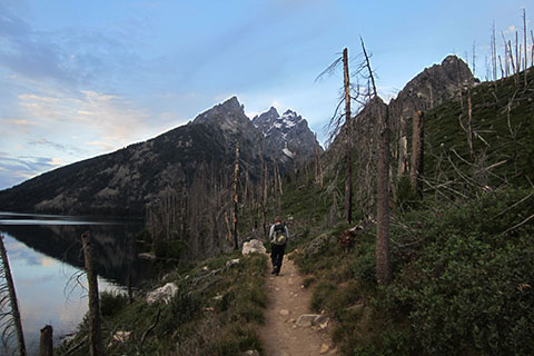
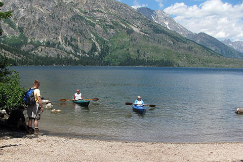
Almost every visitor to the Tetons stops at Jenny Lake and many hike sections of the Jenny Lake Trail. The two miles to the Cascade Canyon Trail (leads to Hidden Falls and Inspiration Point), is well trodden. For us, it has become almost a ritual to take a loop around the Lake when we first arrive in the Park. We enjoy the hike each and every time and the views still leave us in awe.
The Guide
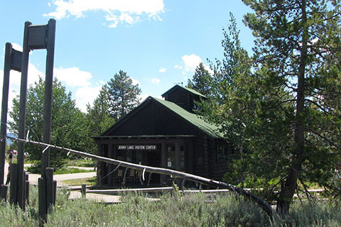
Directions: Jenny Lake Trail is in Grand Teton National Park, Moose, Wyoming. From the fee-entrance station in Moose, WY - head north on the Teton Park Road. It is 6.80 miles to South Jenny Lake Entrance. The area has a Ranger Station, store, Visitor Center, restrooms, boat shuttle (for pay), campground, picnic tables, and trailhead. Parking is limited.
Though the parking area is large, it is still limited and fills by late morning. Paved paths and signs lead to the trailhead and boat shuttle - they are close to each other.

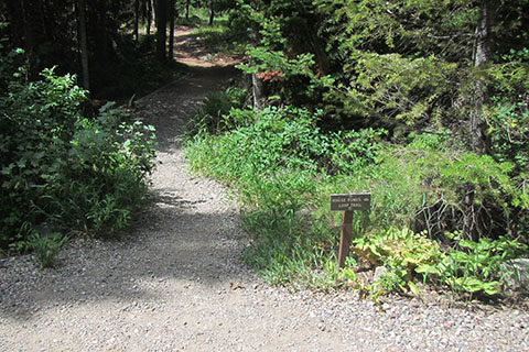
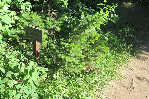
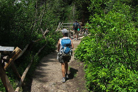
Current trail information is available from the Visitor Center, Ranger Station, and the trailhead kiosk.
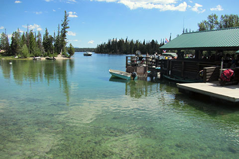
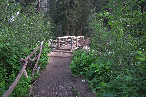
Starting from the trailhead kiosk, going clockwise (the guide is given clockwise, but either direction works) cross Cottonwood Creek on a good bridge. The boat shuttle's dock is attached to the bridge.
From the bridge the trail passes Reimer's Cabin and the parking for the shuttle boat employees. At 0.25 mile from the trailhead, the road passes the boat launch. The launch (and parking) is accessible from the Lupine Meadow Road.
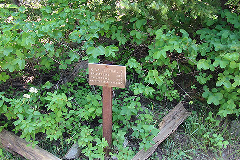
The Jenny Lake Trail joins the Valley Trail at about 0.65 mile from the trailhead. Valley Trail is the actual name of the trail on the west side of Jenny Lake, though I have never heard anyone call the path anything other than the Jenny Lake Trail.
After 0.15 mile from the Valley Trail Jct (.80 from the trailhead), the trail reaches the Moose Pond Trail.
Moose Pond Trail is a good route for those wanting a short hike close to the trailhead. The Moose Pond Trail ends at Lupine Meadow Road and the Valley Trail. Return to the Jenny Lake Trail via the Valley Trail.
At 0.95 mile from the trailhead, the trail reaches the junction with the horse bypass trail. The Hidden Falls Horse Trail climbs above the Jenny Lake Trail. The Horse Trail junctions the Cascade Canyon Trail near Hidden Falls in 1.30 miles. The Horse Trail may be used as an alternate path.
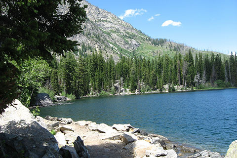
The Jenny Lake Trail climbs over a shoulder and then descends to the lake shore.
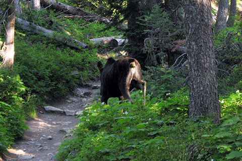
We followed a young moose for a half of a mile along the lake and then as the trail climbed to the junction with the Cascade Canyon Trail, he moseyed along and stepped away from the trail.
At 1.15 miles from the Horse Bypass Trail (1.30 miles from the Moose Ponds Junction), the trail reaches the beginning of the Cascade Canyon Trail. The trail is 2.10 miles from the trailhead.
There are two trails that parallel Cascade Creek, one on each side. Both trails are marked with signs that lead toward Hidden Falls. The trails join near the end of the Horse Bypass Trail.
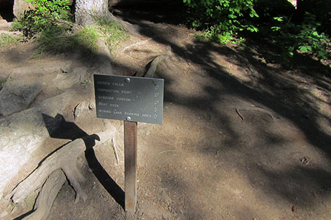
To make the side trip to Hidden Falls and Inspiration Point ...
To continue on the Jenny Lake Trail follow signs toward String Lake. Soon the trail crosses Cascade Creek on a good bridge. On the north bank of the creek, the 2nd trail that leads to Hidden Falls, junctions with the Jenny Lake Trail. (In 2014 the trail was under construction.)
The trail also makes another junction near this point, to continue on the Jenny Lake Trail and bypass the boat dock, follow the String Lake directional signs. It is 0.20 mile to the next junction - the other end of the side trail to the Boat Dock. The junction is 0.30 mile from the Cascade Canyon Trail Junction (south of the creek) and 2.40 miles from the trailhead.
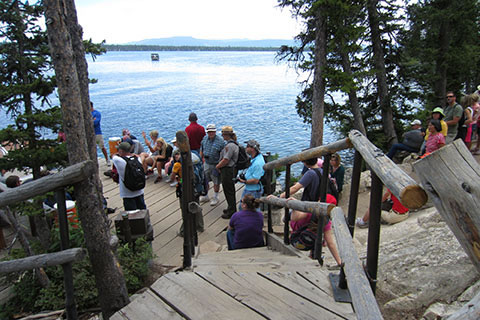
Note: To reach the West Boat Dock follow the right trail (and signs.) The side trail to the Boat Dock descends 0.15 mile to the lake shore. Cue lines of passengers waiting on a return trip line the trail. One way passage is available (if the boats are operating) to return to the Jenny Lake Picnic Area. The trail continues for 0.05 mile to rejoin the Jenny Lake Trail.
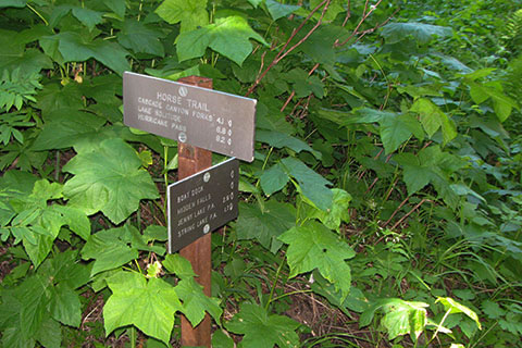
Following the Jenny Lake Trail the route reaches another horse trail in 0.15 mile. This horse trail joins the Cascade Canyon Trail 0.30 mile and bypasses Inspiration Point. The horse trail also provides the closest access to Baxter Pinnacle and Symmetry Couloir.
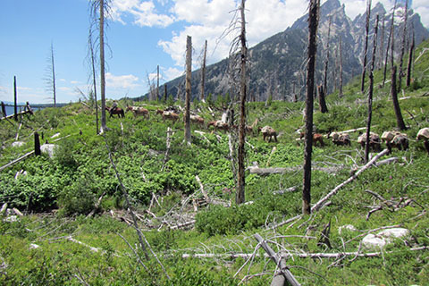
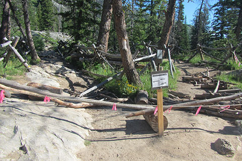
The trail crosses several creeks and then begins a climb to a shoulder. As the trail climbs it enters the area burned by the 1999 Alder Fire. The trail is also used by horses (and mule trains supporting trail crews.)
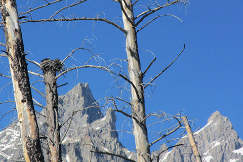
An Osprey has nested above the trail since the burn.
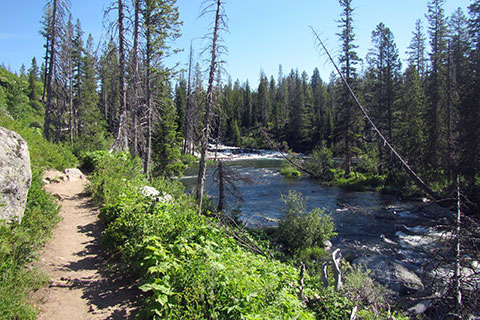
1.0 mile from the horse trail the Jenny Lake Trail reaches the String Lake outlet stream. At this point the trail leaves the lave and follows the outlet stream.
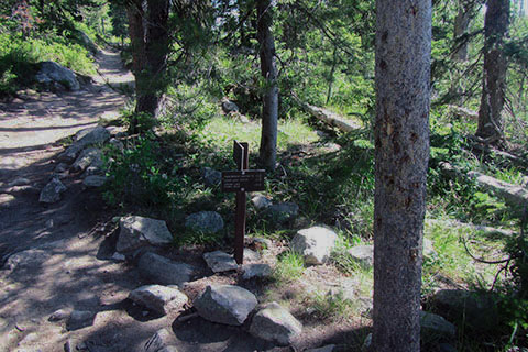
At 0.25 mile the Jenny Lake Trail reaches the junction with the String Lake Loop Trail. To the left 1.30 miles is the junction with the Holly Lake Trail. And, to the right is Jenny Lake Trail.
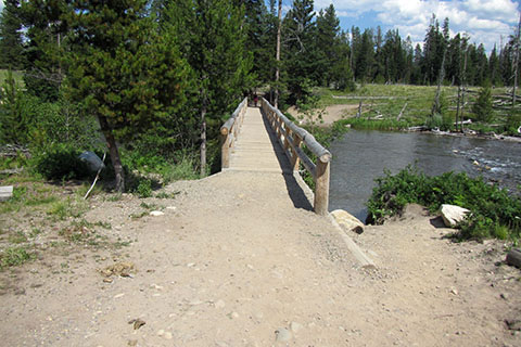
The Jenny Lake trail comes to a good bridge crossing the outlet stream. The trail is seen continuing to the right on the other bank.
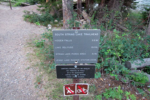
Across the bridge is the South String Lake Trailhead. To the left is the trailhead parking and continuing on the String Lake Trail, the picnic area. There are no facilities at the trailhead. The String Lake Trailhead is 1.95 miles from Cascade Canyon Trail and 4.05 miles from Jenny Lake Trailhead.
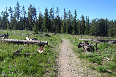
Once across the bridge the Jenny Lake Trail goes to the right (or south) and crosses an open area (the area was also burned in the Alder Fire.)
The trail follows near the outlet stream as it travels south to the shores of Jenny Lake. It is 0.55 mile to return to the lake.
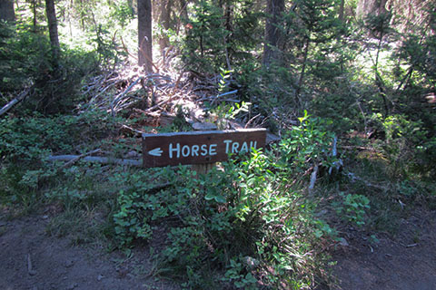
The northeast section of the Jenny Lake Trail sees heavy horse use. A popular stable is located nearby at Jenny Lake Lodge. 1.60 miles from the String Lake Trailhead the Jenny Lake Trail reaches a junction with a horse trail.
0.15 mile from the horse trail junction is the Jenny Lake Overlook accessible from the one-way Jenny Lake Loop Road.
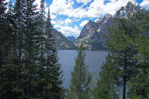
The popular overlook gives great views of Inspiration Point, Cascade Canyon, the Cathedral Peaks, and naturally, Jenny Lake. The viewpoint is 1.75 miles from String Lake Trailhead.
Beyond the Overlook the trail at times follows very close to the Jenny Lake Loop Road.
In a little over 0.50 mile the road curves away from the trail. The Old Jenny Lake Road (non-motorized) begins at the curve and continues between the Jenny Lake Trail and the Jenny Lake Campground to Jenny Lake Picnic Area.
The Jenny Lake Trail follows near the lake for .60 mile when it reaches paved paths near the Jenny Lake Trailhead. Just prior to reaching the paved paths, the trail rolls along on the ridge in steep fashion. The paved path is 1.10 mile from the Overlook and 2.85 mile from String Lake Trailhead.
It is still 0.20 mile to return to the trailhead for those who want to complete every step of the Loop, but directional signs on the paved paths lead to the Visitor Center, store, restroom, and parking.
The total distance for the Jenny Lake Trail is 7.10 miles.
Hidden Falls and Inspiration Point
From the junction with the Cascade Canyon Trail from the Jenny Lake Trail, follow the signs and climb steadily 0.25 mile to the junction where the two trails to Cascade Canyon and Hidden Falls merge.
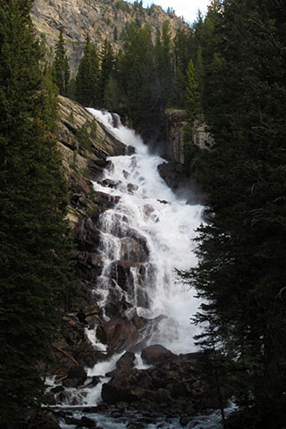
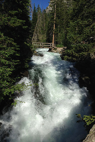
Spectacular Hidden Falls is just beyond the junction. A side trail leads to viewing area.
The trail leaves Hidden Falls and crosses Cascade Creek before it begins to climb.
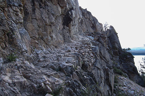
A steep trail has been cut out of the rock cliffs for access to Inspiration Point. The trail is rocky and climbs about 300 feet in elevation from the bridge.

Inspiration Point is reached in .70 mile from the Jenny Lake Trail. By taking the side trip to Inspiration Point, 1.40 miles (round trip) would be added to the total of the Jenny Lake Trail.
From the West Shuttle Boat Dock it is 1.00 mile to Inspiration Point.