

Amphitheater Lake Trail - Grand Tetons
The Adventure Guide to Amphitheater Lake Trail includes a trail description, photographs of the trails, comments from our hikes, mileage data for the Amphitheater Lake Trail, the Amphitheater Lake Trail topo map, and Amphitheater Lake Trail GPS tracklogs. The guide will familiarize you with the mountain and help you on your climb.
Date of Hike: 19JUL12 (most recent)
Range: Grand Teton National Park
Address: Grand Teton National Park, Moose, WY 83012-0170, for Park Information: (307) 739-3300
Lupine Meadows Trailhead Elevation: 6,732'
Trailhead's Latitude: 43.73470, Longitude: -110.74072
Amphitheater Lake Elevation: 9,698'
Lake's Latitude: 43.72922, Longitude: -110.77910
Route: Amphitheater Lake Trail - Disappointment Peak
One-Way Mileage: 4.8, from Lupine Meadows Trailhead to Amphitheater Lake
For Map, Trail Mileage, GPS, and Trail Notes go to Page 2
Comments
We have visited Surprise and Amphitheater Lakes many times. The trail is not overly steep and always interesting. The views from Amphitheater Lake are hard to beat.
The Climb
Directions: From the Grand Teton Visitor's Center - head north on the Park Rd for about 6.5 miles. Turn left at the Lupine Meadows sign. Stay straight on the dirt/gravel road as it heads west and then south to the trailhead at about 1.5 miles from the Park Road. The parking area is large, but it is often crowded. The Park tickets cars parked on the grass outside of the parking area. Restrooms are located at the trailhead, but there is no water.
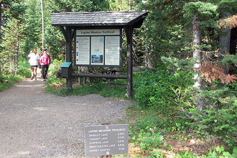
From Lupine Meadows, the Trail begins at the south end of the parking area. Follow the signs to Amphitheater Lake. The trails don't really seem to have names other than their destinations. See more - Notes on Page 2.
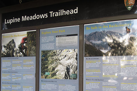
A new kiosk shows maps and information. Be sure to read the kiosk before continuing.
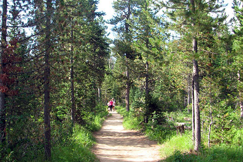
Leaving the trailhead, the trail is almost level as it heads south across the edge of a meadow. After .35 miles the trail turns west and begins to climb.
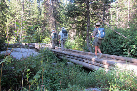
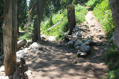
At .60 miles from the trailhead, the trail crosses Glacier Gulch creek on a good bridge.
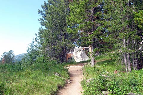
The trail continues mostly south for the next .50 miles when it climbs moderately to a ridge. Burnt Wagon Gulch is to the south of the trail and Glacier Gulch is to the north. There are a few locations that deserve a photo.
The ridge is followed for .60 miles to the Valley Trail Junction. The junction is 1.70 miles from the trailhead and is a popular rest stop. The Valley trail continues to the south to Lake Bradley. Continue straight following the signs to Amphitheater Lake.
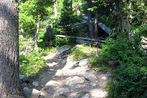
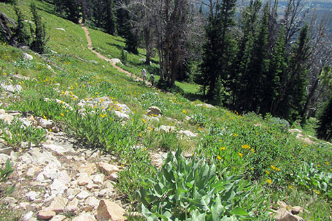
Leaving the junction, the trail begins to climb more steadily. The slope never goes beyond a moderate grade, but the long exposed terrain can be demoralizing. The trail makes 4 long switchbacks and then 1 short one. The sections are .35 miles, .25 miles, .30 miles, .30 miles, and finally .10 miles.
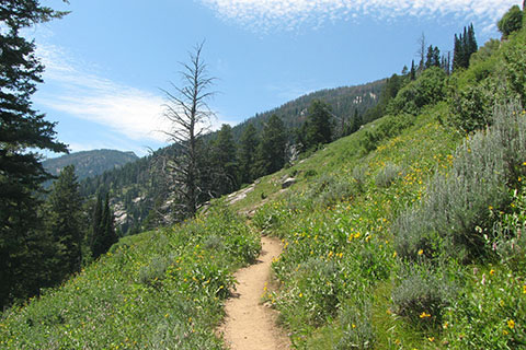
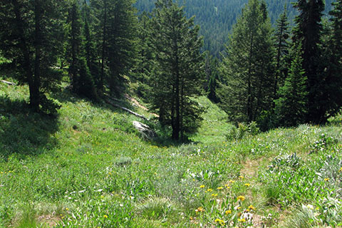
The views are grand as the trail criss-crosses the open slope.
At 3.0 miles from the trailhead and 1.3 miles from the Valley Trail Junction, the trail reaches the Garnet Canyon Junction. The junction is at 8400 feet elevation - a climb of 1700 feet! The Amphitheater Lake Trail continues straight.
Above Garnet Canyon Junction, the trail continues through long switchbacks. The lengths to the first three legs are .20 miles, .35 miles, and .30 miles leading to the 3rd switchback.
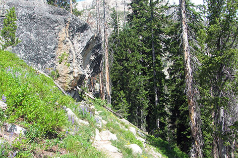
At the third switchback, a large boulder sits outside the trail. It is .85 miles from the Garnet Trail Junction and 3.85 miles from the trailhead.
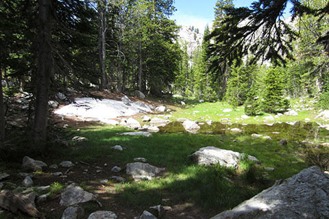
From the third switchback, the trail switchbacks ten more times before Surprise Lake. As the trail nears the top of the climb, a small pond from snow melt is on the right side of the trail.
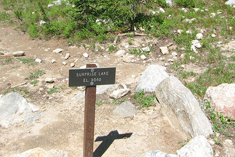
.75 miles from the 3rd switchback and 4.60 miles from the trailhead the trail junctions with a short side trail to Surprise Lake.
Surprise Lake is a must see side trip!
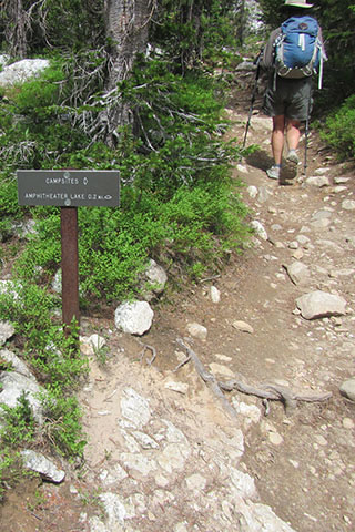
Returning to the main trail, a sign indicating campsites is passed. Three campsites are located to the east of Surprise Lake. Campers need permits for the sites.
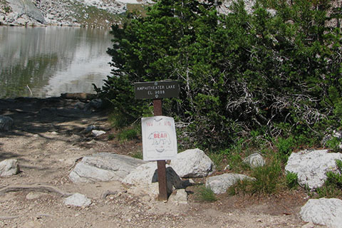
The trail reaches Amphitheater Lake in .20 miles from Surprise Lake.
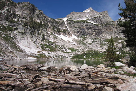
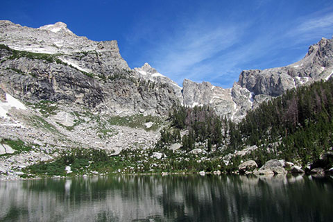
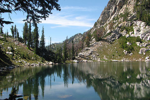
Amphitheater Lake is on the slopes of Disappointment Peak. Early mountaineers thought the slopes leading to Amphitheater Lake would continue to the summit of Grand Teton. When they reached 11,618 feet they were disappointed to find that the ridge ended at the summit of now named Disappointment Peak. A chasm lay between the south-east slopes of the Grand and their position.

Good views of Mount Teewinot are seen to the north.
Amphitheater Lake is 4.8 miles and 2,966 feet in elevation gain.