Walk 100 Miles with the Mayor
Nashville (and Area) Trails
Nashville offers an amazing array of trails. Most of the trails are very popular on good weather days.
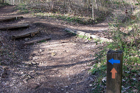
While hiking the trails, remember that your safety (and the safety of your group) is your responsibility. Plan accordingly.
The trails of the area have a bit more of a wilderness feel to them, than the greenways.
A few notes ...
If you walk all of the listed trails, your total distance would be 102.85 miles. (Most of the trails make a loop.)
There are still other trails in Nashville and the neighboring areas. These are just the ones we have hiked. They are all recommended.
The trails are more difficult than the greenways.
Don't forget to carry the essentials on the hike.
The trails were sorted by location, not mileage.
All of the trails (except for the Radnor Lake trails) make good trail runs.
Dogs are not allowed at Radnor Lake State Park (except on the road) or at Long Hunter State Park's Bryant Grove/Couchville Lake areas.
Dogs should always be on a leash and under control.
So for those who like to walk on the wild side, 100 Miles of Trails to of course naturally walk with the Mayor.
The Trails
3.50 - Loop Trail and Buchanan House Loop - Bells Bend Park. The Loop Trail begins at the Poplar Hollow Trailhead. The trail makes a loop through the fields on old farm roads. There are good views of the Cumberland River and the old farm. After going close to the Buchanan House the trail also passes a small pond before returning to the Loop Trail and finishing the route. Don't forget to visit the Outdoor Center. (Map)
1.95 - Dove Farm Trail - Bells Bend Park. From the Poplar Hollow Trailhead do not cross the Poplar Creek. Instead continue on the entrance road through a gate. The old farm road follows the creek to the Cumberland River. There are a few viewpoints of the river before the trail loops around the rest of the property. When the trail returns to the the main trail go left to return to the trailhead. The Dove farmhouse was located on the hill to the right of that junction. (Map)
3.20 Henry Hollow Loop and Sedgehill Trails - Beaman Park. Starting at the Nature Center, descend to Henry Creek on the Sedgehill Trail. After crossing creek, join the Henry Hollow Loop Trail. Either direction is fun. Henry Creek has several nice access areas. Finish the Loop and return to the Nature Center on the Sedgehill Trail. While at the Park walk the boardwalk at the Nature Center and look out into the canopy of hardwood trees. If the Nature Center parking area is closed begin at the Creekside Trailhead. (Map)
4.40 - Ridgetop Trail - Beaman Park. The Ridgetop Trail is an out and back trail. Begin at the Highland Trailhead and walk the trail along the top of the ridge for 2.2 miles and then return. There are views off the ridge after the leaves have fallen. The trail may be walked with as a combination with the Henry Hollow Loop and Sedgehill trails. (Map)
2.80 - Lake Trail - Radnor Lake State Park. The Lake Trail may be walked from either trailhead, but the mileage is from the West Trailhead and Visitor Center. From the trail kiosk go left and take the Spillway Trail up an easy incline on a groomed trail. At the Dam, continue along the north shore of the Lake. There are great viewpoints as the trail circles around the Lake to Otter Creek Road. Turn right on the road and return to the Visitors Center. Bring your camera! Other trails may be linked from the Lake Trail. (Map)
3.85 - Ganier Ridge Trail and Lake Trail - Radnor Lake State Park. The Ganier Ridge Trail must be linked by other trails. From the West Trailhead follow the Spillway Trail to the Lake Trail and continue around the Lake to the junction with the Ganier Ridge Trail. Turn left and join the trail. After gaining the ridge pass the Ganier Memorial and continue on the crest. The trail then descends and rejoins the Lake Trail. The given mileage, turns right and returns to the trailhead. (Map)
2.45 - South Cove and South Lake Trails - Radnor Lake State Park. The South trails are accessible from Otter Creek Road. From the West Trailhead and Visitor Center continue up Otter Creek Road past barriers to the Lake. A short distance beyond the Dam the trails begin to the right (South). Take the South Cove Trail as it climbs to the top of the ridge. Follow the ridge and descend sharply to a junction - turn right and continue. Cross the new bridge and contour through hollows and finally down steps to a junction with the South Lake Trail. Turn left and walk the South Lake Trail as it catches views of the Lake and Otter Creek Road. The trail loops around to the junction with Otter Creek Road. Return to the West Trailhead. (Map)
2.50 - Harpeth Woods Trail - Edwin Warner Park. The trail is accessible from several locations, but the mileage is from the Nature Center. From the Trailhead follow the blue blazes as the trail crosses the Old Natchez Trace Road and continues up hill to the Old Roadway. Cross the road and continue through a few switchbacks. Contour the wooded slope to a saddle and climb once again. The trail skirts the left side of the knob and then descends to cross the Old Roadway again. Descend to Owl Hollow and then climb a small rise as the trail passes through a cedar glade. After passing the old Quarry the trail descends to the Old Natchez Road. Follow Old Natchez to the short connector that returns to the trailhead. (Map)
2.80 - Warner Woods Trail - Percy Warner Park. Park at the Belle Meade entrance to the Park. Climb the stairs to the Park Road Overlook. Cross the road and climb to the junction with the white blazed, Warner Woods Trail. Turn right and begin the loop The trail descends to Buggy Bottom and then climbs to the old Farrell Road. Descend sharply and pass the connector trail that leads to Deep Well. Climb another good climb, cross a road, and descend all the way to the top of the steps above Belle Meade Boulevard. Descend to the parking area. (Map)
4.90 - Mossy Ridge Trail - Percy Warner Park. Begin Mossy Ridge Trail from the Deep Well Trailhead. Climb the hill and turn right at the junction. Follow the red blazes over a rise to the Loop Trail. Go right and follow the trail as it crosses the horse trail and then climbs to Quiet Point. Descend a bit and then climb steadily to the road crossing near Three Mile Hill. Descend sharply and pass Dripping Springs carefully. A steep rocky climb is just beyond. Continue to the top of a knob and then descend to a road crossing near Vaughn Gravel Road. Climb through an open field, entering the woods, and coming to the junction with the Cane Connector Trail. A short distance beyond climb another steep rocky slope. At the top of the climb the trail contours the slope and crosses a horse trail, the road, and another horse trail before it climbs to a knob. Descend, cross the horse trail, and join a gravel road. Cross the park road and climb to re-enter the woods. Continue to climb through a long switchback and cross a horse trail. Climb a steep road-like trail to the crest, the old Tornado Road. Cross the long ridge and descend sharply. Turn left on the road for a short distance and turn right to re-gain the trail. Climb a steep hill and cross the park road before descending to a hollow. An old chimney and foundation is to the left. Finish the loop and return to the trailhead via the connector trail. (Map)
12.1 - Red, White, Blue - Warner Parks. This is the most difficult trail on the list. Begin at the Belle Meade Entrance to Percy Warner Park. Climb the steps and go right at the junction with the white blazed, Warner Woods Trail. Loop around to the connector leading to Deep Well. Leave Warner Woods and follow the connector to Mossy Ridge Trail, red blazes. Go right and continue the Mossy Ridge Trail to the Cane Connector Trail, blazed red and white. Follow the Cane Connector to Old Hickory Blvd. Cross with care. Continue to the next trail junction. To the right leads to water and restrooms at the Nature Center. To the left is the start of the Harpeth Woods Trail, blue blazes. Loop around Edwin Warner Park and make another stop for water and restrooms - if necessary, before returning on the Cane Connector to the Mossy Ridge Trail. Go Right and loop around to the Deep Well Connector. Turn right and continue to the Warner Woods Trail. Turn right at the junction and return to the top of the steps above the Belle Meade Entrance. Carry plenty of water, a bit of food, and extra clothing. (Map)
2.25 - Vaughn Creek Cross Country Trails - Percy Warner Park. From the trailhead on Highway 100, follow the trail clockwise around the large loop. The cedar trees mark the turns. the trail is plainly marked but it does join the Vaughn Gravel Road for a short section and crosses the park road twice. The trail then goes close to Old Hickory Blvd before returning to the trailhead. (Map)
1.70 - Rogers Walk - Ellington Agricultural Center. Park at any of the trailheads. Follow the trail, Rodgers Walk around the perimeter of the campus. The trail is interesting as it passes several museums, show arenas, pastures, and a great creek. The trail is a surprisingly good adventure. (Map)
4.00 - Day Loop - Long Hunter State Park. From the Bakers Grove Trailhead follow a road a short distance then leave the trail at a signed junction. Turn right and follow the trail as it loops around the shore of Percy Priest Lake. Continue straight at the first junction with the Volunteer Trail. An excellent viewpoint is marked with a bench. Continue on around the shoreline until reaching the second junction with the Volunteer Trail. Turn right and climb a short hill. the trail passes through and then follows and old stone fence line. After cresting the hill the trail descends as it returns to the first junction with he Volunteer Trail. Turn left and return to the trailhead. (Map)
8.00 - Bryant Grove - Long Hunter State Park. This is a linear trail. There are half-mile posts along the route. Park at the Couchville Lake Trailhead. From the trailhead follow the trail as it leaves the Couchville Lake area and joins the shore of Percy Priest Lake. The trail follows the shore for long stretches. there are great views and very little climbs. Bryant Grove has seasonal restrooms and water. Return on the same trail to the trailhead. (Map)
11.0 - Volunteer Trail - Long Hunter State Park. Park at Bakers Grove Trailhead and follow the Day Loop (listed above) until the first junction with the Volunteer Trail. Turn right and climb a bit of a hill. Head downhill and reach the second junction with the Day Loop Trail. Turn right a large trail kiosk is located a short distance on the trail. Continue straight as the trail follows the shore line as it crosses several streams and passes through cedar glades and views of the lake. At about 5.5 miles the trail reaches the camping area (permits are required). No water or facilities are available on the trail. the trail is an out and back, return on the same trail. (Map)
1.80 - Cedar Forest Trail - Cedars of Lebanon State Park. Park along Cedar Forest Road (the main road) past the park office and at the firs picnic area. Cross the road and climb and begin the trail as it follows an old road. The trail branches off to the left and then reaches a junction. Go right and climb to the top of a knoll. Pass a few sink holes and a rock garden as the trail loops around. On returning to the junction, turn right and return to the parking area. May be combined with the Hidden Springs Trail. (Map)
4.40 - Hidden Springs Trail - Cedars of Lebanon State Park. From Cedar Forest Road pass the campground and group lodge to an intersection with the road from the pool, veer right and then turn right (well signed) to the Trailhead. The parking is also for a picnic area. Cross the road and begin the loop. Either direction is fine. Highlights include a cedar glade, sink holes, and a creek that disappears into a hole. finish the loop to return to the parking area. Trail may be combined with the Cedar Forest Trail. (Map)
2.70 - Bledsoe Creek Loop - Bledsoe Creek State Park. Located on Old Hickory Lake near Gallatin, the park offers a good hike. On entering the Park, go past the Park Office, and turn right on Raccoon Creek Lane. Park at the end of the lane in a picnic area near the Wildlife Observation Deck. The Loop is done by combining the Shoreline, High Ridge, Big Oak, and Birdsong trails. The names of the trails are descriptive. The Shoreline section travels the shoreline of the lake. The High Ridge climbs to a ridge and follows it to the Big Oak Trail. The Birdsong Trail finishes the loop going through a paved garden like area on a paved path. The paths are easy to follow and signage is provided. The map helps! (Map)
4.55 - Trails at Barfield - Wilderness Station Barfield Park. Park at the Wilderness Station in Barfield Park (Murfressboro). The loop combines several trails. Begin on the Marshall Knobs Trail (paved) and follow it to the overlook. From the overlook leave the pavement and follow Marshall Knobs Trail (unpaved) to the Stones River. Continue around the Park passing the campground and a gravel road. Turn right on the Valley View Trail, blue blazed. One highlight of the trail is an overlook. Finish the loop and turn right on Marshall Knobs. The next loop is the white blazed, Rocky Path. Follow the path as it weaves through exposed rock and sink holes. At the end of the loop turn right again on the Marshall Knobs Trail and return to the Wilderness Station. (Map)
1.90 - Hidden Lake - Harpeth River State Park. From a trailhead on the banks of the Harpeth, the trail crosses a field and climbs an old road to a junction. Go right (the start of a loop) and continue to climb to a tee. Turn left and climb to the top of the knob with great views and the remains of a resort building. Reverse the path and turn left at the next opportunity. Follow the ridge to the rim of Hidden Lake. Walk around the rim and down a rocky ridge to the Lake. Continue to the end of the loop. On returning when the trail re-enters the field, turn left and finish the hike on the Bluebird Trail. (Map)
2.10 - Trails at the Narrows - Harpeth River State Park. Parking at the take out for the Harpeth River Blue Way (water route) go toward the river and follow a trail upstream (left). The trail goes under the highway and continues as it contours a steep slope. Near a saddle are several options including the Overlook (great views), the tunnel's entrance (requires walking down a road), and the tunnel's exit. After walking each section return to the trailhead. (Map)
7.10 - East Loop - Montgomery Bell State Park. Enter the park and follow signs to the trail parking at the Maintenance area. The trail begin near the creek on the left of the parking area. Go upstream and cross the creek on a bridge. Climb to the ridge crest and continue ups and downs and a road crossing until reaching a signed junction with Creech Hollow. The loop begins at this point. Go left. The trail is a little difficult to follow after it descends and crosses the Hotel Rd. Consult with a map. Pick up the trail leading to the ridge just past the old Park Office. Follow the trail as it travels the ridge and then descends to the Wildcat Shelter. Continue following the drainage upstream and then climb and reach a gravel road. go left and then right on the gravel roads. After over a mile the trail turns right off to the road (signed) and descends to Creech Hollow Lake. A junction is reached. Leave the Montgomery Bell Trail and follow the Creech Hollow Trail to the lake and continue passed the dam as the trail climbs a slope to finish the loop. Go left to return to the parking area. There are many views of the lakes from the trails. Combining the West Loop (not using the Creech Hollow connector) shortens the overall distance by a few miles! (Map)
6.90 - West Loop - Montgomery Bell State Park. Enter the park and follow signs to the trail parking at the Maintenance area. The trail begin near the creek on the left of the parking area. Go upstream and cross the creek on a bridge. Climb to the ridge crest and continue ups and downs and a road crossing until reaching a signed junction with Creech Hollow. Go right and up Creech Hollow to the dam and along the lake shore. Just beyond the lake is a trail junction. Go right joining the MB trail. The trail crosses a road and then descends to the junction with the side trail that leads to Woodland Shelter. Continuing the MB Trail goes to a great viewpoint on Woodhaven Lake and then follows a drainage to Hall Spring Shelter. The trail continues along the west boundary of the Park (at times very close) and then descends to follow a creek to the old settlement and McAdow Cabin. Follow the signs to cross the creek and through the Ore Pits. Descend and cross the road, careful to follow the trail's blazes and signs. Leave the picnic area and finish the loop, returning to the parking area. Combining the West Loop (not using the Creech Hollow connector) shortens the overall distance by a few miles! (Map)
Total distance - 102.85 miles